- Elevation 1929m
- When to climb May - mid-November
- A quick hike to the peak will take under 3 hours, or you can extend your hike to 6 hours to also visit the car.
Mountain stats
Access via a 40-min bus from Gotemba station. The bus is runs between July and mid-November.
A 2 hour drive to the Gotemba 5th Station or Mizugatsuka Park. Both have carparks.
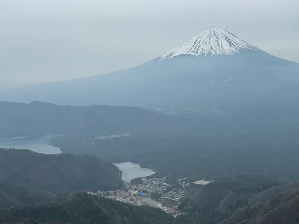
Mt Futatsuzuka (二ツ塚, futatsuzuka), also known as Mt Futago, is a pair of small hills protruding out from the side of Mt Fuji. With an elevation of 1804 and 1929m respectively, the hike gives you a chance to get up close and personal with Mt Fuji outside of its main summer hiking season. What’s even more exciting about this hike is that we took the opportunity to go see a broken-down car that has been mysteriously abandoned on the slopes of Mt Fuji for possibly up to 40 years.
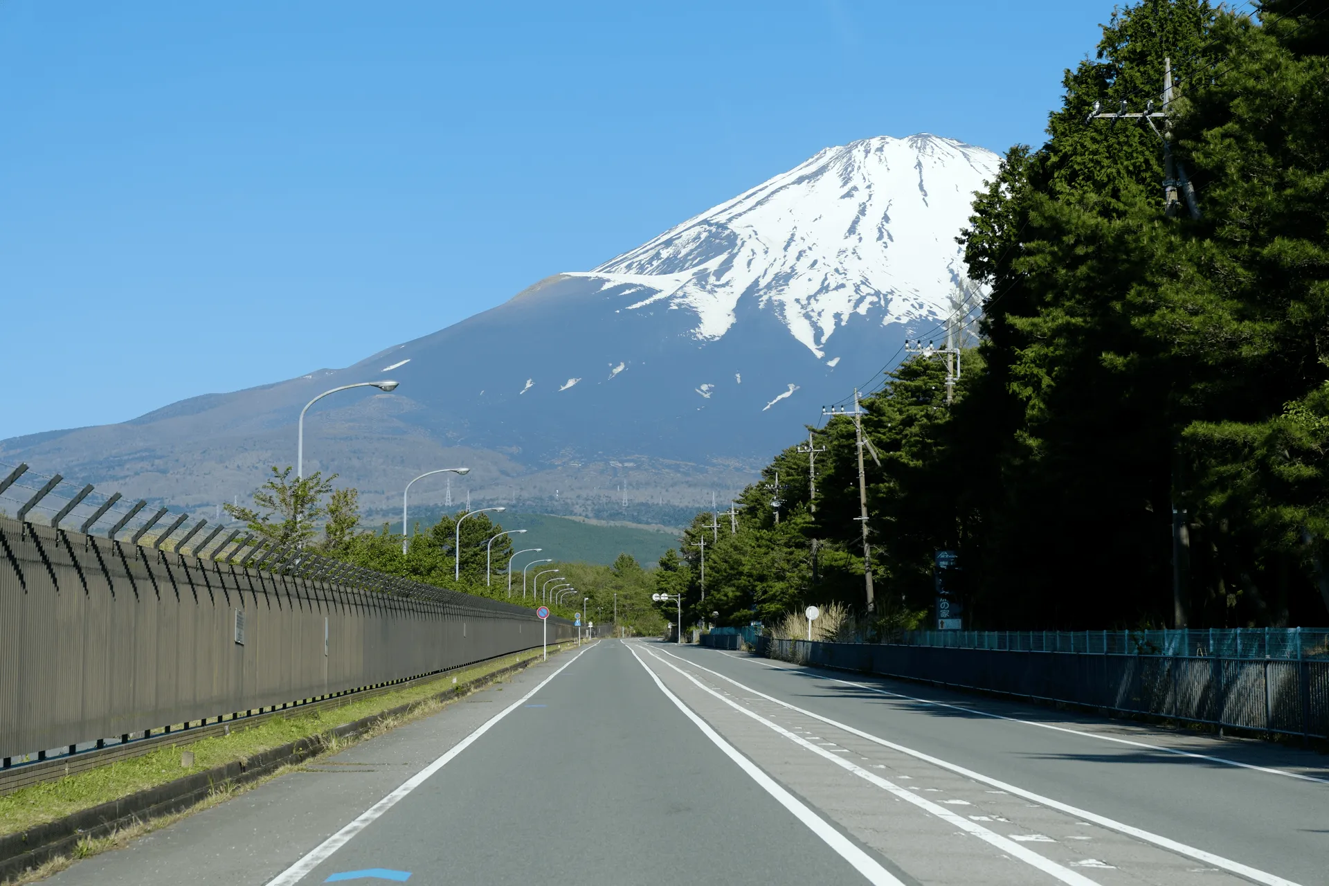
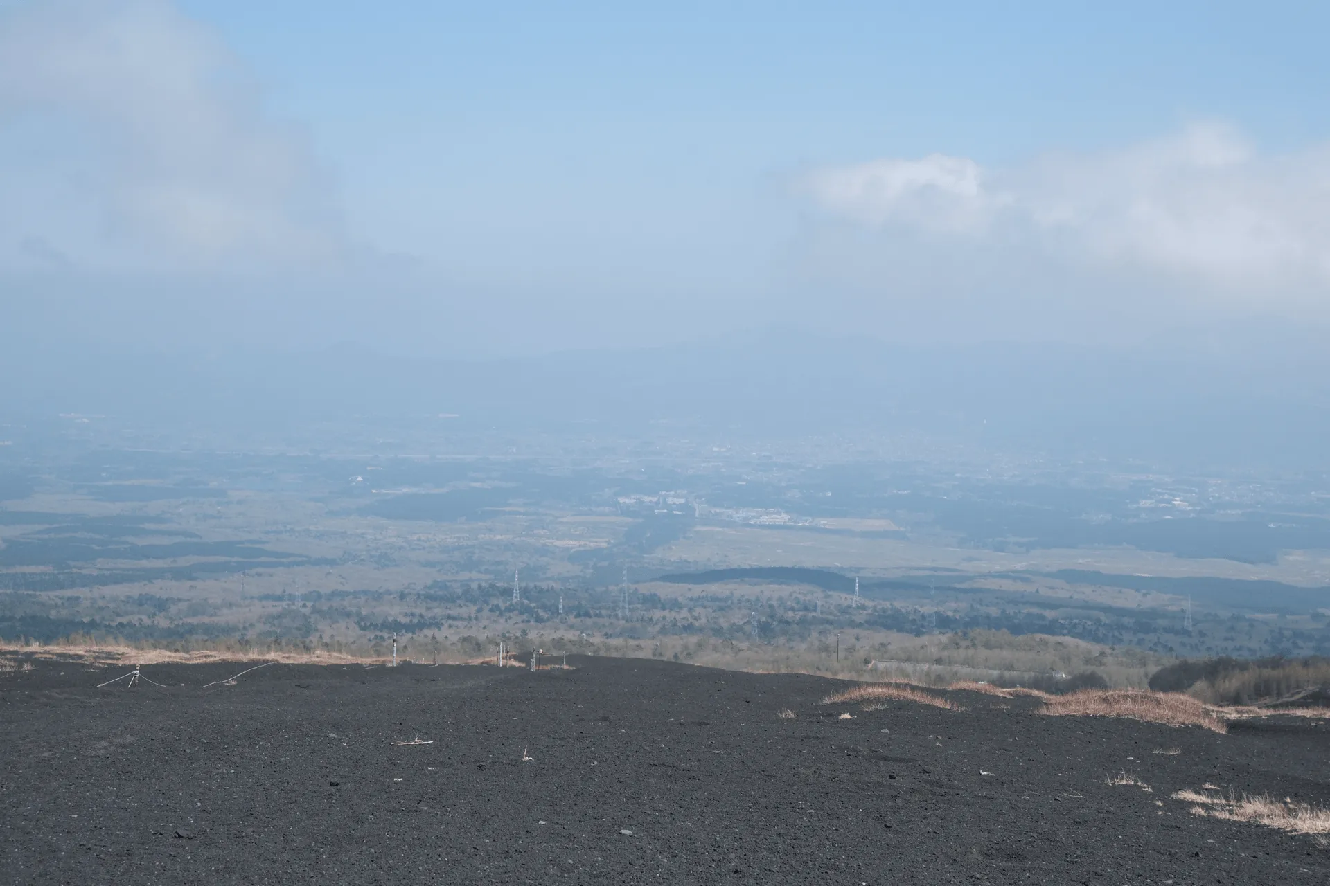
I had been keeping an eye on the weather leading up to this hike, since it would be pretty disappointing if I made it all the way to Mt Fuji and it was hidden by clouds. Our luck was good today, and it was a sunny day without a cloud in sight.
We began our hike from the Gotemba 5th Station trailhead. This is actually also one of the 4 major trailheads if you’re looking to hike to the top of Mt Fuji itself. The Gotemba trailhead is the lowest elevation of the four trailheads, and so the Gotemba course also the longest and hardest trail to the summit.
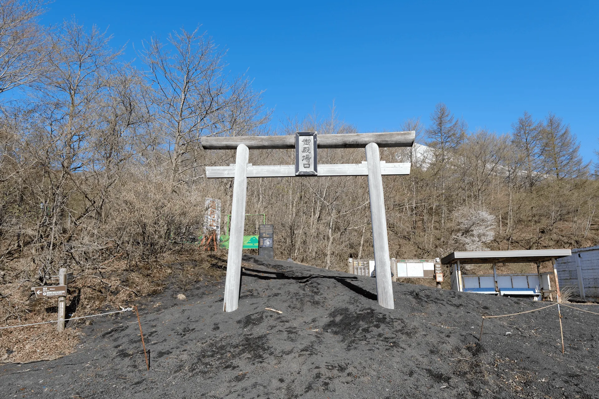
Of course, you’re only supposed to climb Mt Fuji during its official hiking season in summer. As we approached the trailhead, we could the path was blocked off with a bunch of warning signs.
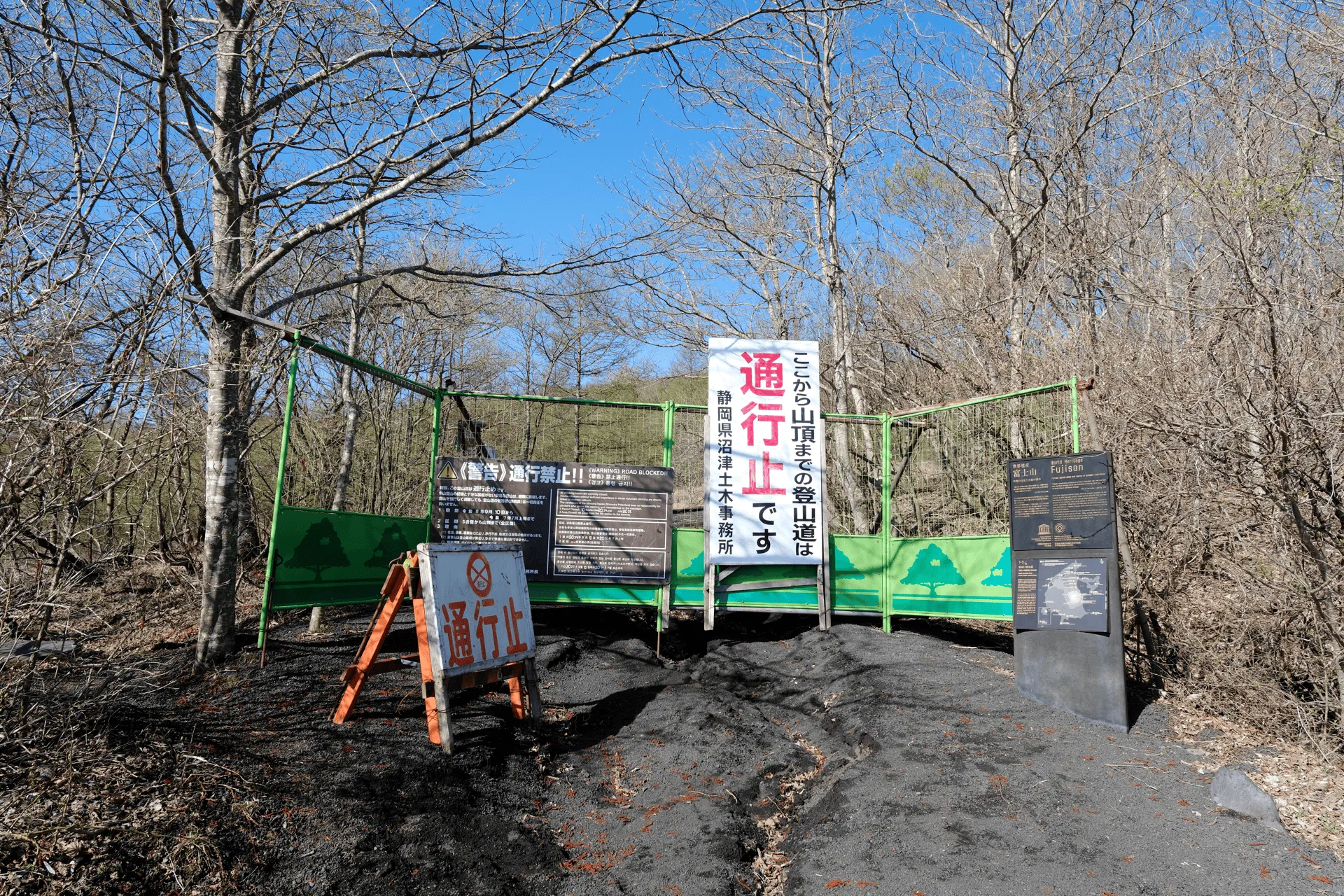
I don’t know if access to Mt Futatsuzuka is technically allowed (since we’re not going to the summit of Fuji itself) but it does feel like a bit of a grey zone to me. There were a fair few people passing through this trailhead today so I think it’s okay.
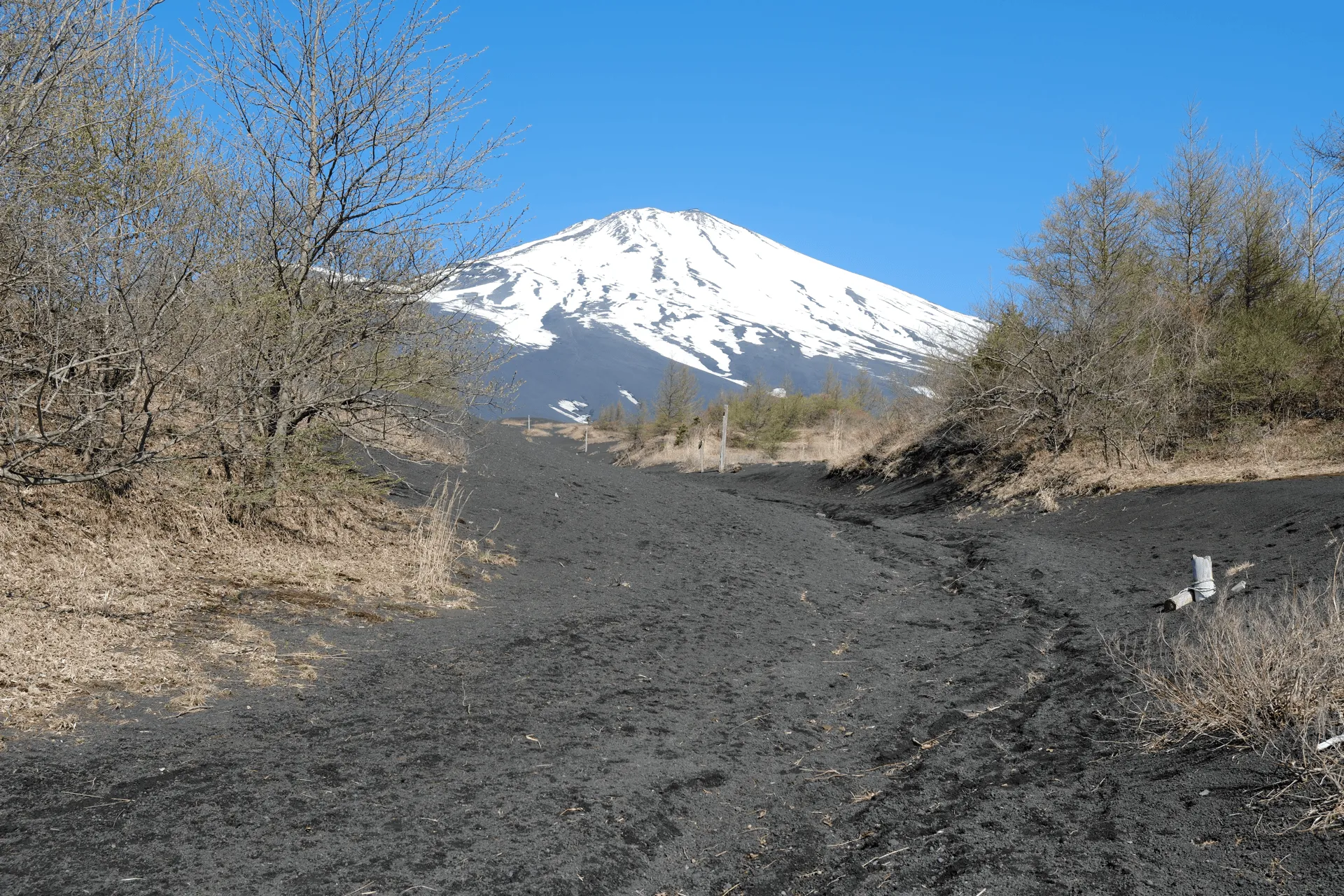
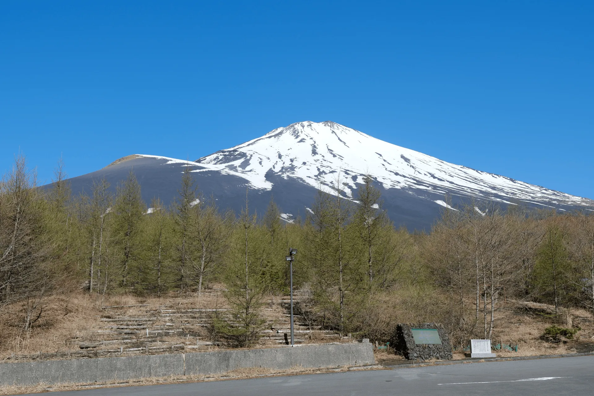
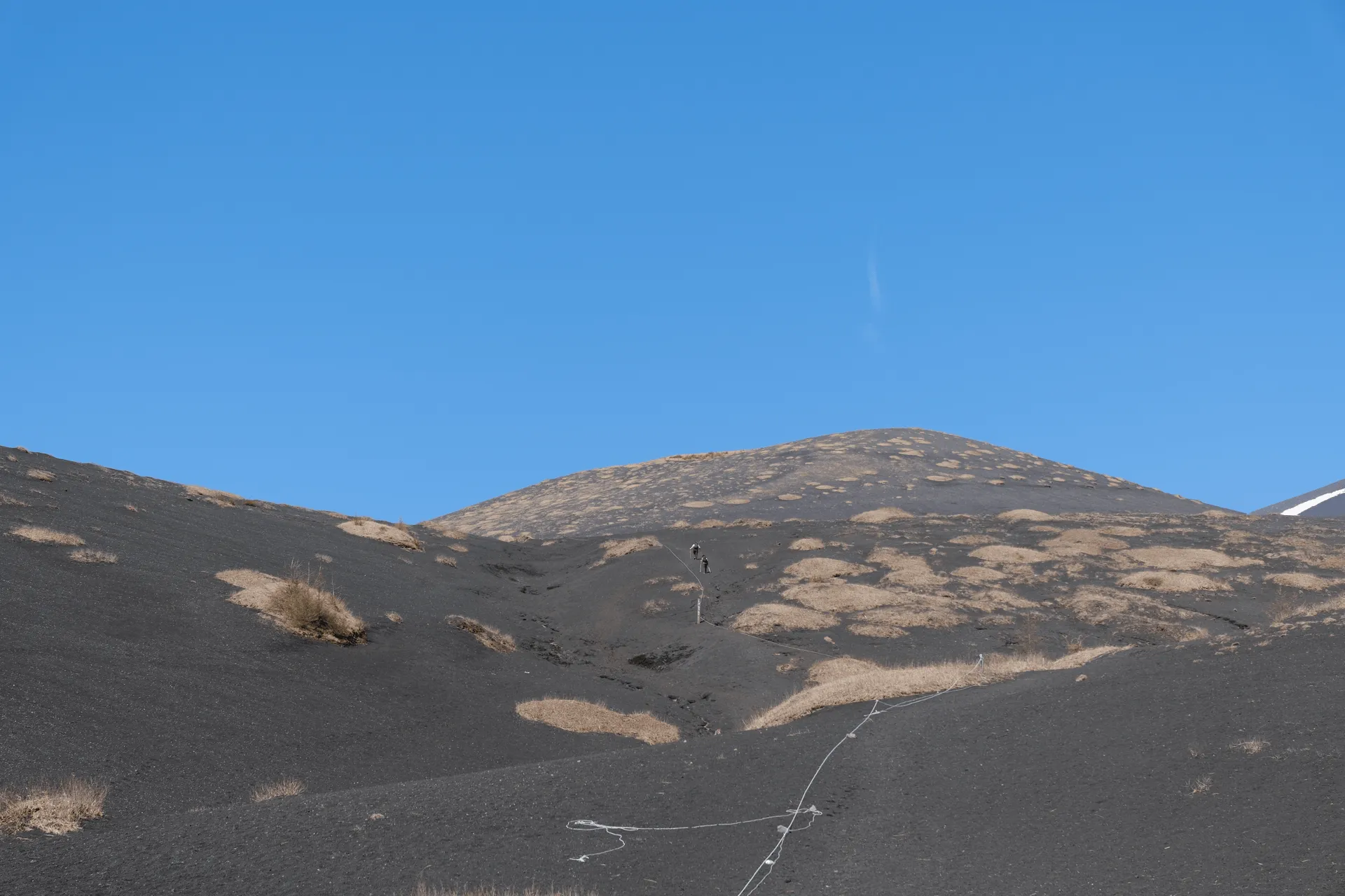
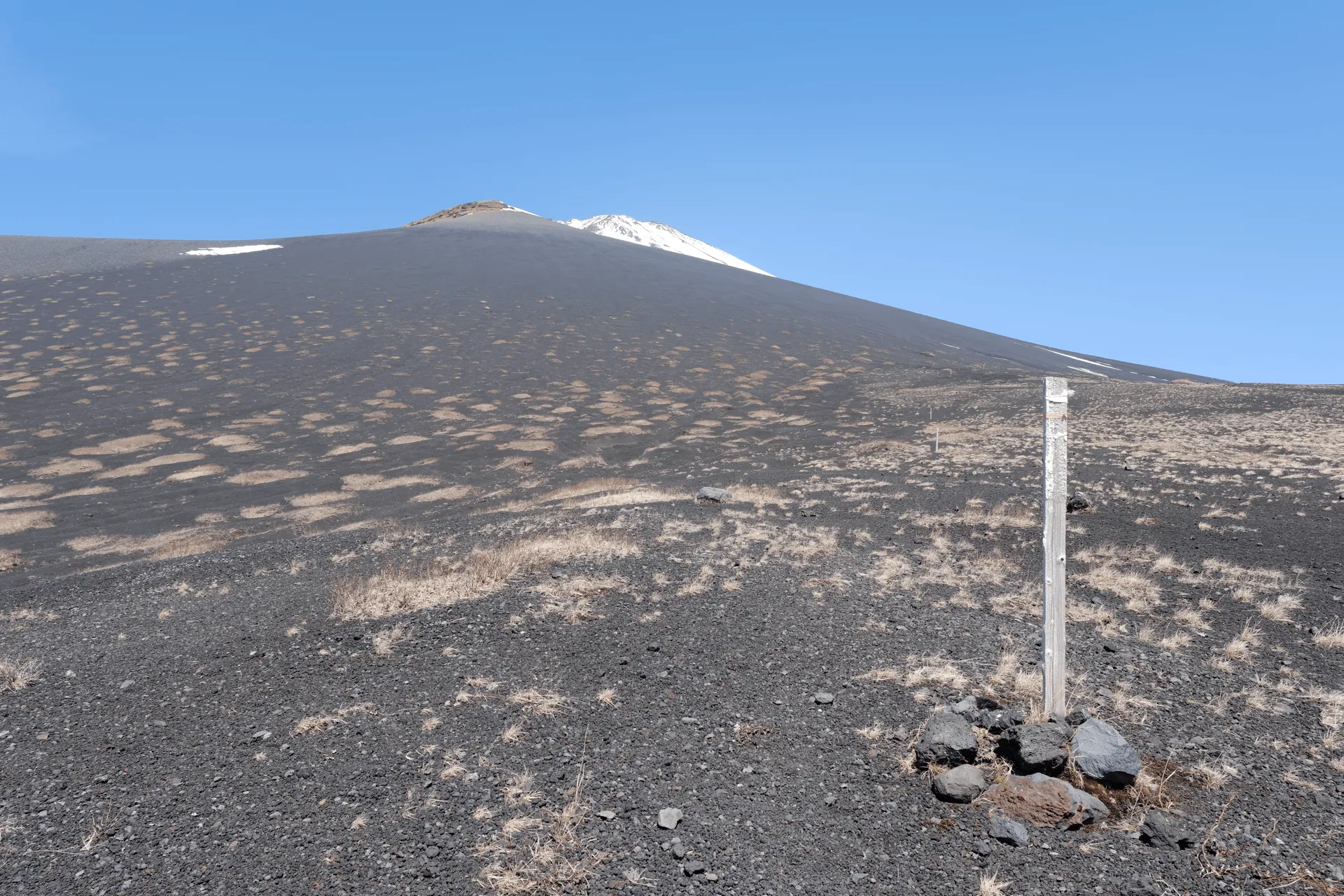
The enterity of today’s hike is on Fuji’s black volcanic sand, which is quite soft and easy to walk along - as long as it’s not too steep.
Today was also the debut of my first camera! Up until now I’ve only been using an iPhone to take photos, but I decided to try out a Fujifilm. I downsize the quality of the photos to put them on my blog, so I’m not really sure if you can tell the difference.
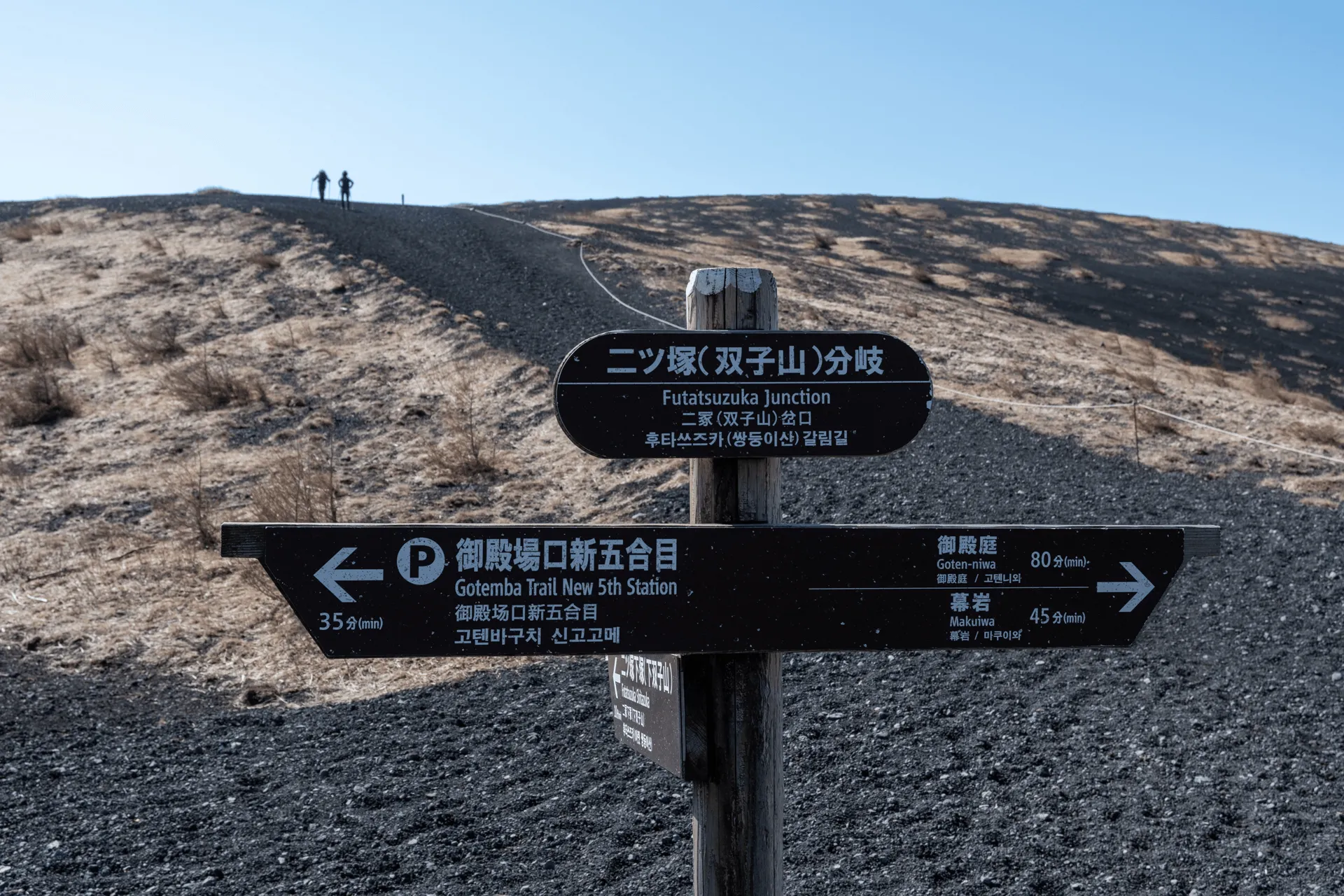
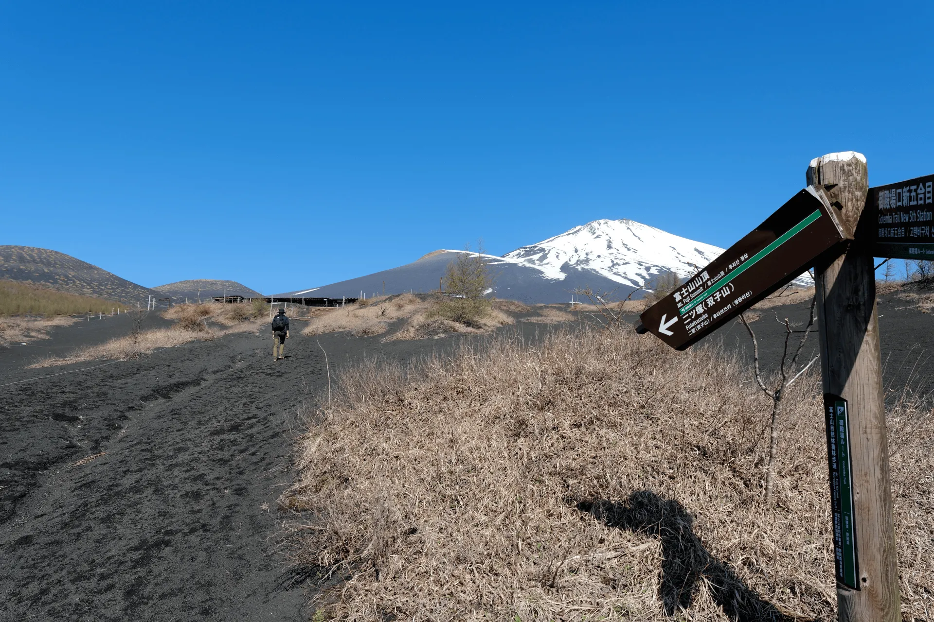
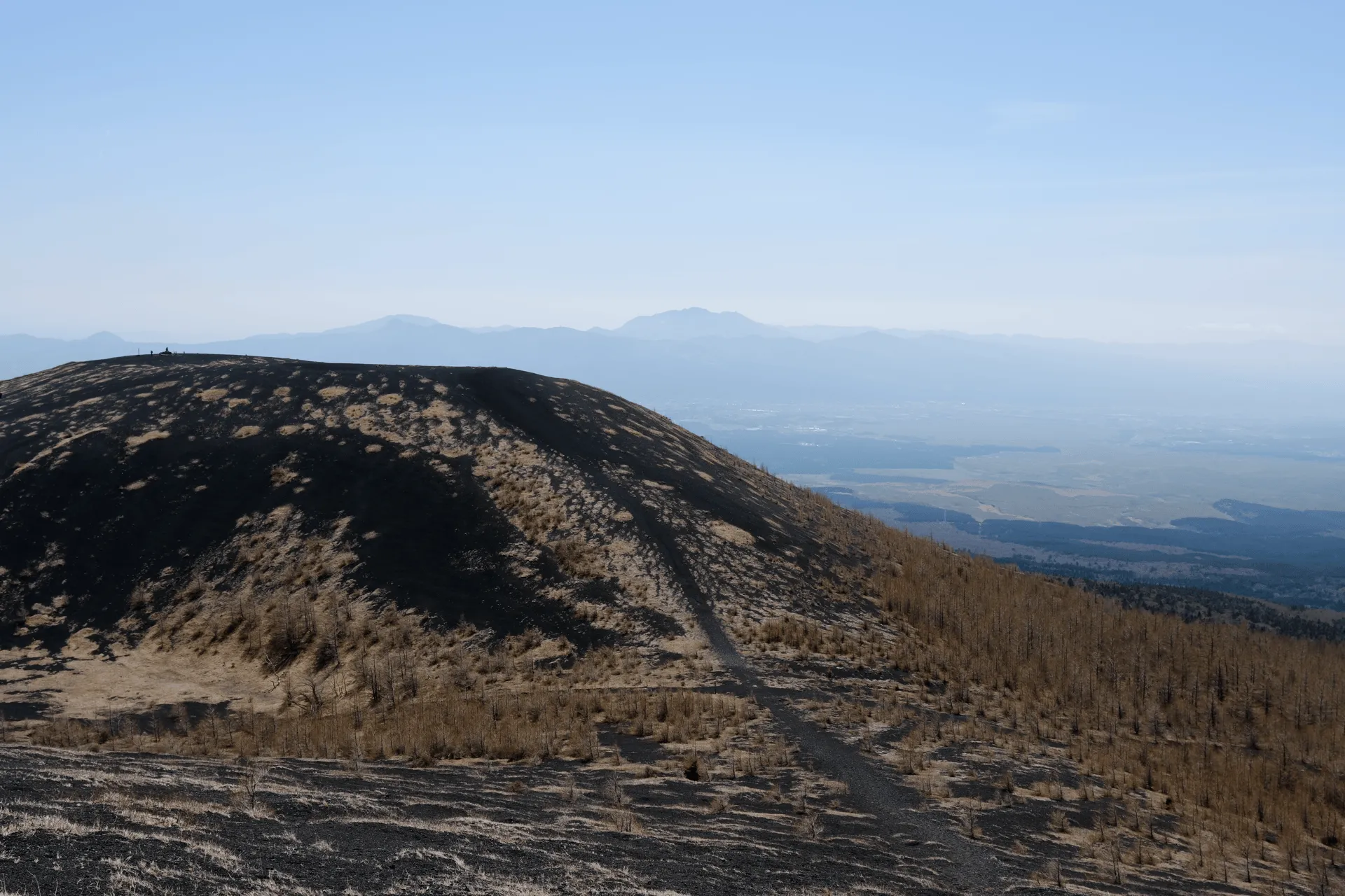
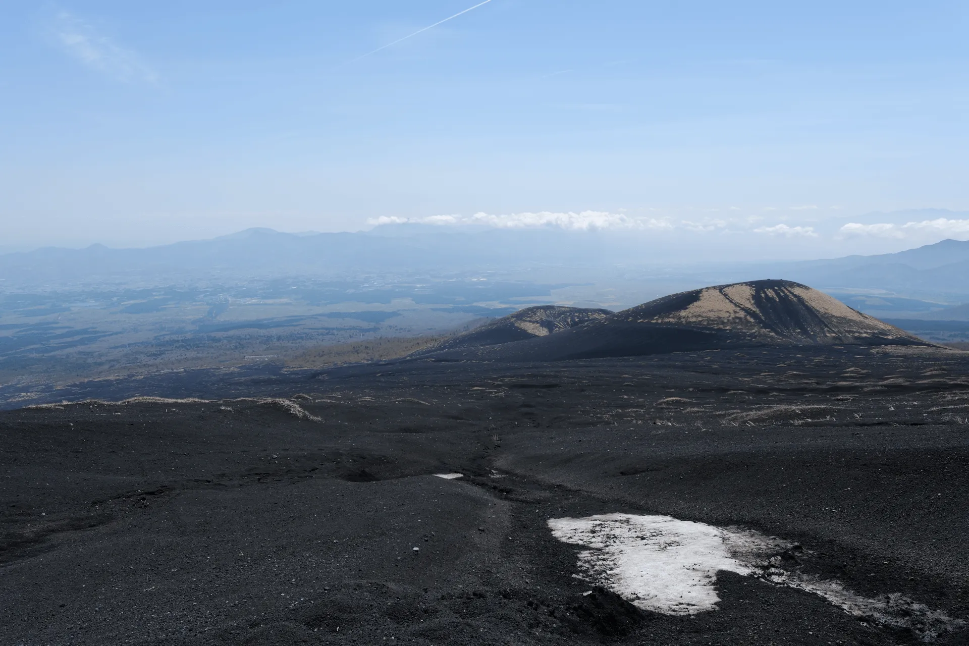
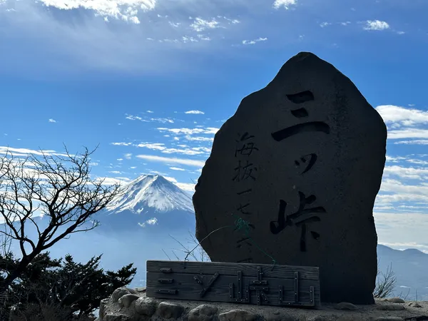
Mt Futatsuzuka is split into two peaks that are directly next to each other. So once you reach the Futatsuzuka junction, you can take a left to climb the lower peak, return to the junction, and then climb the higher peak.
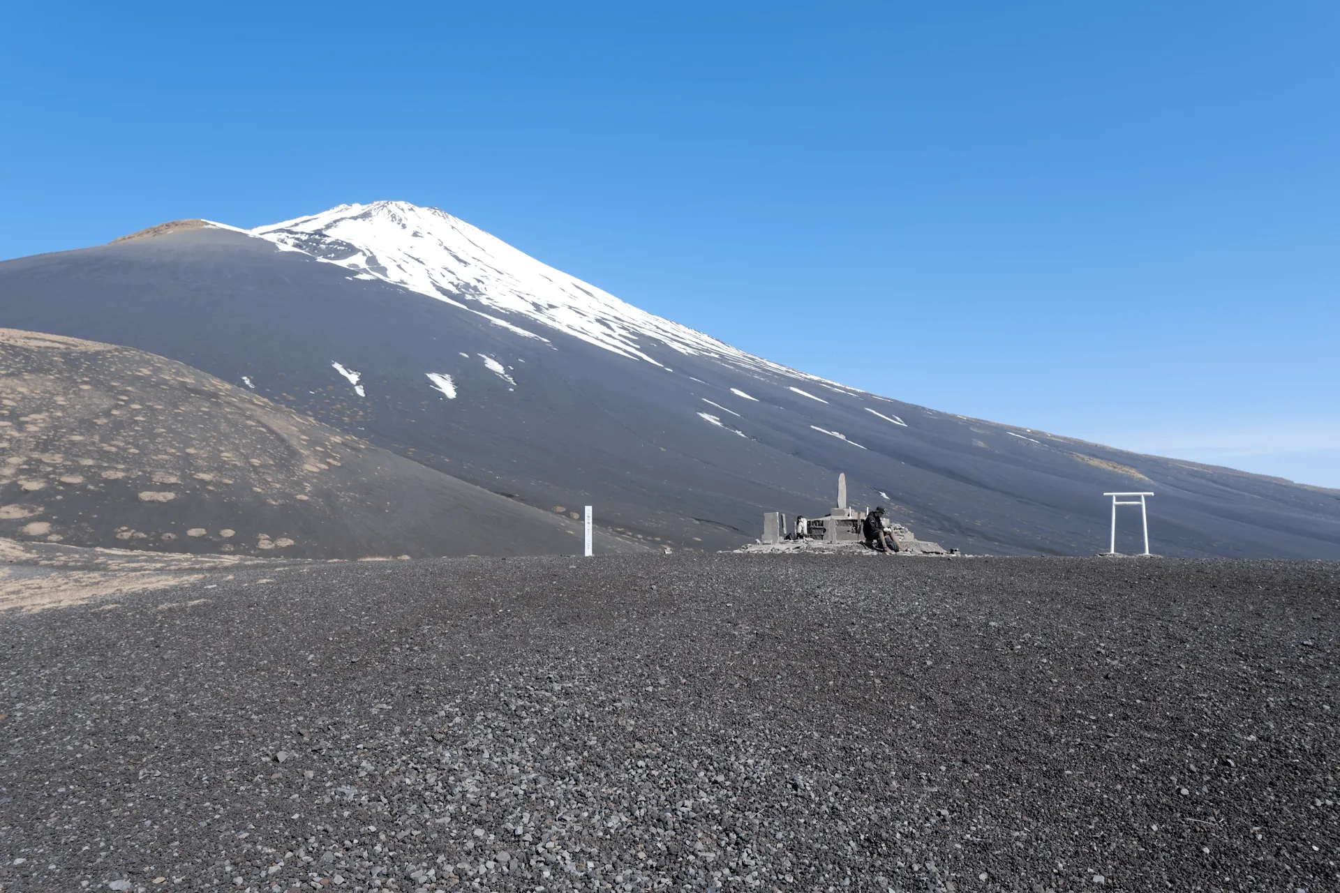
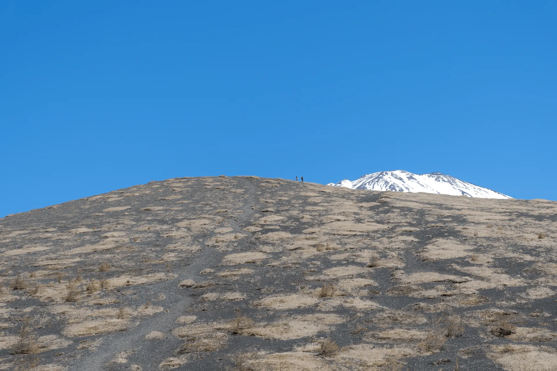
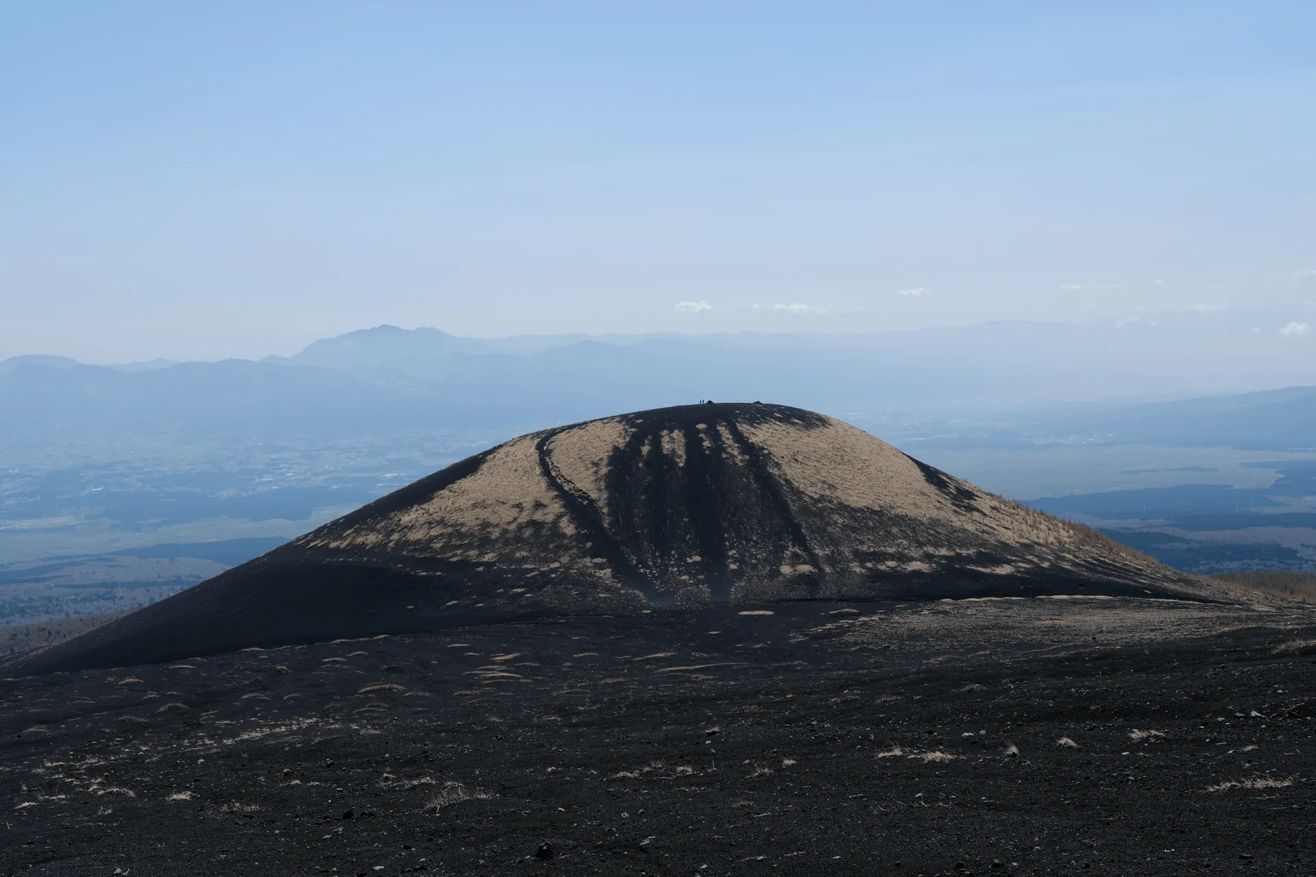
The lower peak is a wide open space, complete with a little torii gate and a peak marker. We got here in under an hour of hiking, so it’s pretty quick! We saw a number of hikers choose to just summit here and then turn around and head back to the trailhead. You can get some great views from here, so it’s great if you’re just looking for an easy hike.
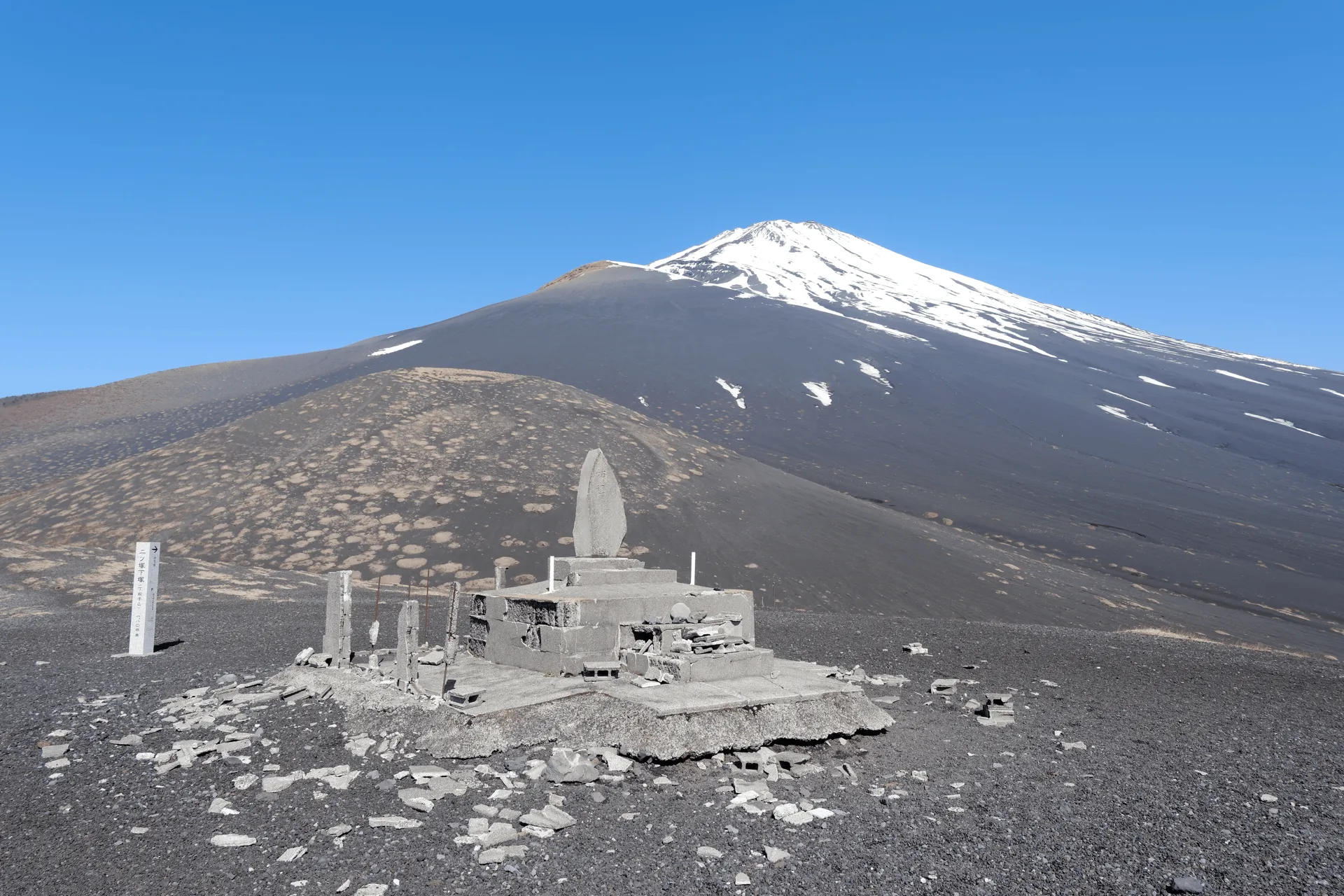
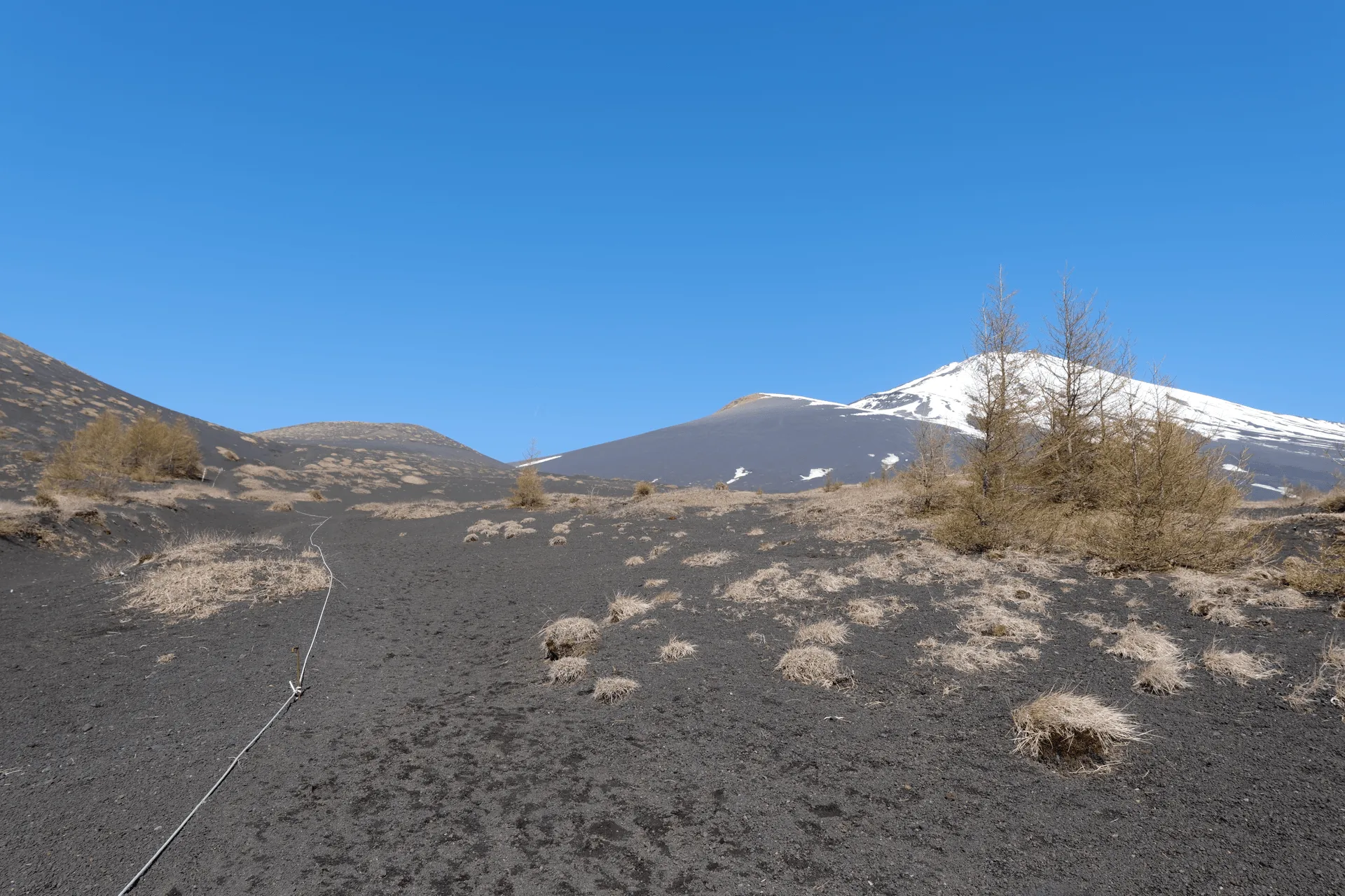
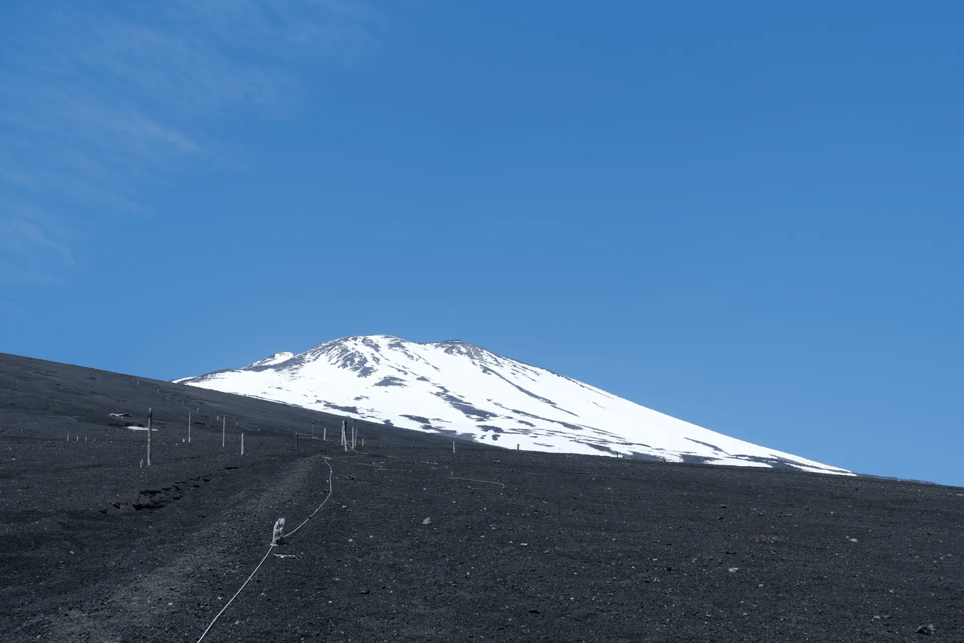
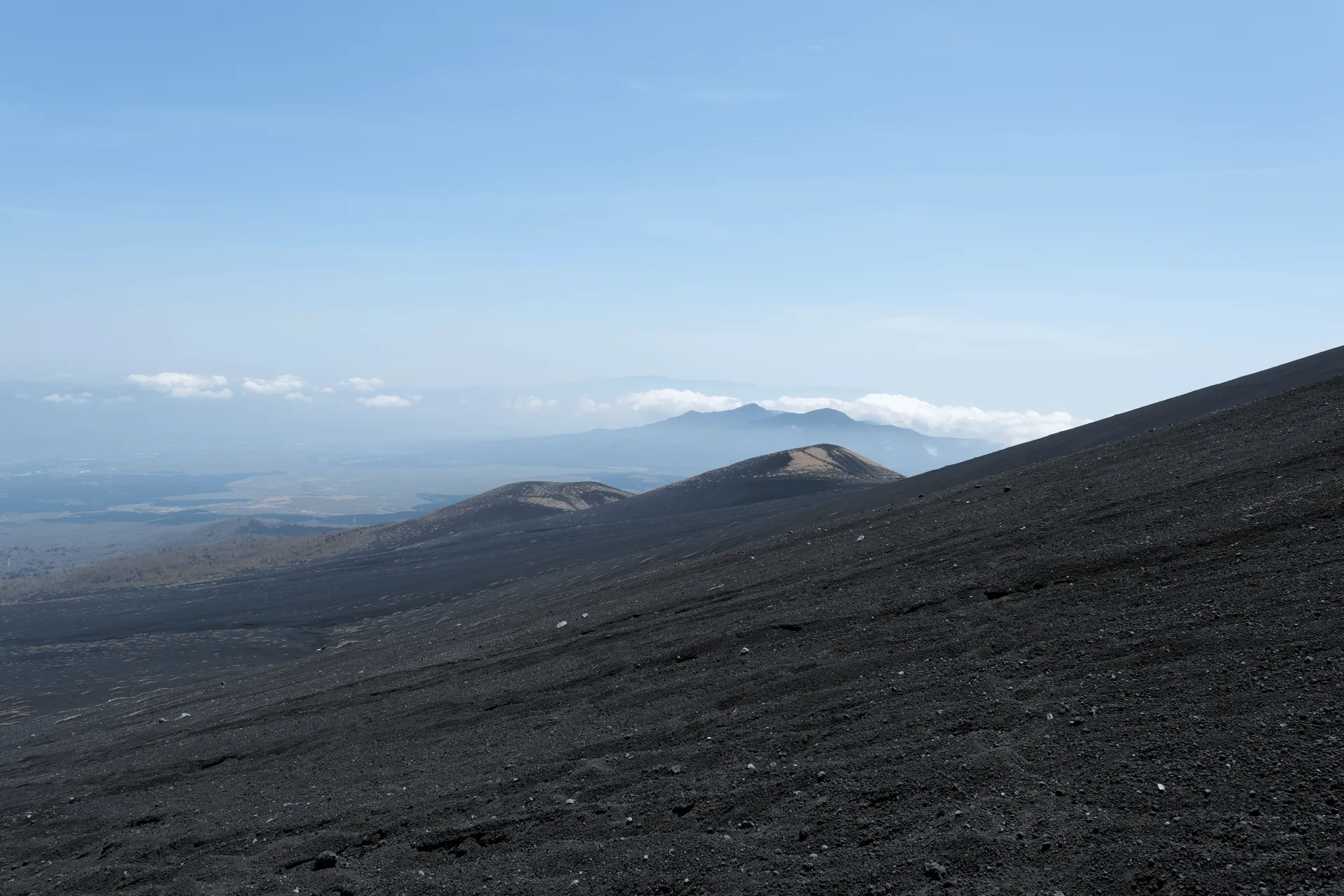
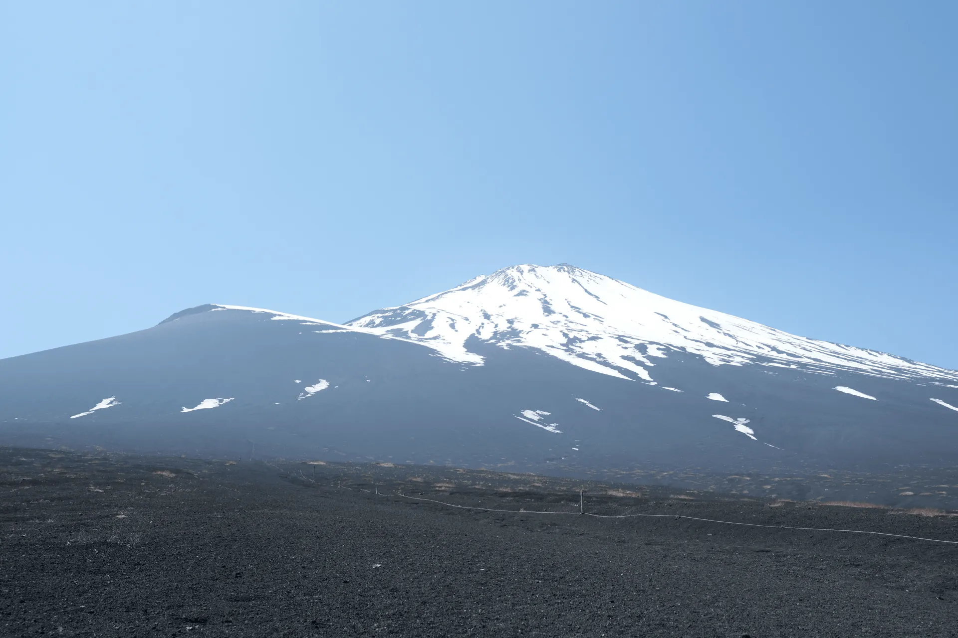
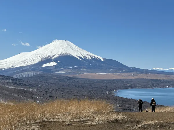
From the lower peak of Mt Futatsuzuka, you can spot a spotty mound directly in front, which is the other peak of Mt Futatsuzuka. The pointy bit sticking out to the left of Mt Fuji is Mt Hoei (elevation 2693m). From this angle it looks pretty close to the elevation of Mt Fuji itself, but in fact over 1000m lower.
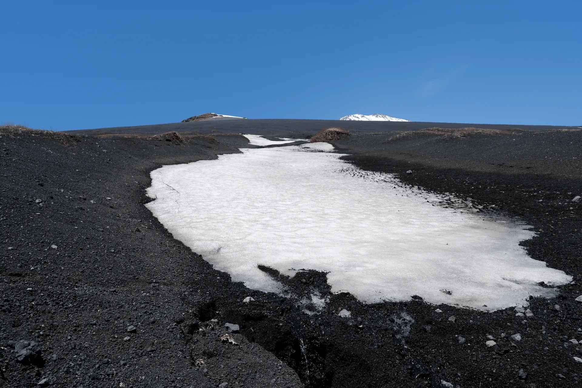
You can see there’s a tiny bit of snow on the top of Mt Hoei still, so I’m hoping I can come back and climb it sometime in June.
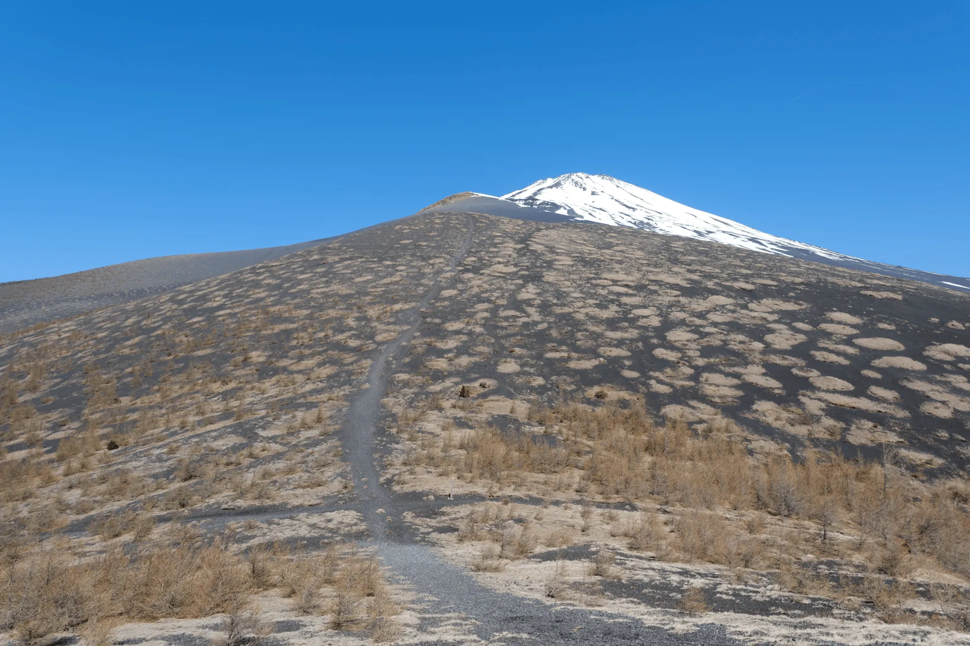
From here, we return back down to the junction, and then climb up to the higher peak. This part was a little rough - it’s quite steep, and the entire trail is just volcanic sand, so your feet will slide around a bit trying to get a footing. A hiking pole comes in handy here.
After about 30 minutes of hiking, we reached the upper peak! Although you’d think the higher elevation mountain would have more on it, there was just a pile of rocks - not even a peak marker. I suppose the lower peak is technically the “true” peak of Mt Futatsuzuka.
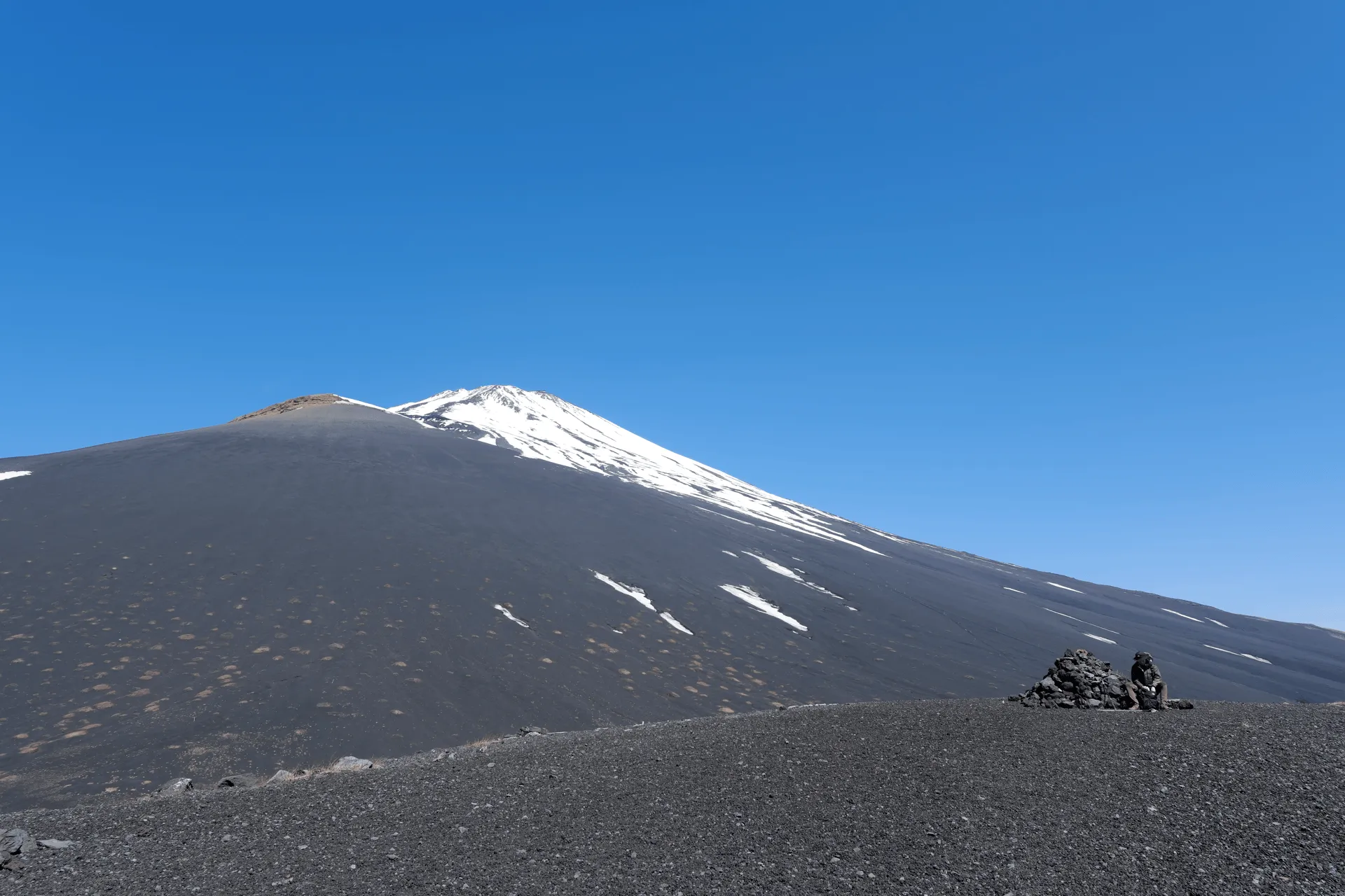
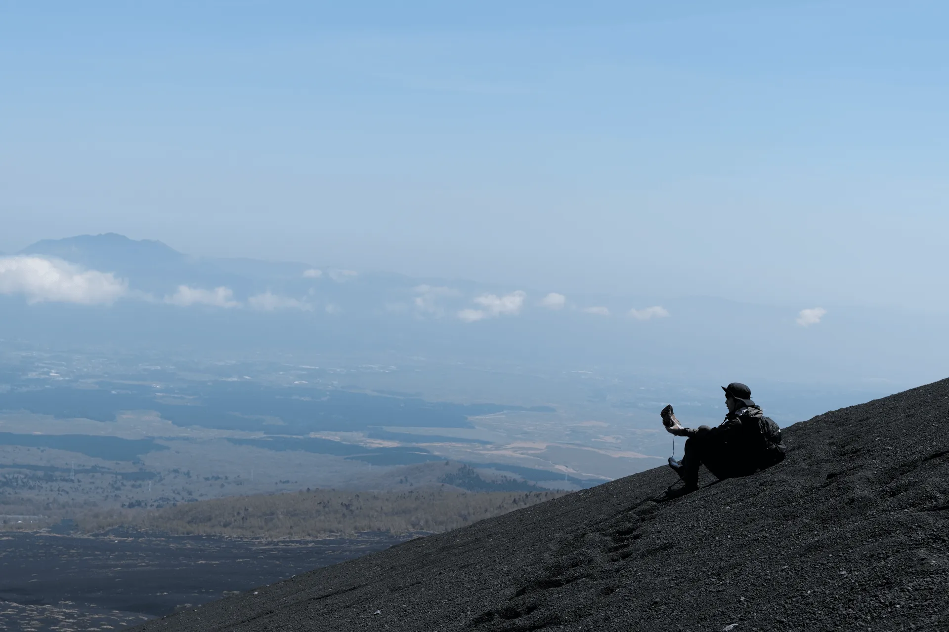
You can take a little closer look at Mt Fuji from here - you can see the descent path for the Gotemba trail coming down the right side of the mountain.
For now, we head back down to the junction.
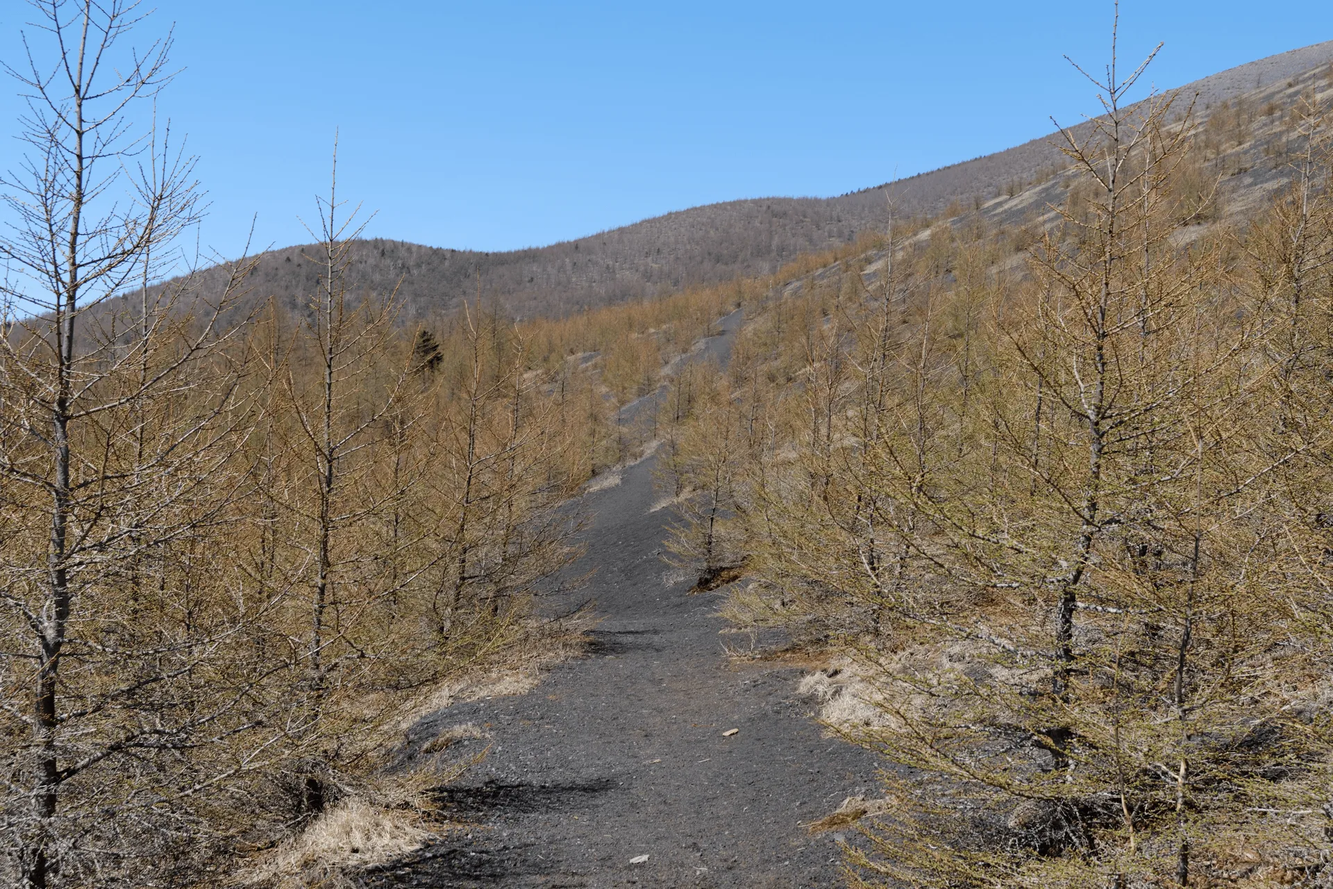
From the junction, you take a right, and enter some trees - this was the only foliage we got for the entire hike. It didn’t provide any shade though, so I can imagine it getting quite hot in the summer months.
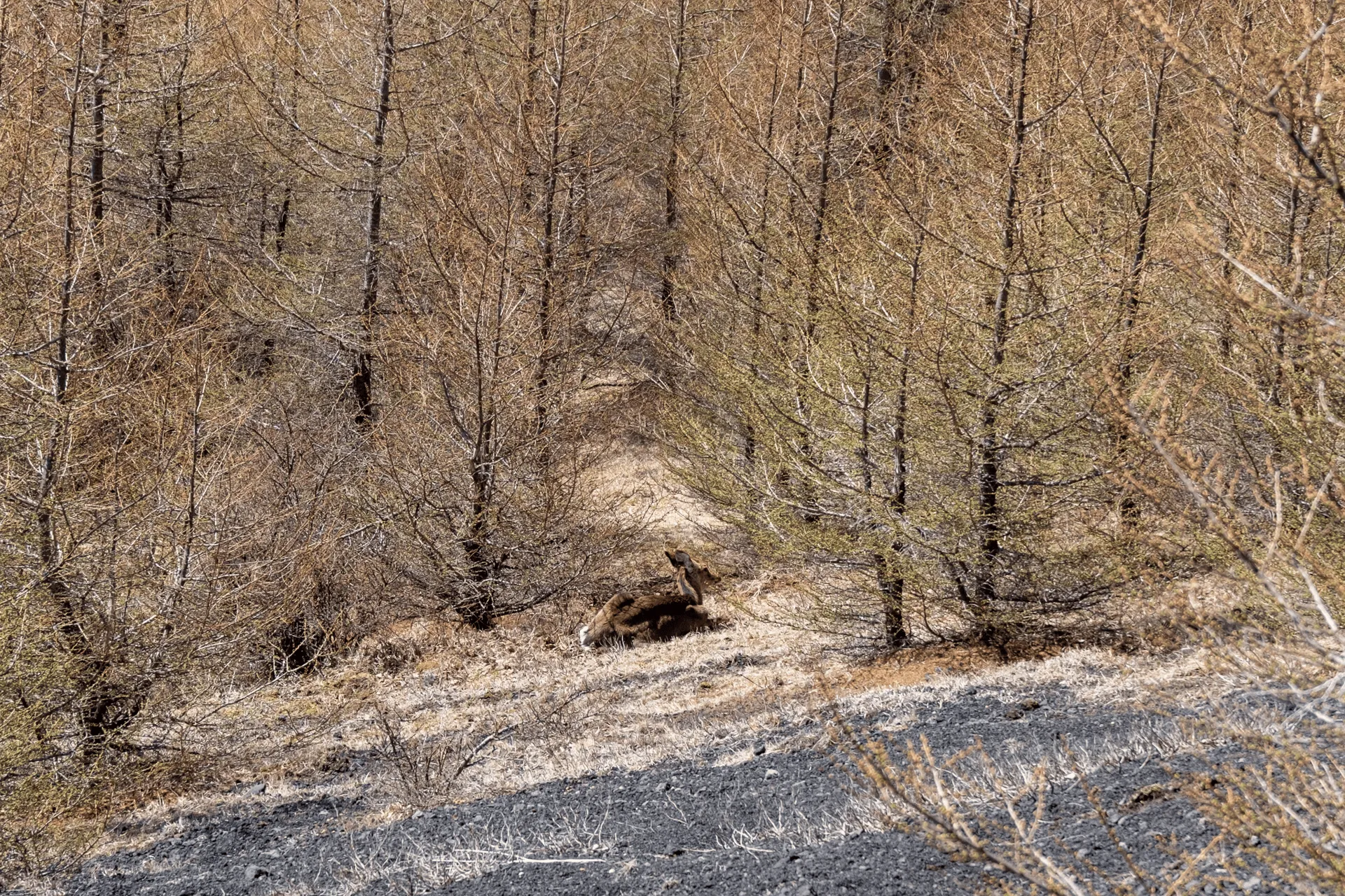
This was also the one deer we managed to spot and get a photo of! She seemed to know we were there - her ears were flicking - but I suppose she was far enough away from us not to be bothered.
As you keep walking, you’ll come to a signpost. Although we want to head in the direction of Mt Fuji, interestingly the signpost does not have a marker pointing in that direction. This is because the trail from Mt Fuji is technically a descent-only path so I suppose they don’t want to be pointing people to go up here.

Since we are hiking in the off-season, we don’t have to worry about going against the non-existent traffic. You just have to keep an eye out for the pink ribbons to get a sense of which direction you should be heading in - these are used in Japan to mark the trail.
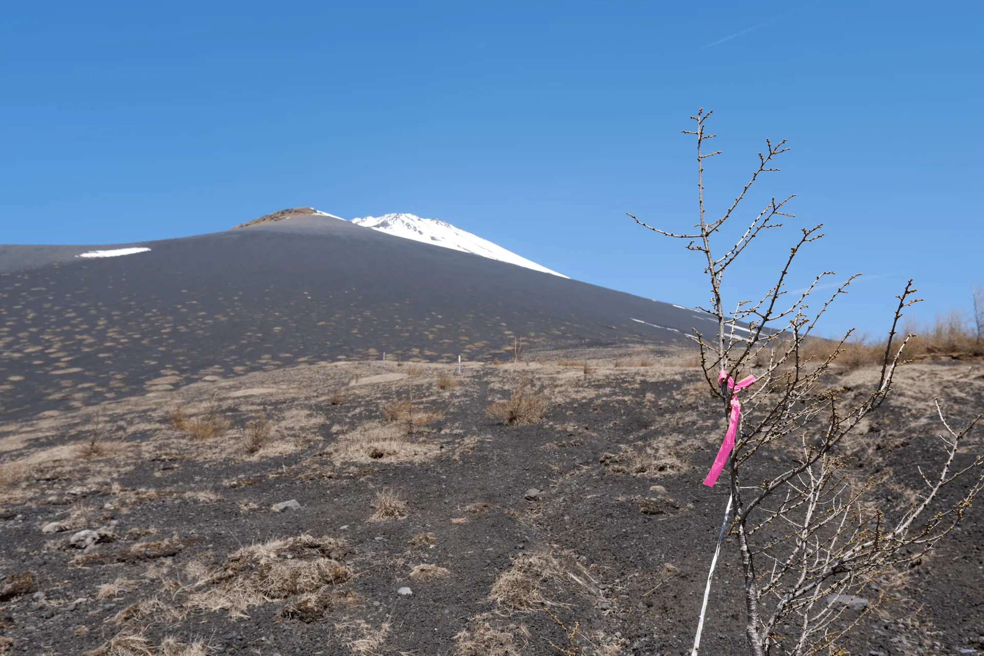
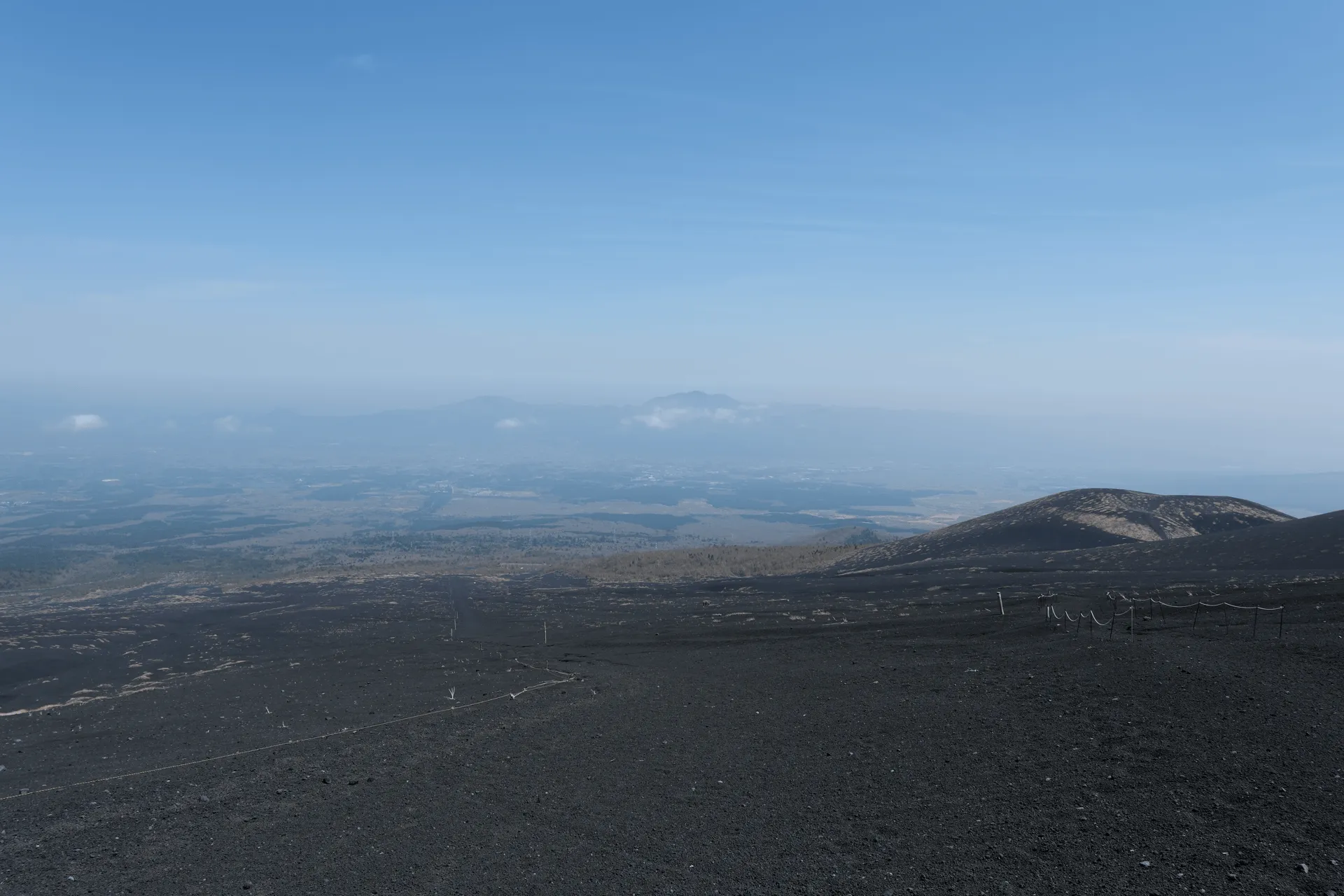
The pink ribbons then eventually turn into poles that are scattered around. But honestly, you’re basically on a giant gravel field on the side of Mt Fuji, so you can kind of wander around a bit, and there isn’t really a fixed trail to tread.
As we kept hiking, we could see the upper peak of Mt Futatsuzuka on our right, with plenty of tracks worn down the side of it. We had actually descended from the opposite side, since my GPS map only showed that as a path. We took the long way around, but the silver lining is that we got to see a deer, at least!
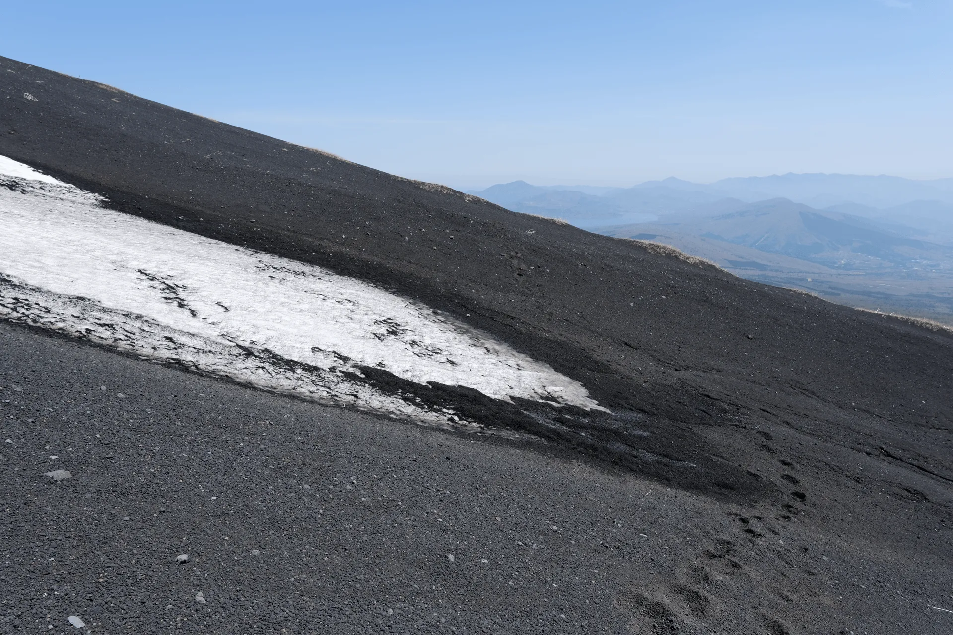
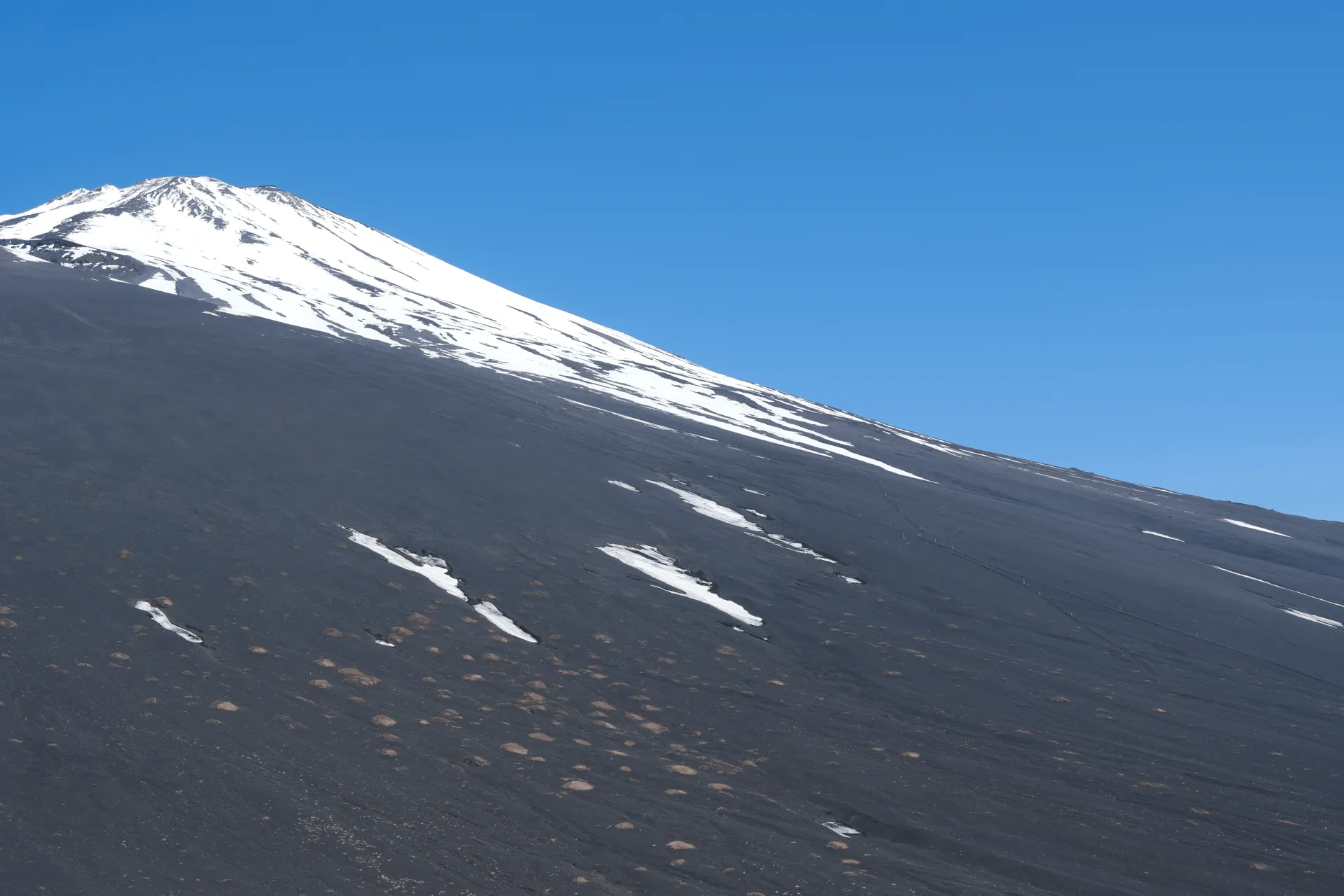
Cutting across the side of Mt Fuji is pretty fun at first, but with only the endless sea of volcanic ash to keep you company, I’ll admit it did start to get a little boring. Our monotony was broken up with a rather large patch of snow that we got to cross. Luckily we happened by near the bottom end of it, so we were able to just go around. I could see it melting, so I suppose it will have completely disappeared before long.
Eventually, you’ll join up with Mt Fuji’s descent trail, which you can use to get back to the trailhead. But we had one more goal in mind - which was to check out Mt Fuji’s abandoned car, so instead of joining the descent trail, we just cut across it and kept on walking.
Although people do go to visit the car, there isn’t a fixed trail to do so, so at times you have to carve your own path. And this is harder than it sounds - the gravel on Fuji is very soft, and so your feet slide around quite a bit with each step you take. If you’re lucky, you’ll spot someone else’s path and be able to follow in their footsteps which does make things a bit easier. Walking from the descent trail out to the car itself took about an hour.
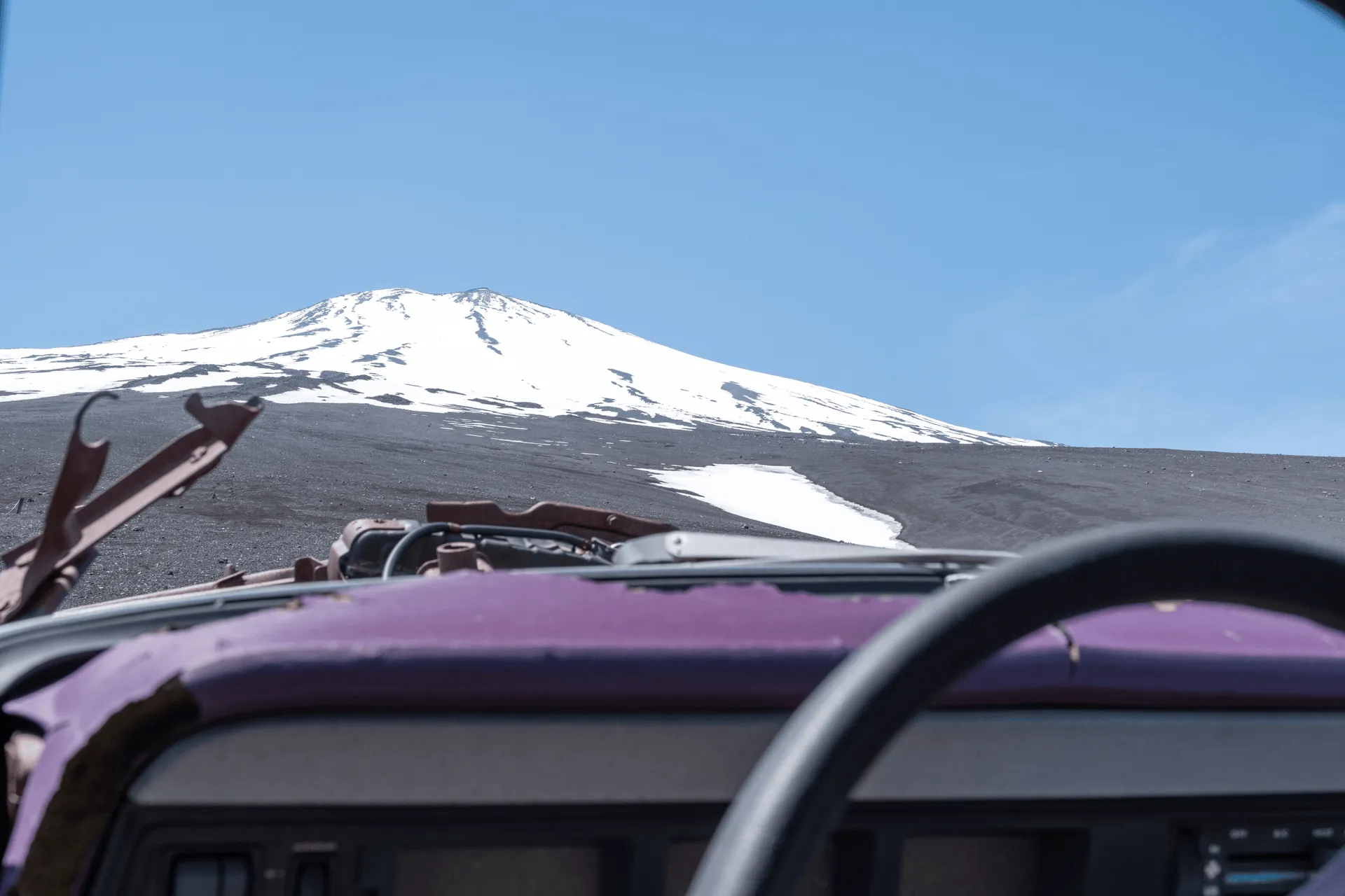
And eventually, the car started to come into view!
Visiting the abandoned Jeep Wagoneer
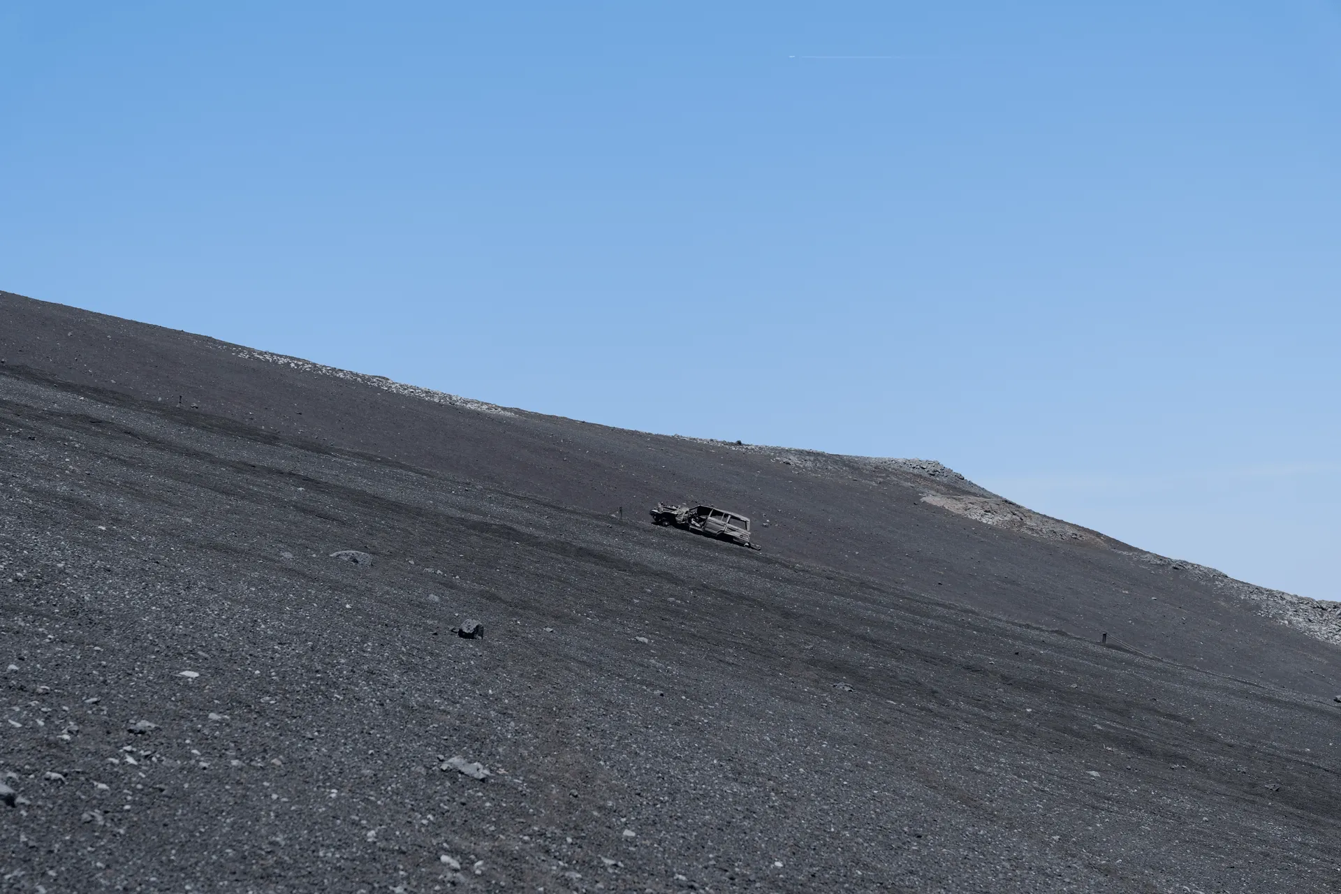
The car is apparently a Jeep Wagoneer, known as a ワゴニア (wagonia) in Japanese. There’s no real information about how this car ended up here, but one article mentions that back in the 1960s, access to the peak of Mt Fuji was a lot less restrictive. Kawasaki ran an ad advertising how they were able to drive a motorcycle up to the summit, and another company successfully drove a car up to the 8th station - which is at an elevation of 3100m.
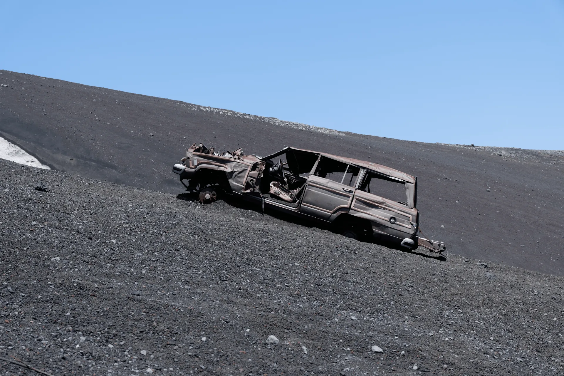
Since the car is abandoned around the 2100m mark, maybe at the time it was not completely unlikely to drive a car up the side of the mountain? The model of the car is up to 40 years old, but I suppose we don’t know whether the car was driven up when it was brand new and got stuck, or whether someone decided to drive their 20-year old car up the side of the mountain just to see how far they could go, and then left it there.
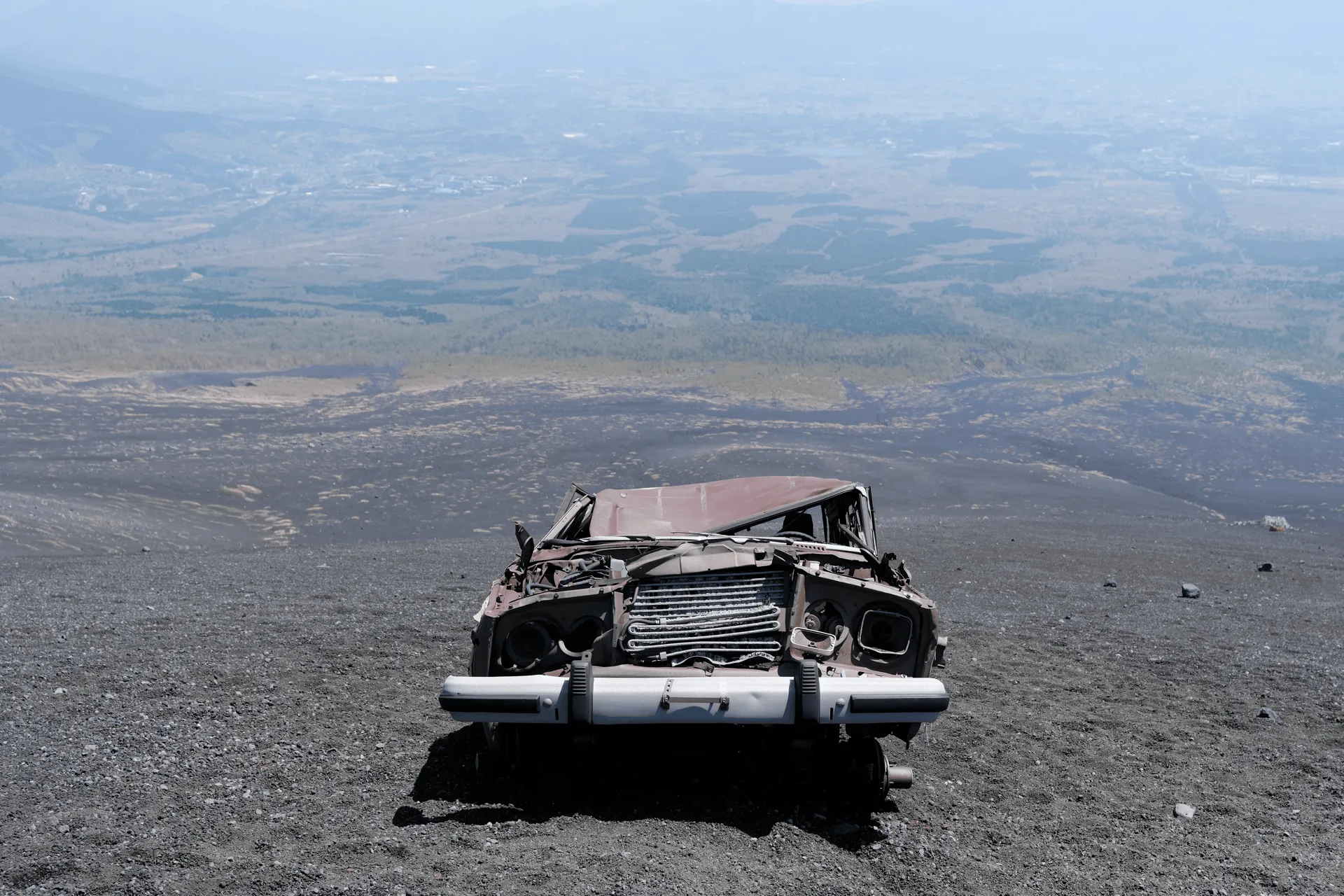
Nonetheless, it seems like the wheels have been at least removed, which removes the risk of it rolling back down the mountain again. The car has quite a few big dents in it, which I guess would come from piles of snow heaping up on its roof in the winter.
We had the car to ourselves for a good 15 minutes, while I fiddled around with my new camera trying to figure out how to use it. Eventually another 2 hikers showed up, so we decided to let them have their own photoshoot too, and set out on our path back.
We again followed in someone’s footsteps on the way back, but they were a different set of footsteps, so we inadvertently had to cross a large patch of snow.

Once we made it back to the main trail, the rest of the course was all downhill. We even passed 2 hikers who seemingly had come down from the top of Mt Fuji - and had sets of skis strapped to their backs. I suppose they hike up, and then ski part of the way down?
Hiking course options
| Date climbed | Length | Course time |
|---|---|---|
| 2025-04-27 | 9.4 | 6h (the expected time for an average hiker without breaks) |
The main Mt Futatsuzuka hiking course is a 7km loop course that will take you under 4 hours. If you’re looking for something shorter, you can do a 5km, 3h out-and-back course instead. Both of these courses hit both peaks of Mt Futatsuzuka, so you could save a bit of time by skipping the upper peak and just climbing the lower one.
We did a fairly modified course since we wanted to visit the car, so after visiting Mt Futatsuzuka, instead of heading back down to the trailhead in a loop, we kept going up towards Mt Fuji and cut across the side of the mountain towards the car. A GPS app will really come in handy here, as there are no signposts for the car itself.
Public transport access
If you are coming via public transport, there does seem to be a bus running from Gotemba station to the trailhead in certain months of the year. There is a shuttle bus service used in the main summer hiking season for those looking to reach the peak, so you could probably that bus too (if you don’t mind the crowds of the summer season).
Alternatively if you want to climb in the off-season, for 2024 I found a bus timetable that was running between the 14th of September and 4th of November on weekends and holidays only.
If the timetable turns out to be the same this year, you would be looking to get on at Gotemba station (御殿場駅) at the #1 bus stop at 8:35am, and then getting off at the Gotemba trailhead (御殿場口新五合目) at 09:05am, which will give you plenty of time for your hike. Alternatively you can get on the 11:35 bus, which probably would give you enough time to do a quick hike to the lower and possibly upper Mt Futatsuzukas, but maybe you would need to give the car a miss depending on your speed. The only feasible return bus seems to be at 3:55pm, so make sure you don’t miss it!
The PDF file was linked on the Fujikyu Mobility website, so I would suggest keeping your eyes peeled for the 2025 edition.
Car access details
The carpark where we began our hike is the Gotemba 5th Station (御殿場口新五合目), which has 3 carparks.
I would have assumed that in the summer months they close off this carpark in favour of shuttle buses due to the crowds, but apparently they do keep the carparks open, so maybe it’s not as crowded as I would have thought.
But note that the road to this trailhead is closed off in winter and spring due to snow. In 2024, it closed on the 19th of November, and then reopened in 2025 on the 25th of April.
To find out the latest information for when you hike, you would need to google the name of the road (富士山スカイライン) and get road closure information from a site like here.
In the months where that access road is closed, you can still hike Mt Futatsuzuka via the nearby Mizugatsuka Park (水ヶ塚公園), which also has a carpark, and the roads remain open. You can see an example of the YAMAP log for it here. You would have to be mindful of the snow depending on when you go, but it does seem like a small handful of people do hike from this trailhead as well.
When to hike Mt Futatsuzuka
The main drawcard of this hike is being able to see Mt Fuji, so I would check the weather forecast and Fuji view prediction sites to try and increase your odds. Personally, I would prefer coming in the colder months when the hiking route to the peak of Mt Fuji is closed, since I assume that would make for a much quieter hike with less crowds. But you could hypothetically hike it from May through November while the roads are open.
If you wanted to get a sense of the latest trail conditions, you can also see photos from recent trail logs on YAMAP here. Although note that some people also climb Mt Hoei (宝永山) in the same hike, so you’ll have to double-check the logs to see the trail they took.
Leave a comment