hikes
A guide to the best hikes in Kyushu
28 Jun
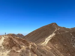
Mt Hinata (日向山, Hinata-yama) is a mountain in Yamanashi unique for having a sandy white “beach” at the summit. With an elevation of only 1660m it’s also probably the most accessible mountain in the Southern Alps.
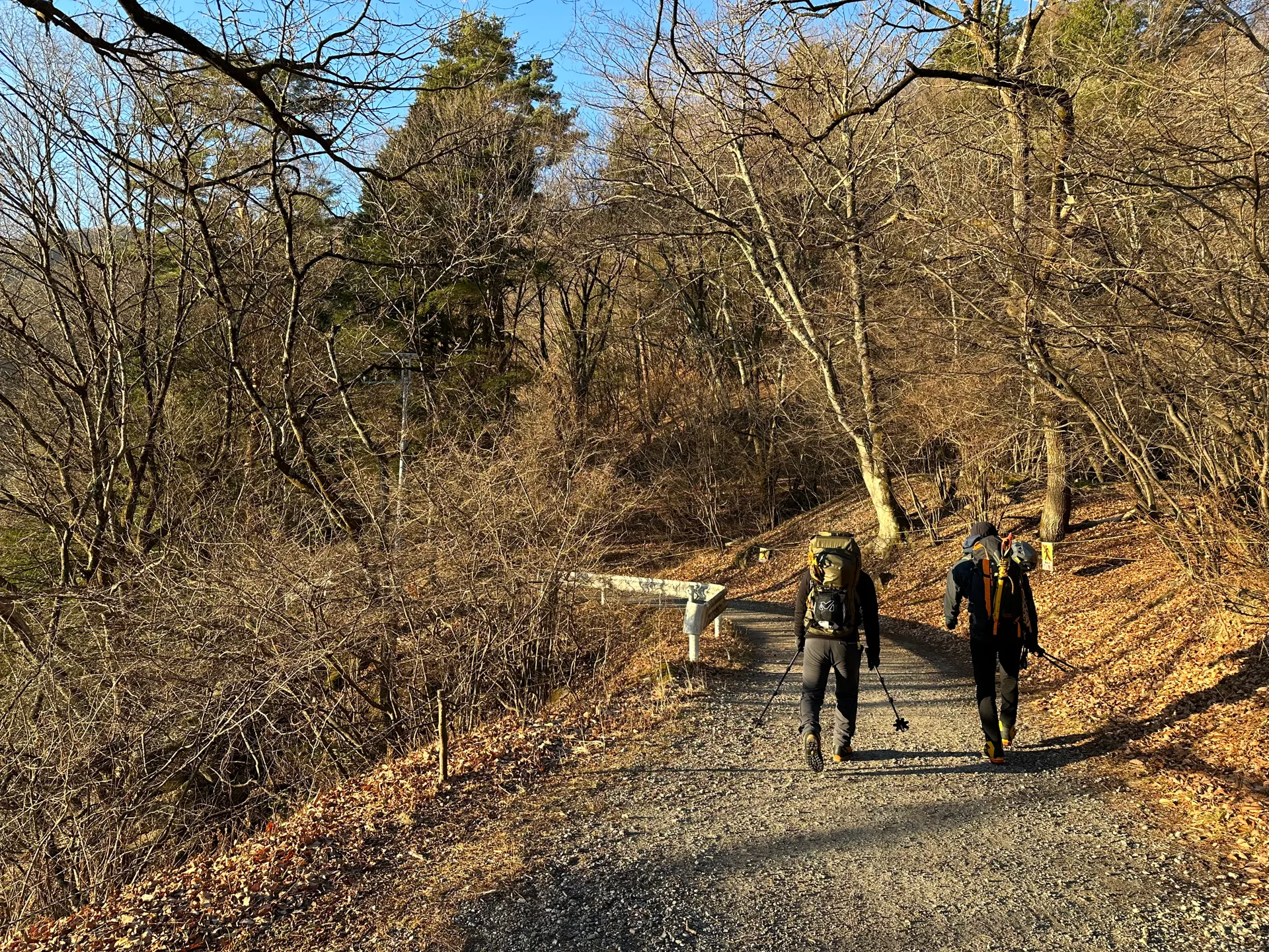
Mt Hinata can be done as a daytrip with public transport - although the number of buses is limited, and you have to walk 50 minutes from the bus stop to the trailhead.
Since I recently got my driver’s license in October, I decided to make this my first solo trip to the mountains by car. With this year’s winter being warmer than normal, I was able to climb this without any snow at the end of December 2023.
The course is fairly short which made it a good candidate for a beginner driver like me, as I didn’t want to tire myself out too much before my drive home.
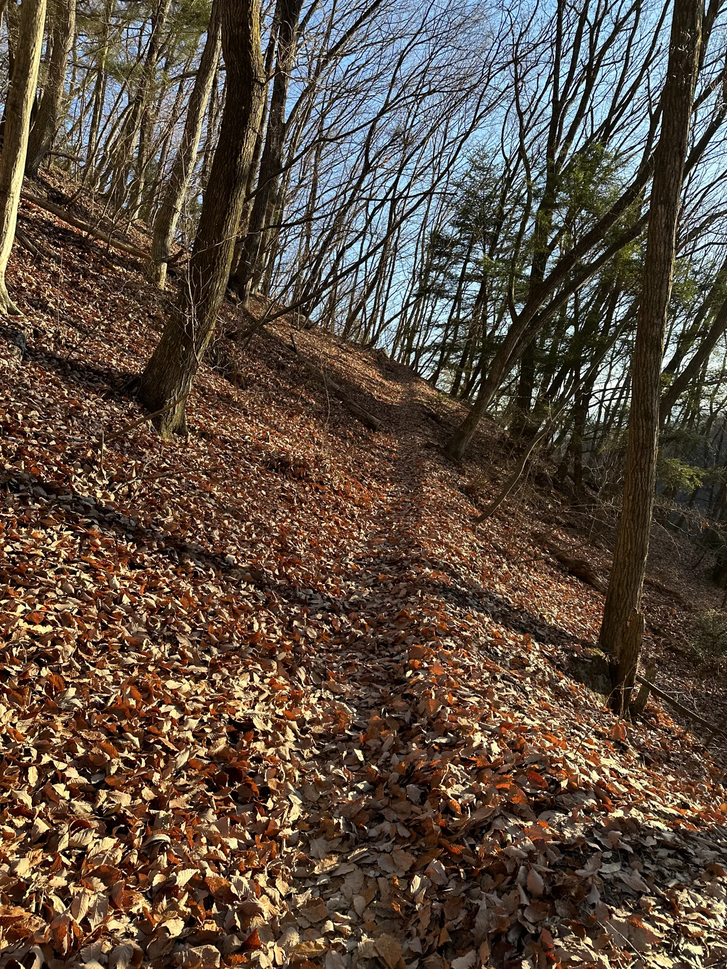
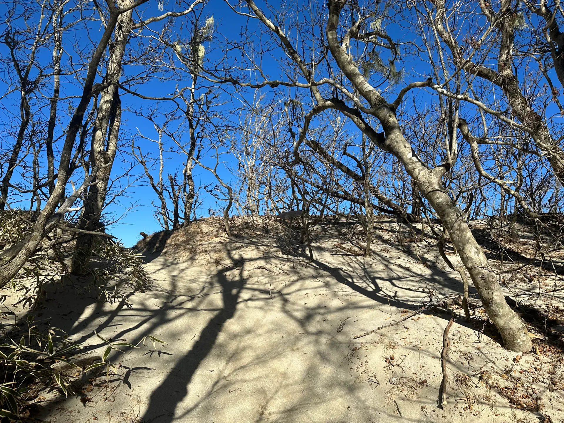
The route up is a fairly straightforward mountain trail, with lots of leaves.
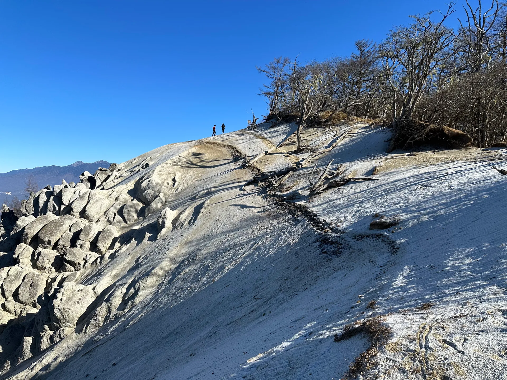
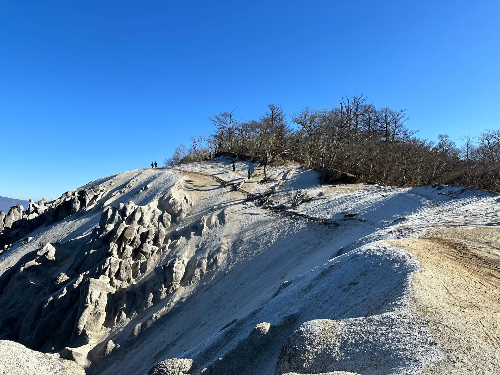
Once you get close to the summit, you finally start to see the famous sand.
The sand at the summit is so white it almost looks like snow. I’m not really sure why there is sand here at all, but it’s quite a unique feature that I haven’t seen in any of the other Japanese mountains that I’ve climbed.
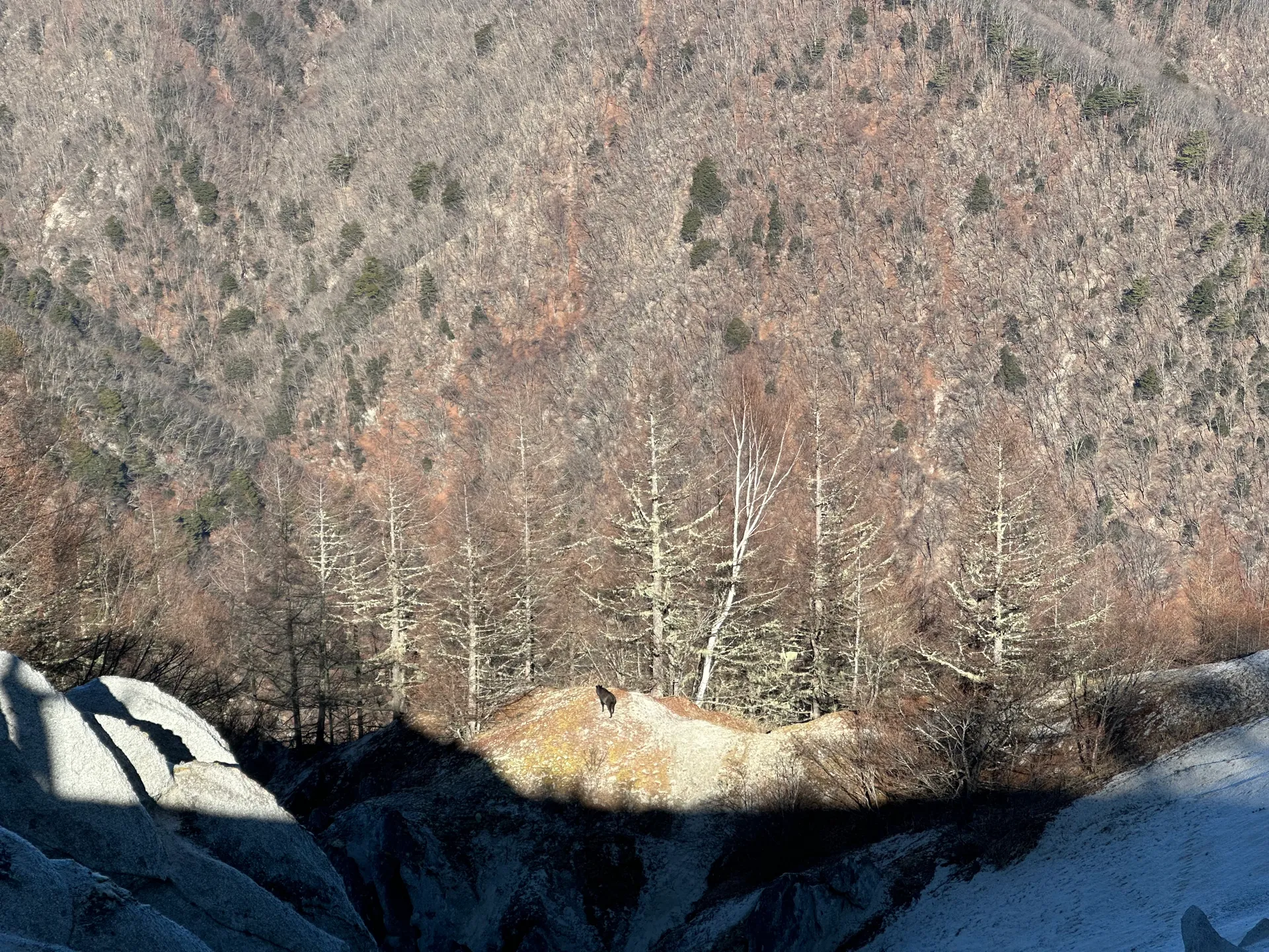
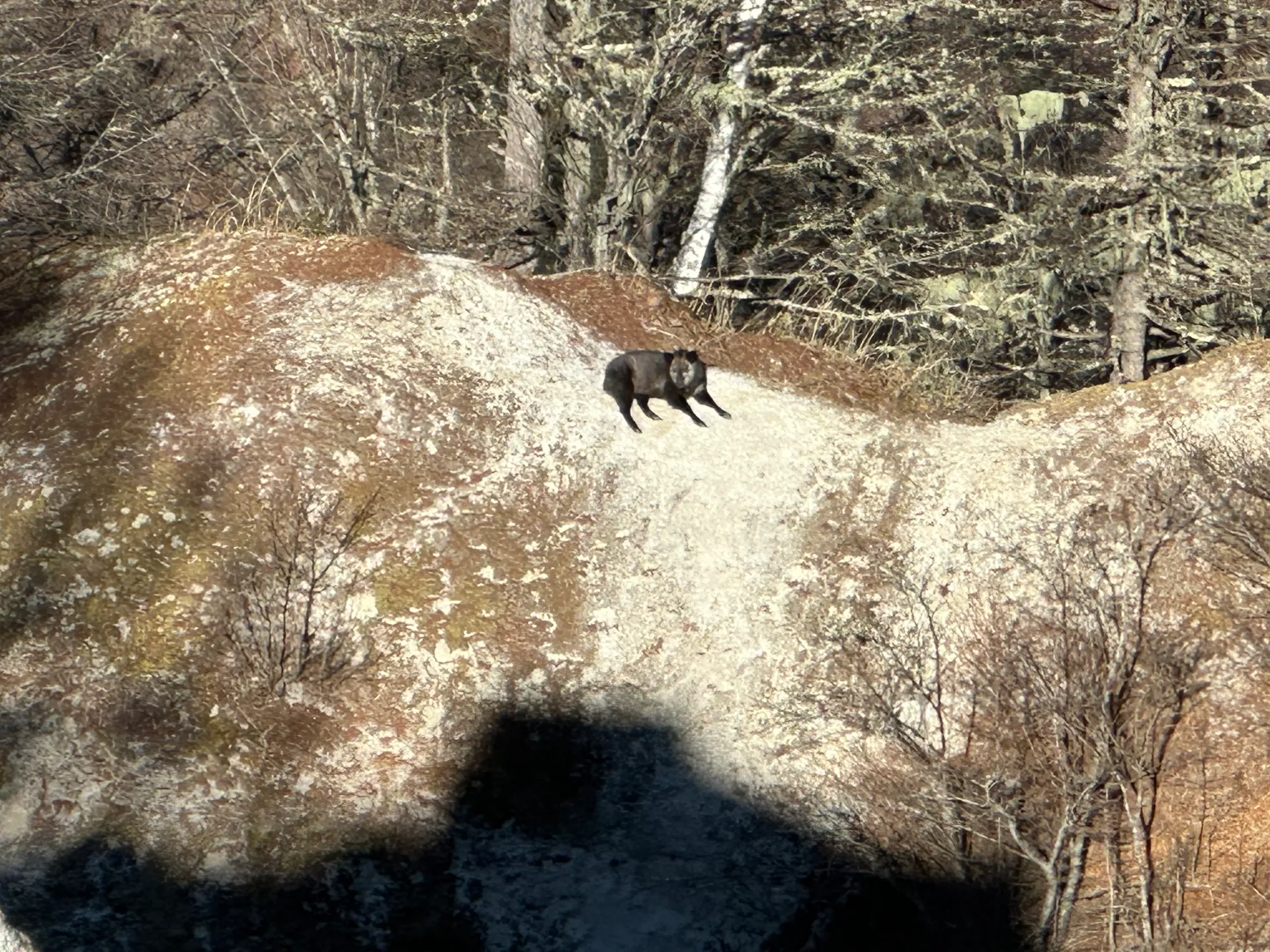
But more exciting than the sand, was the Japanese serow (カモシカ, Kamoshika) I spotted in the distance. They’re quite timid and this was only the second time I’ve ever seen one, but this one was far enough away that he either didn’t notice I was there or didn’t care.
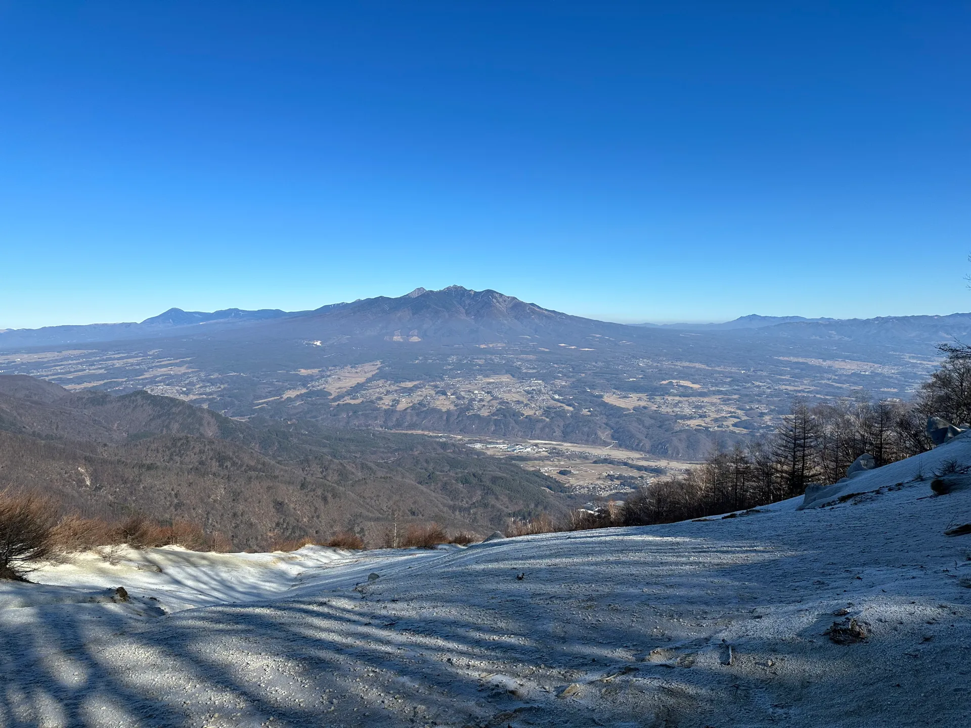
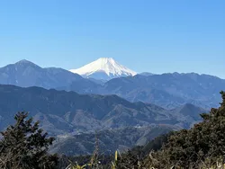
From Mt Hinata, you can also see the snow-tipped Mt Kaikoma (甲斐駒ヶ岳, Kaikoma-ga-take) in the distance. People can start from the same trailhead as I did and do 2-day loop course of both Kaikoma-ga-take and Mt Hinata.
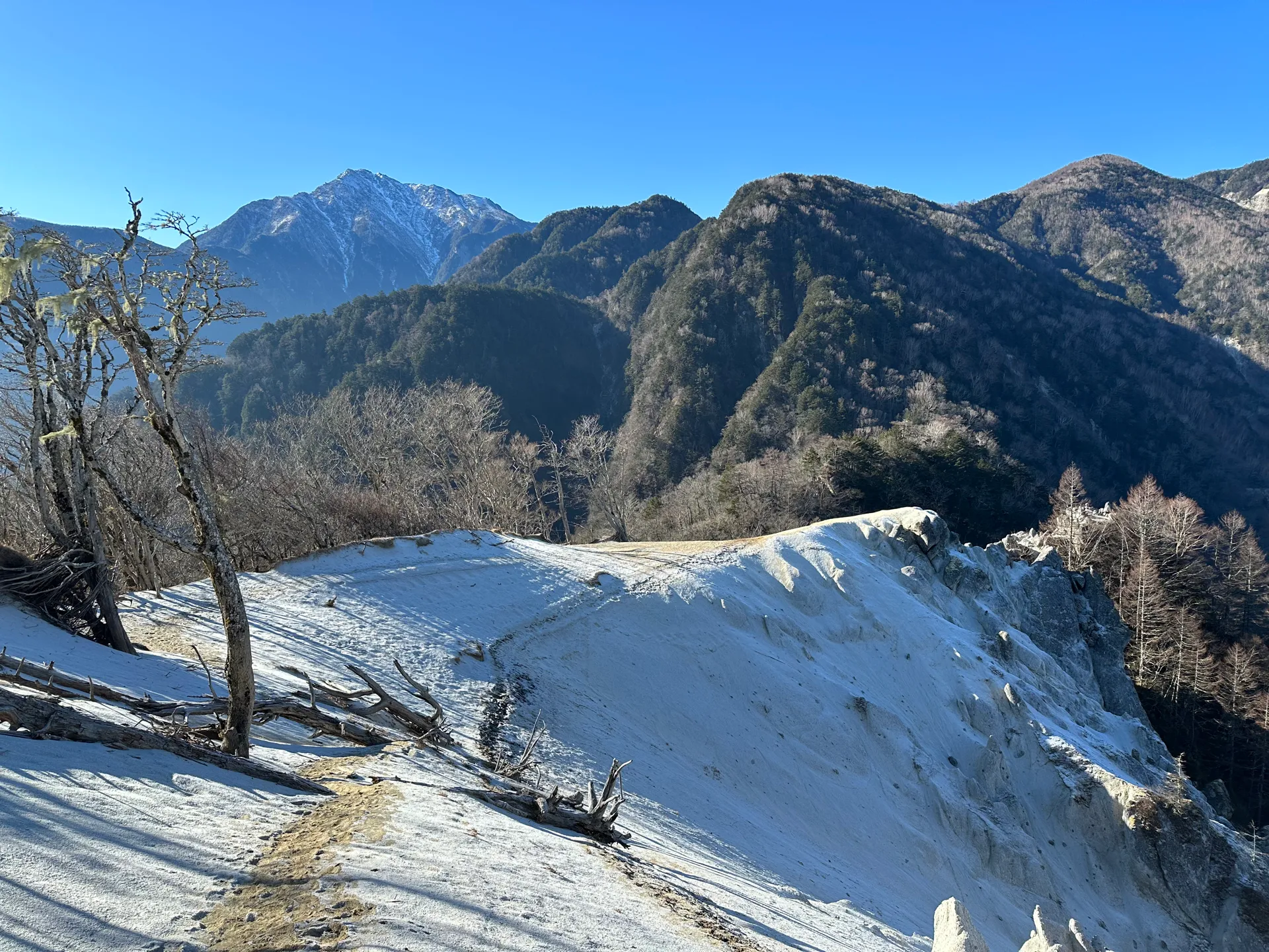
I was also able to see Yatsugatake in the distance - probably one of my favourite mountain ranges!
I enjoyed some hot chocolate at the summit (while staring at the Kamoshika) before making my way back down. This was my final hike of 2023, and it was a really good one!
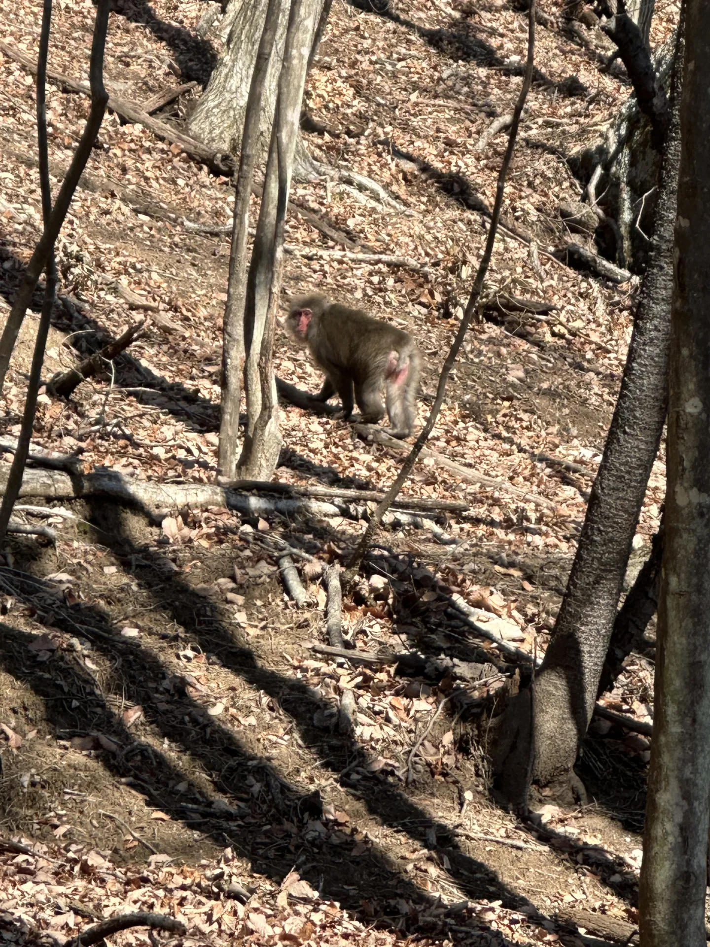
On the way back, I passed a family of monkeys who were playing on the trail ahead of me. I sneakily took some photos through the trees, and as I got closer they ran away.
Finally I stopped off at the Ojira-no-Yu (尾白の湯) onsen, which is under 10 minutes by car from the trailhead, before heading home.
| Date climbed | Length | Course time |
|---|---|---|
| 2023-12-30 | 8.3km | 4h55m (the expected time for an average hiker without breaks) |
If you’re doing Mt Hinata as a daytrip, this is the only course available. If you have the stamina you can extend it by continuing on to the nearby 鞍掛山 (Kurakake-san) before returning back the same way you came.
There is one toilet available at the trailhead.
This page has a overview of the different bus options available.
| Time | Location | Transport | Cost | |
|---|---|---|---|---|
| 05:29 | 東京 (とうきょう) | Train | 2640 | |
| 08:30 | 韮崎 (にらさき) | |||
| 08:45 | 韮崎 | Bus | 1040 | |
| 09:18 | 道の駅はくしゅう南 (みちのえきはくしゅうみなみ) |
The 05:29 start involves taking a local train. You can spend an extra 1580 on the express train if you want to sleep in the extra 30 minutes.
From the bus stop, you have to walk 40 - 50mins to the 尾白川渓谷 trailhead to begin the course.
There’s also quite a big gap between the return buses - they’re at 14:49 or 17:39. If you have a lot of time left over, I recommend killing time at the nearby onsen.
You can get a local train home as well, but generally I prefer to pay the extra money rather than get home super late, so I’ve put the express train into the example schedule.
| Time | Location | Transport | Cost | |
|---|---|---|---|---|
| 17:39 | 道の駅はくしゅう南 | Bus | 1040 | |
| 18:12 | 韮崎 | |||
| 18:25 | 韮崎 | Express train | 4220 | |
| 20:26 | 東京 | |||
| Trip total: | 8940 |
| Car park | Time (from Tokyo) | Round trip cost |
|---|---|---|
| 尾白川渓谷 駐車場 (おじらがわかいこく ちゅうしゃじょう) | 2h30m | ~11100 yen |
The car park at the 尾白川渓谷 (Ojiragawa-kaikoku) trailhead is very large and fits 100 cars, so you shouldn’t have any trouble finding a spot.
To make your course shorter, there’s also the option to park at the 矢立石登山口 (Yadateishi-tozanguchi) trailhead, which you will walk past on the way. However this doesn’t fit many cars and is also closed off December through April. I did notice multiple cars parked along the road up to this trailhead though.
Leave a comment