hikes
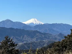
Mt Ena (恵那山)
14 Jun
Access to the Oshimizu trailhead via a local bus from Numata station. Alternatively, The Miike and Oshimizu trailheads are also accessible via direct overnight bus from Tokyo.
Expect to drive up to 4 hours from Tokyo, with a car park available at both Miike and Oshimizu trailheads. There are road closures in the winter months.
Mt Hiuchigatake (燧ヶ岳, hiuchi-gatake) is one of Japan’s Hundred Famous Mountains in Fukushima. Along with its neighbour Mt Shibutsu, the two mountains flank the beautiful Ozegahara marsh. Mt Hiuchigatake can be done as a day hike, or as a 2 or 3 day traverse course together with Mt Shibutsu.
I hiked Mt Hiuchigatake in the summer of 2023. My friend and I took an overnight bus from Tokyo, and did a 21km “day hike” from the Oshimizu trailhead (2023 Emma had a lot of energy). For those who want to enjoy a more reasonable day hike, there is also the option to do a 6 hour, 8.5km hike from the Miike trailhead.
💡 Mt Hiuchigatake is also known as Mt Hiuchi, but make sure not to confuse this with the 2462m elevation Mt Hiuchi (火打山) in Niigata.
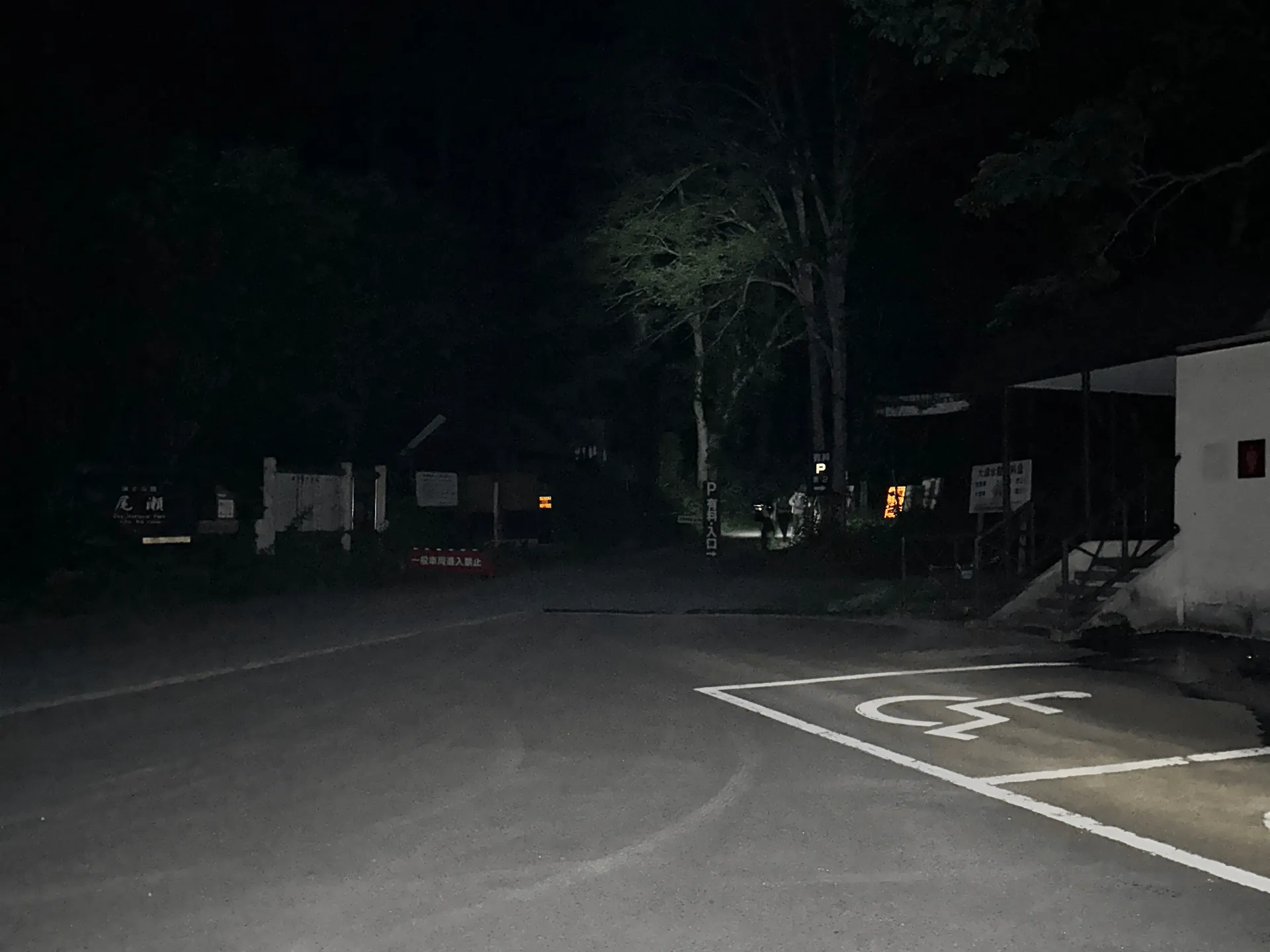
Our overnight bus arrived at the Oshimizu bus stop at 3:50am. It was still pitch black, and so we started our hike off with a headlamp. This was my first time using a headlamp, and walking in the dark felt quite spooky, so I was glad I did this one with a friend.
The first hour’s stretch of walking is 3km along a road, and around 4:45 we passed the Ichinose (一ノ瀬) bus stop. We would be returning to this bus stop later in the day, and would be able to get on a shuttle bus back down to Oshimizu. By this point it was starting to get quite a bit brighter.
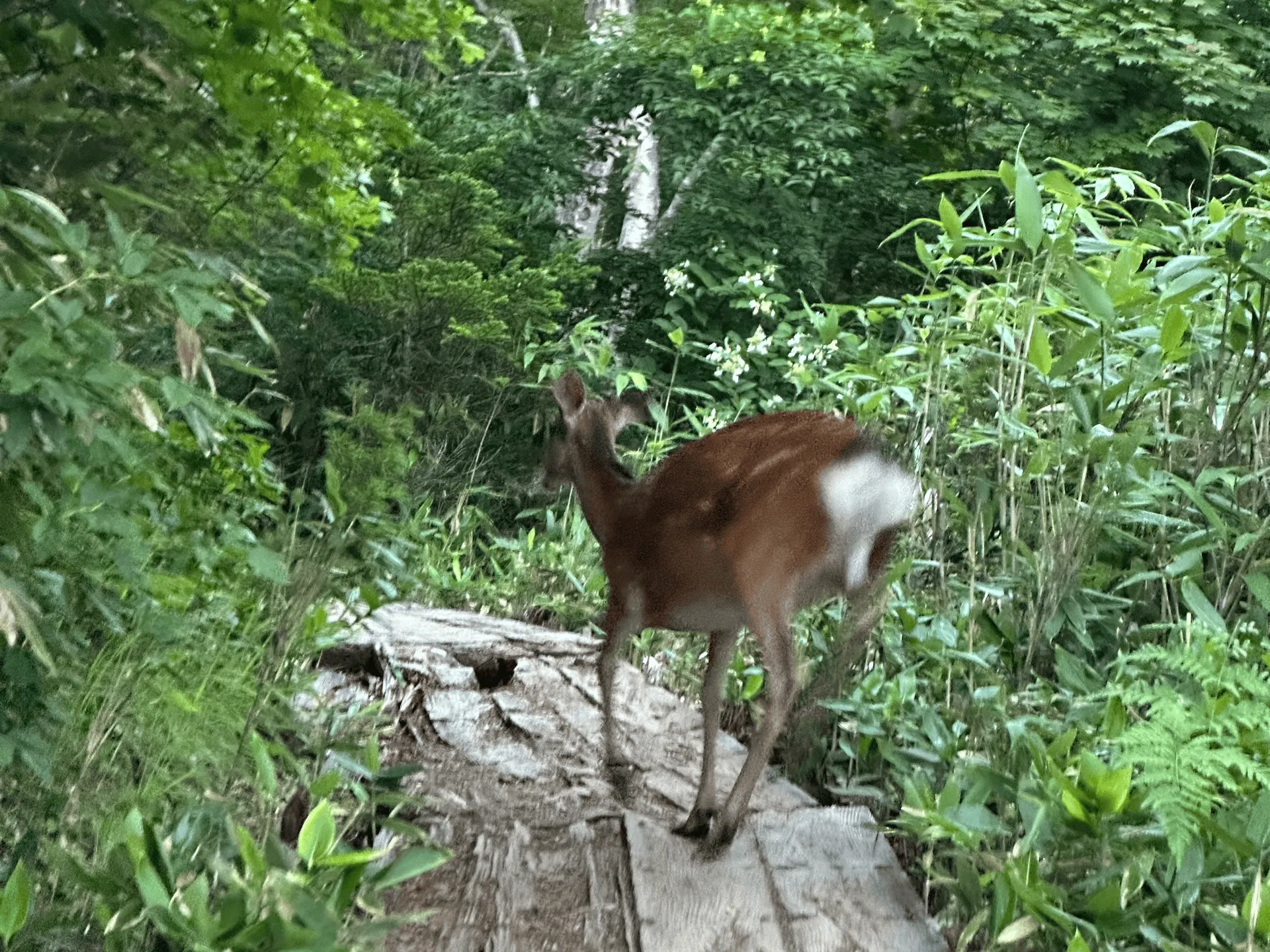
As we left the road and entered the trail itself, we had our first wildlife encounter of the day - a deer - who was immediately spooked and darted away as soon as we spotted each other.
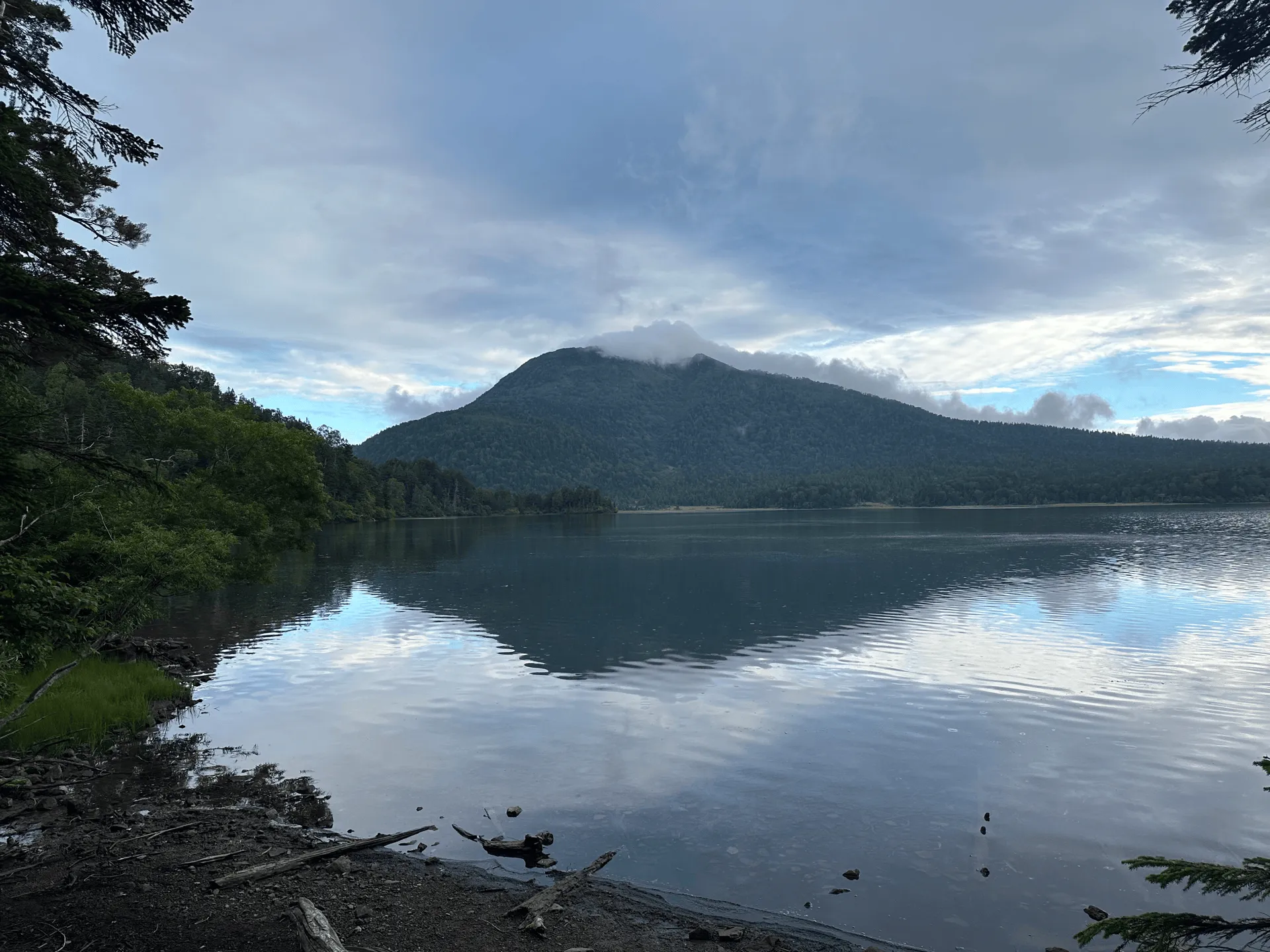
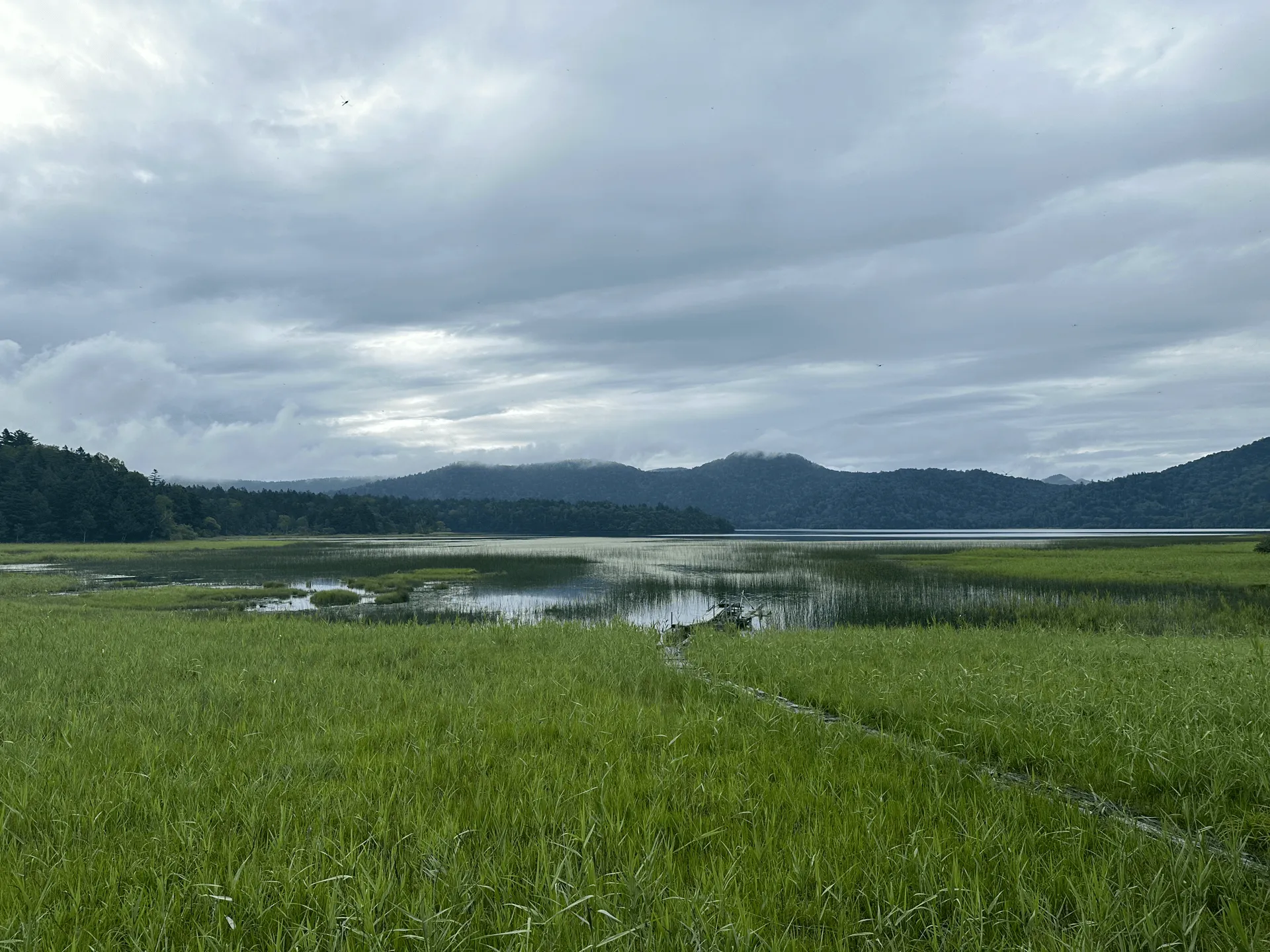
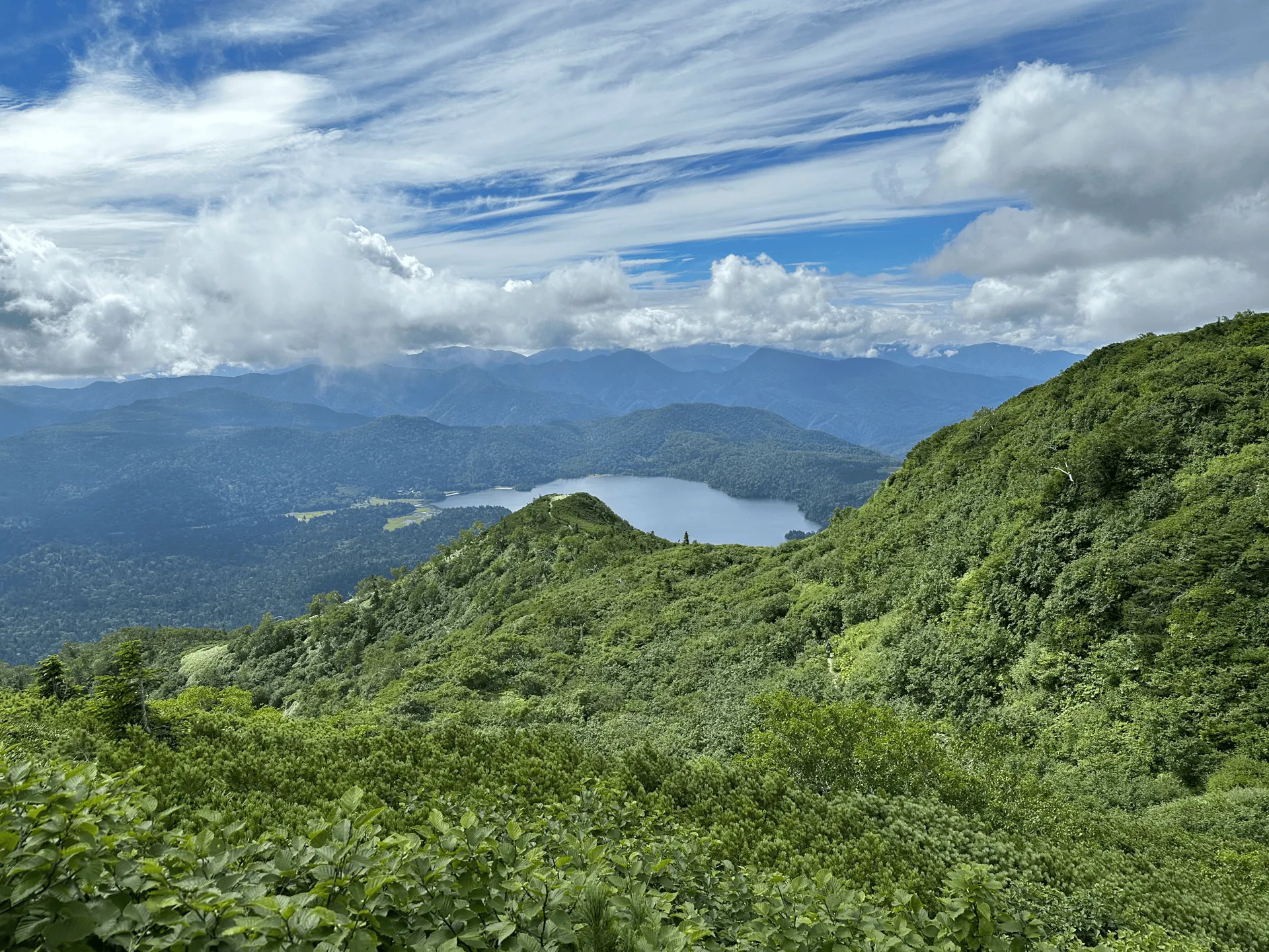
Around 6am we reached Lake Ozenuma, and from here you get quite a comfortable flat stretch for 45 minutes, as you walk around the left side of the lake.
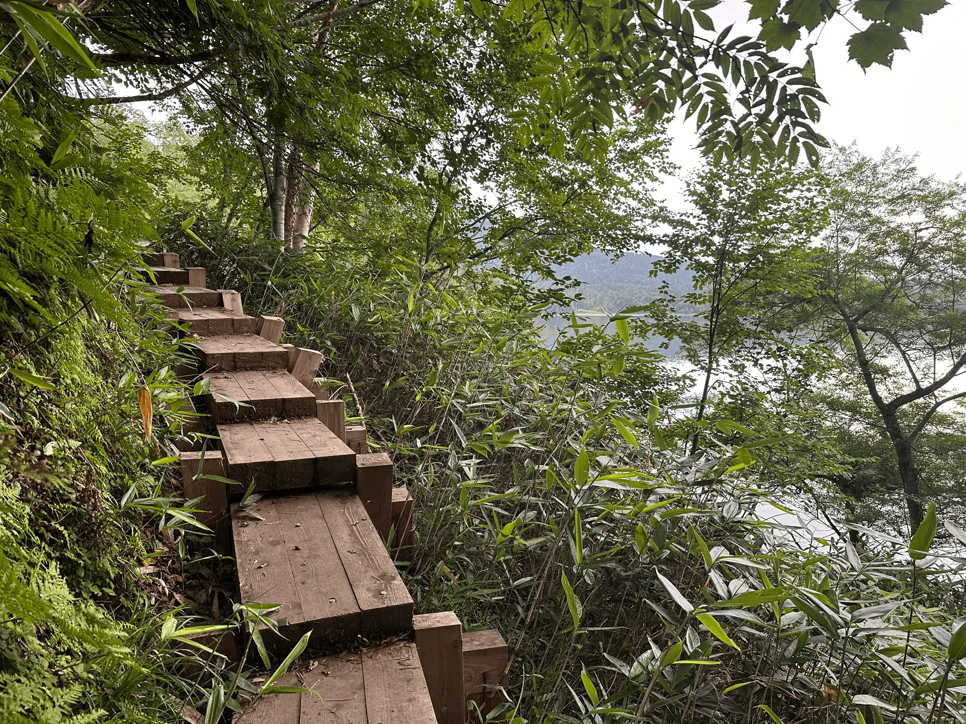
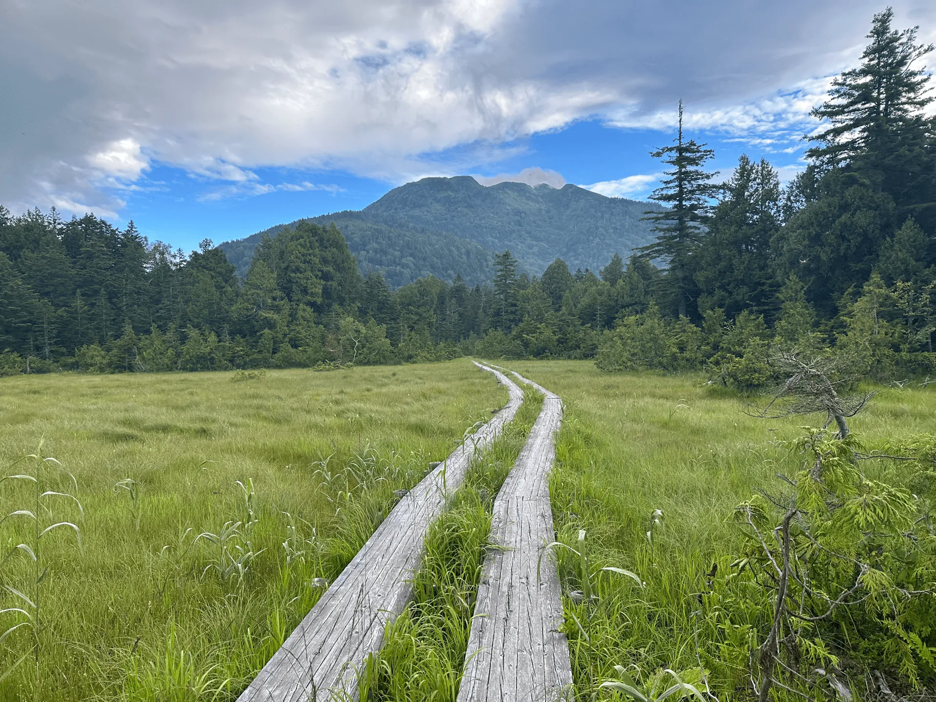
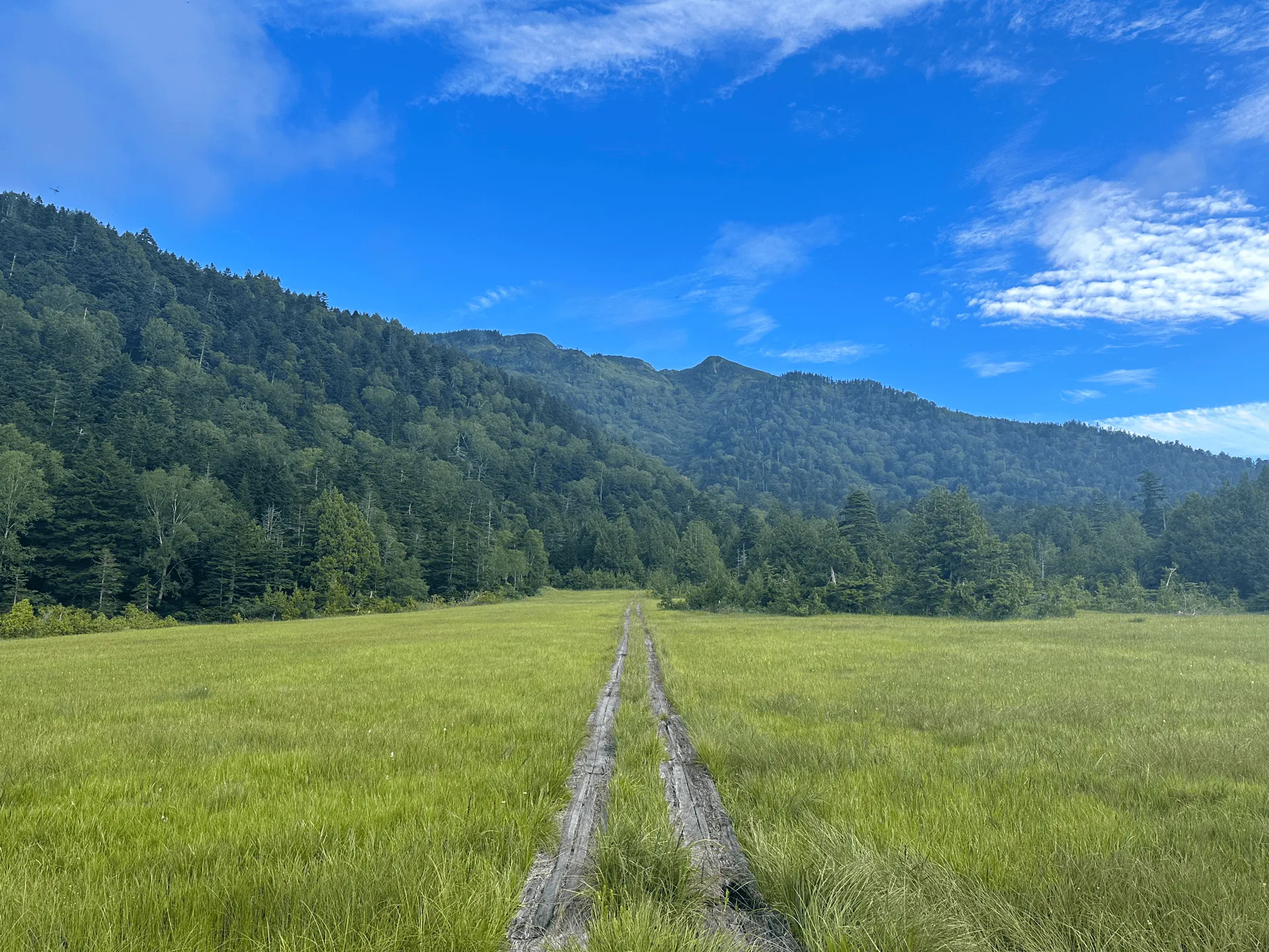
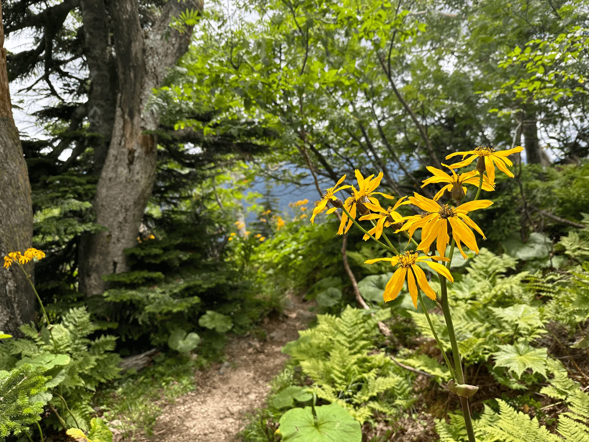
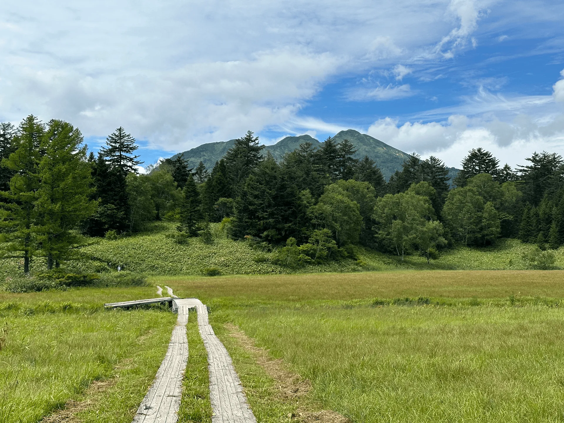
As you head out past the lake, you come to a boardwalk. These stretch out across the Oze marsh, and I would say are quite iconic - if you see a photo of someone hiking along a boardwalk, it’s more than likely Oze.
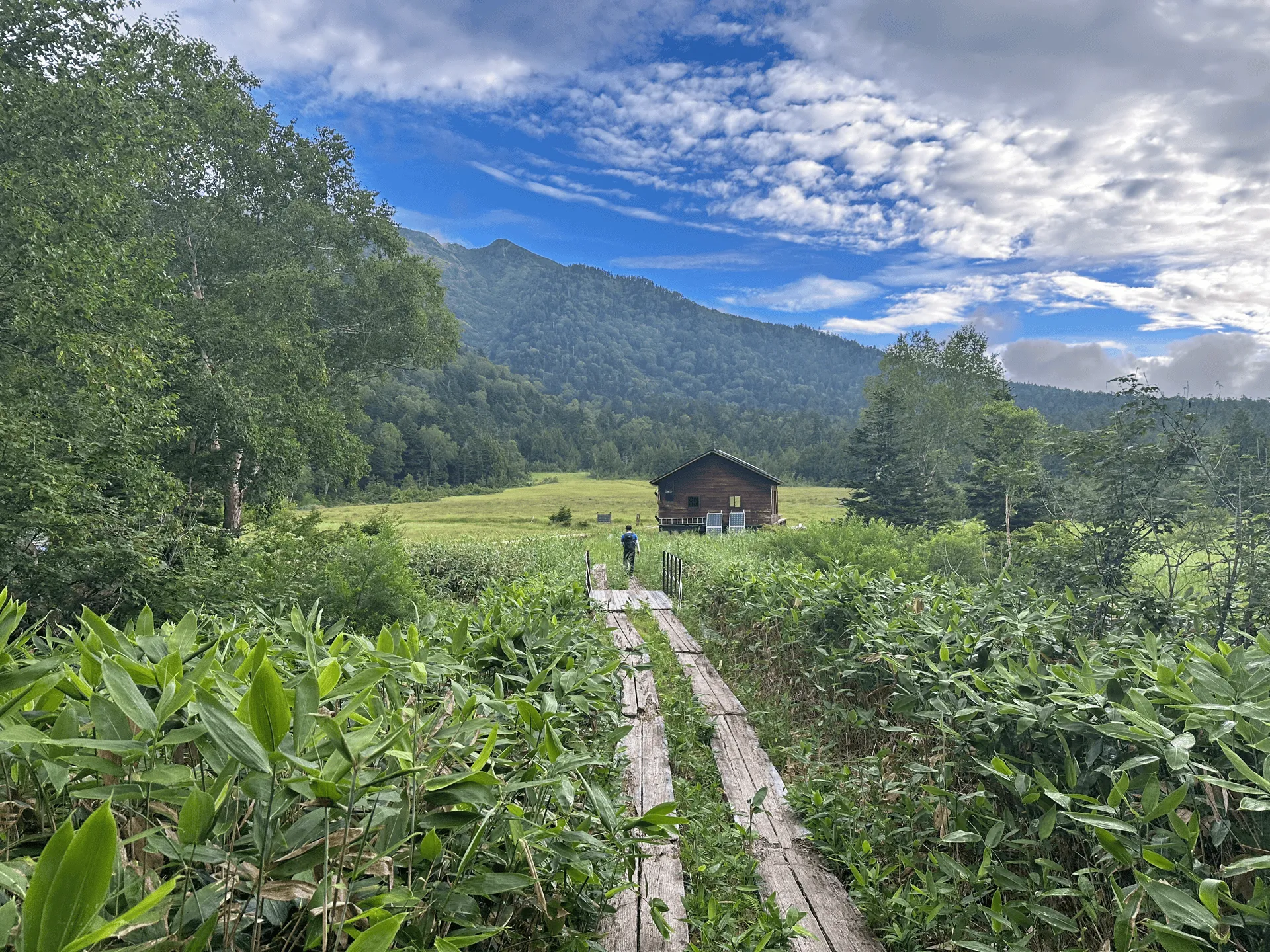
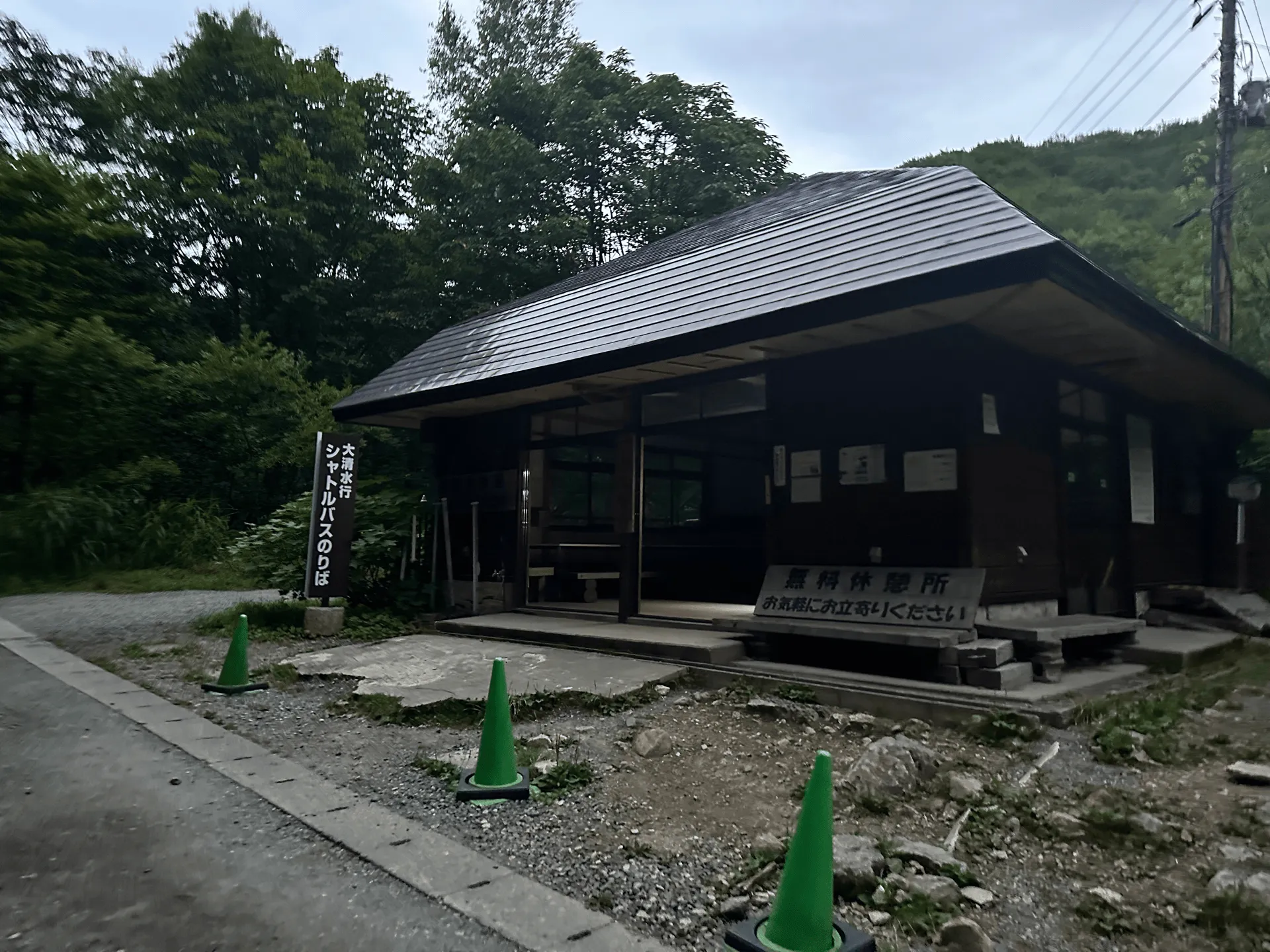
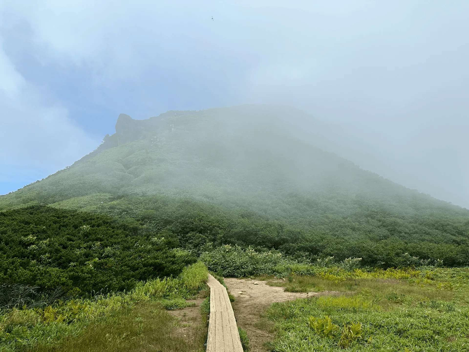
Near the end of the boardwalk, there is the Numajiri rest spot (沼尻休憩所), which is a small building sitting next to the edge of the marsh. This is your last chance to take a break before the main hiking begins.
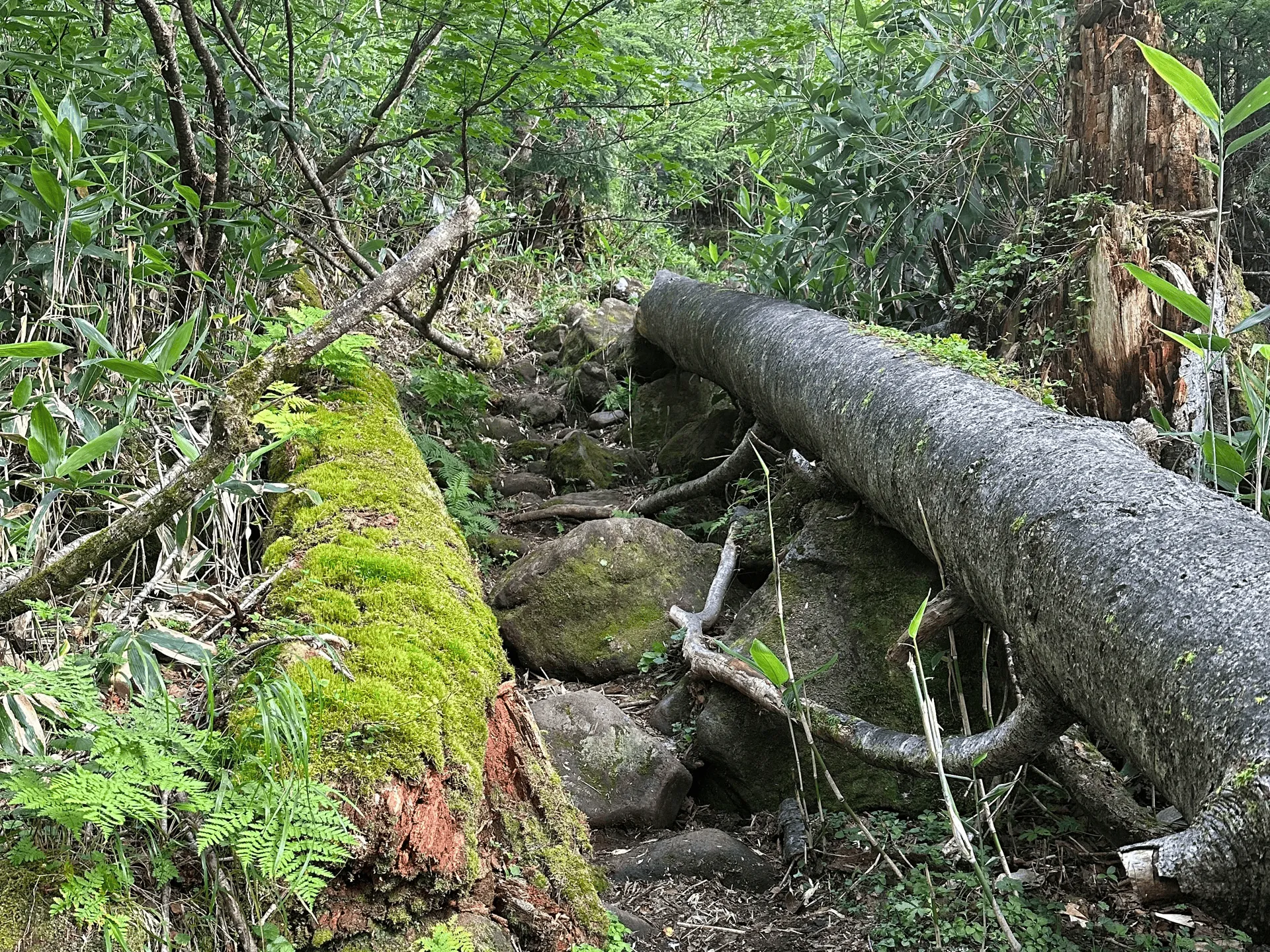
By 7am we reached the end of the boardwalk and began our climb. This trail was quite steep, with a lot of scrambling up over rocks, and the lack of sleep probably started to kick in at this point and I found it quite exhausting. It didn’t help that I had just gotten back to Japan from a work trip to Australia the week before so I definitely was not in top condition. I was grateful to my friend for dealing with me being a bit of a slowpoke!
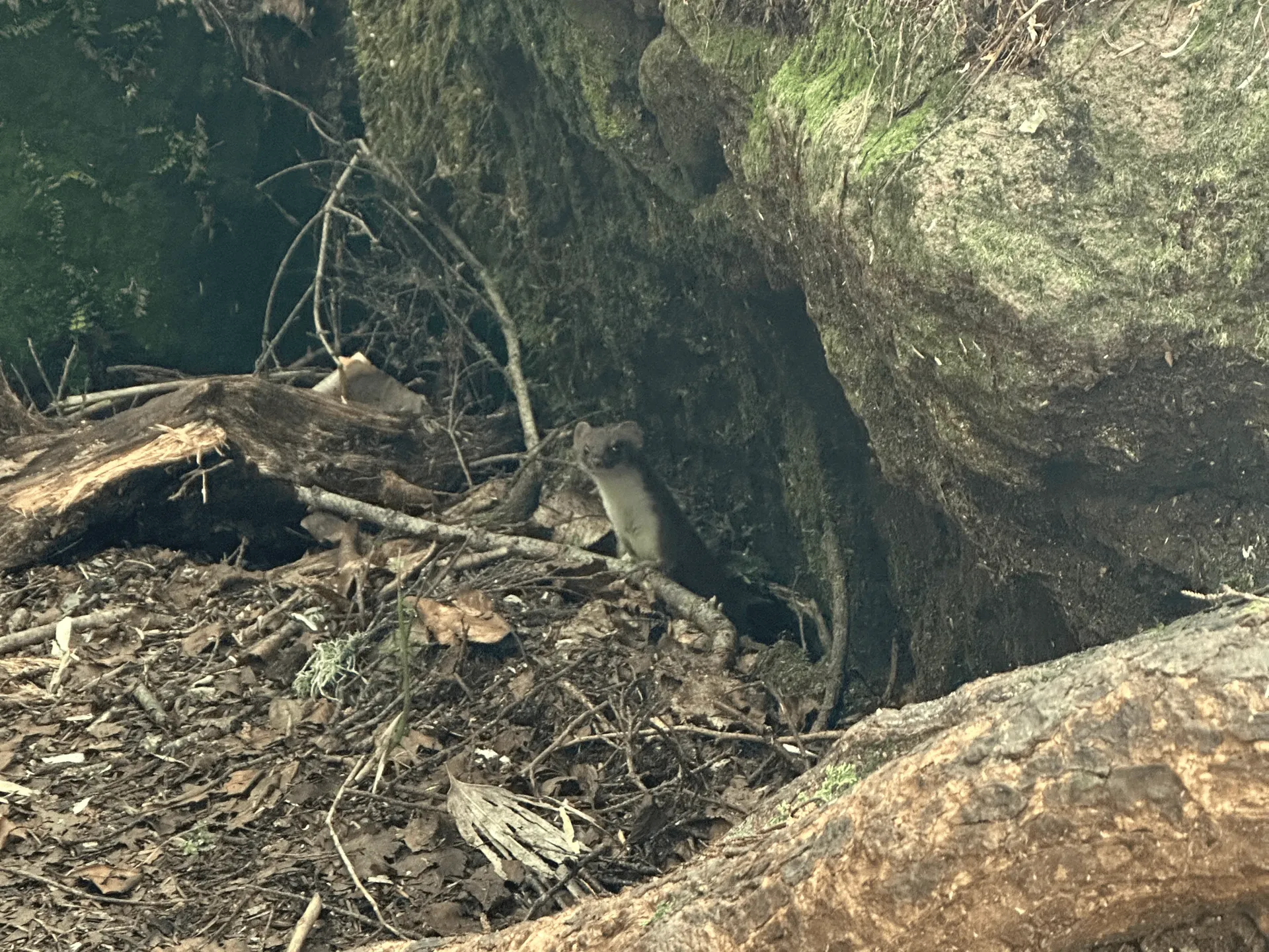
But one highlight of this climb was us spotting a Hondo stoat (オコジョ, okojo). This guy was very curious about us, and would pop his head out from one hole before disappearing and reappearing from another hole. Very cute.
As we kept climbing, we had the opportunity to look behind us and see the edges of the lake and marsh we had previously been walking past.
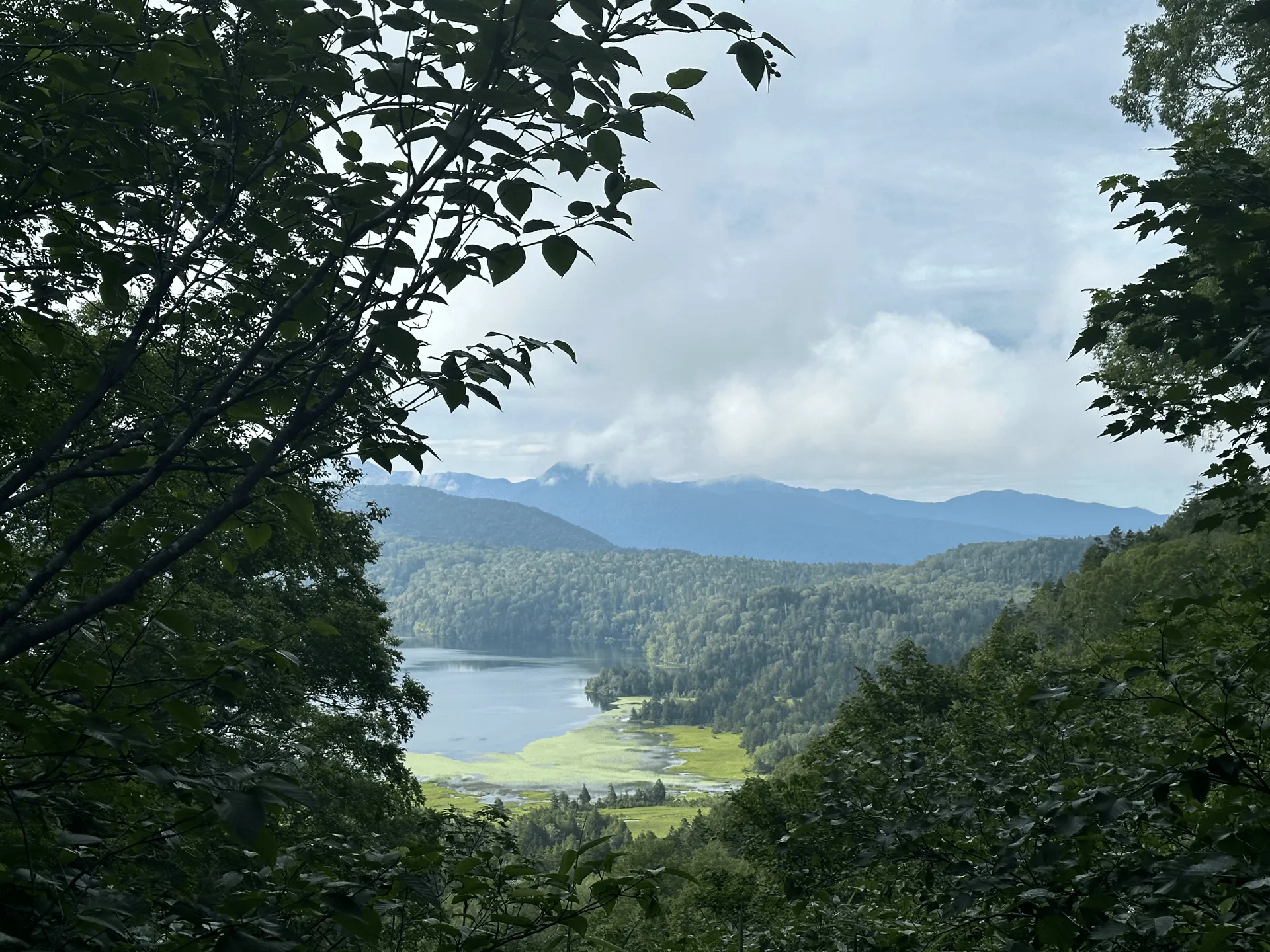
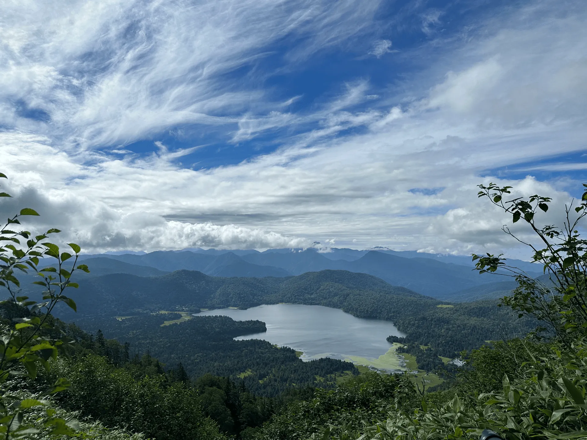
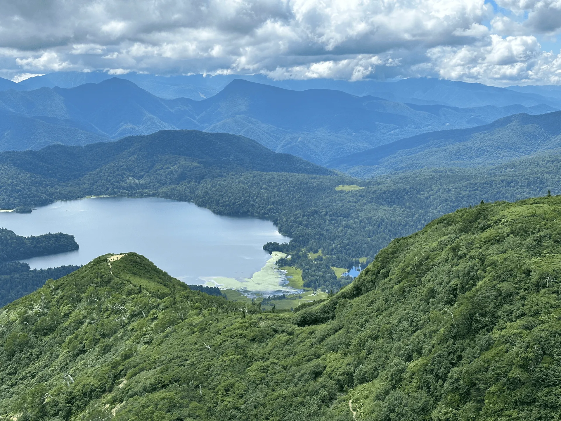
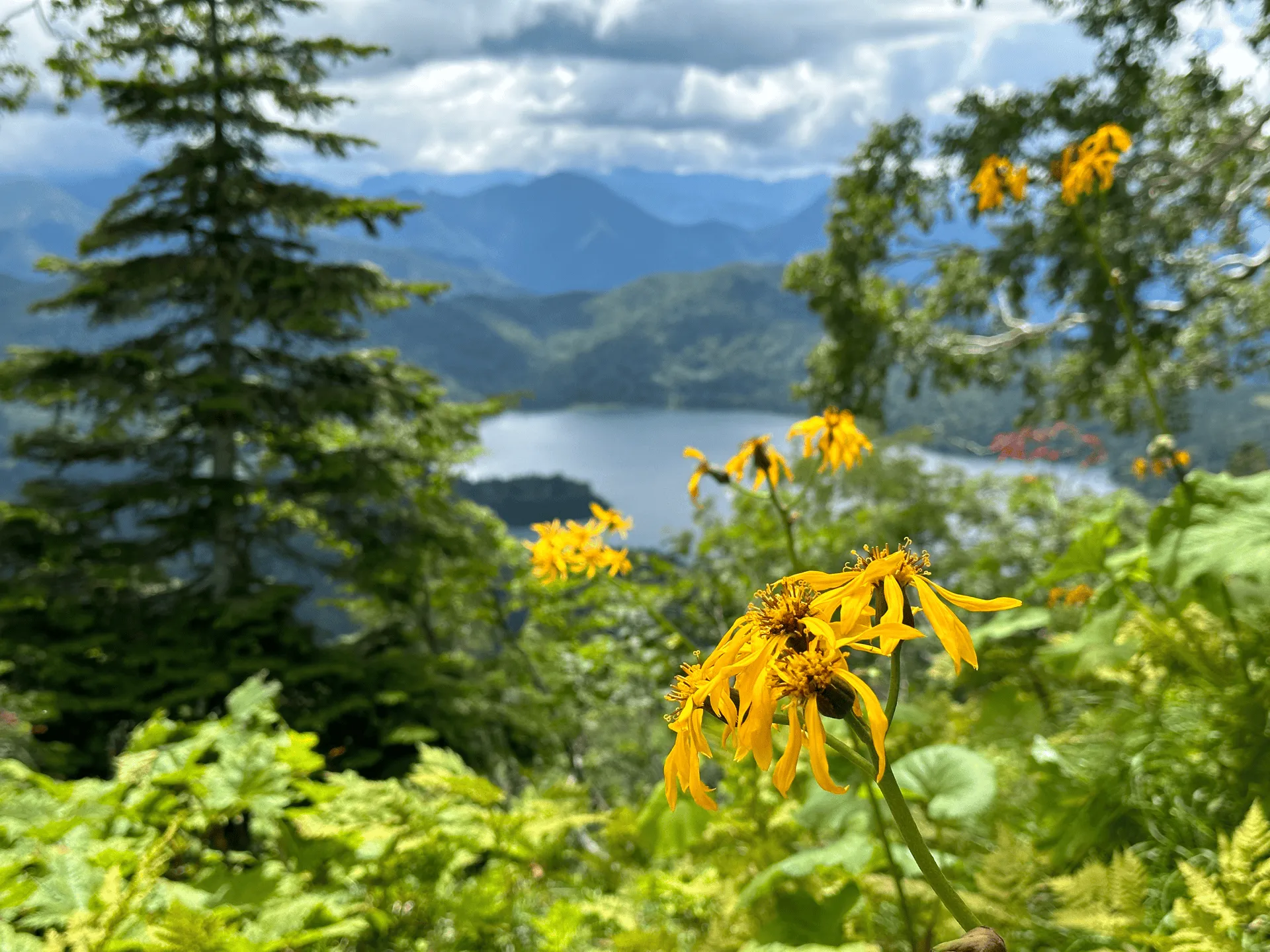
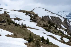
And as we kept climbing and climbing, we got the chance to see the whole of Ozenuma Lake itself.
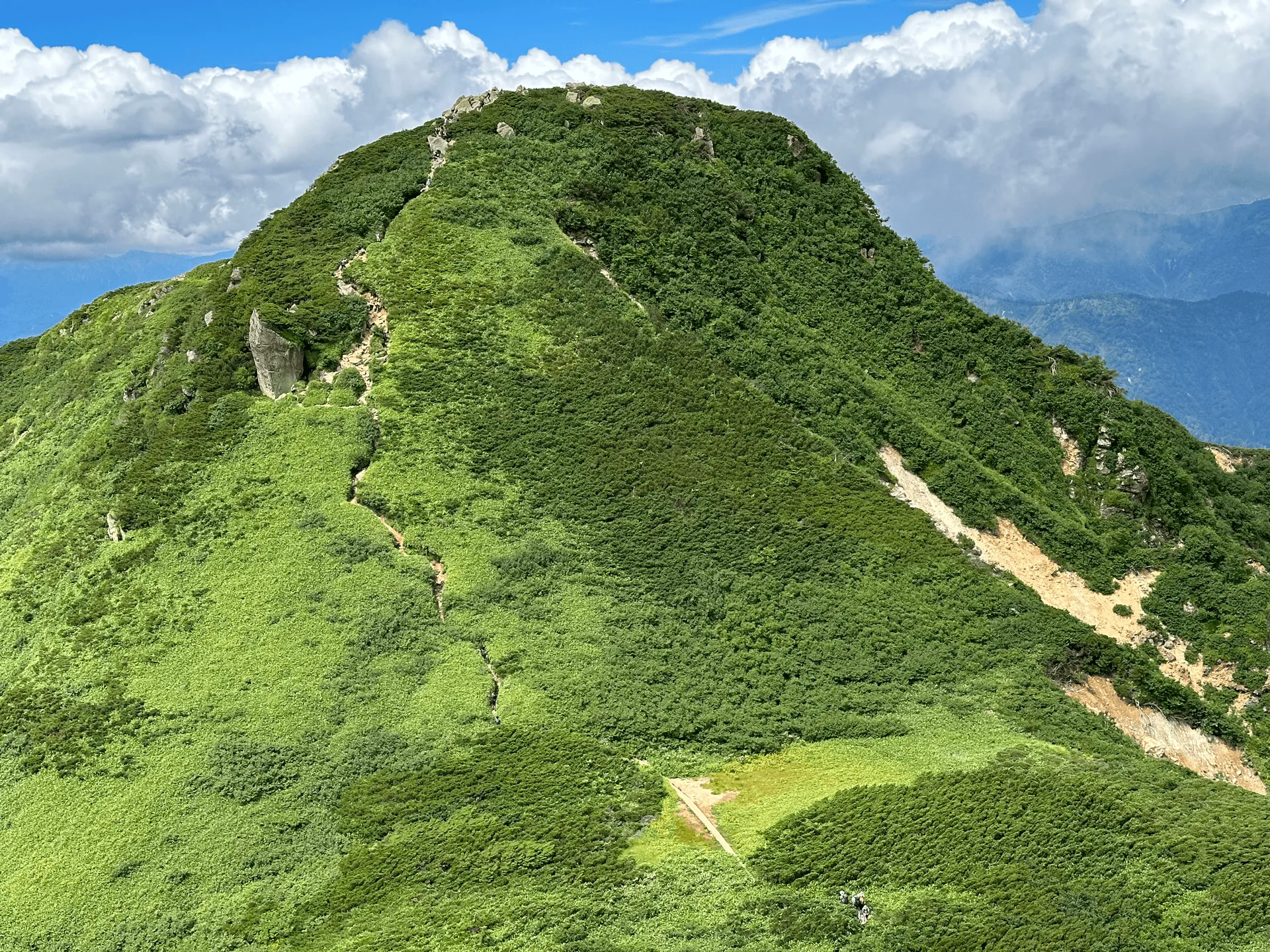
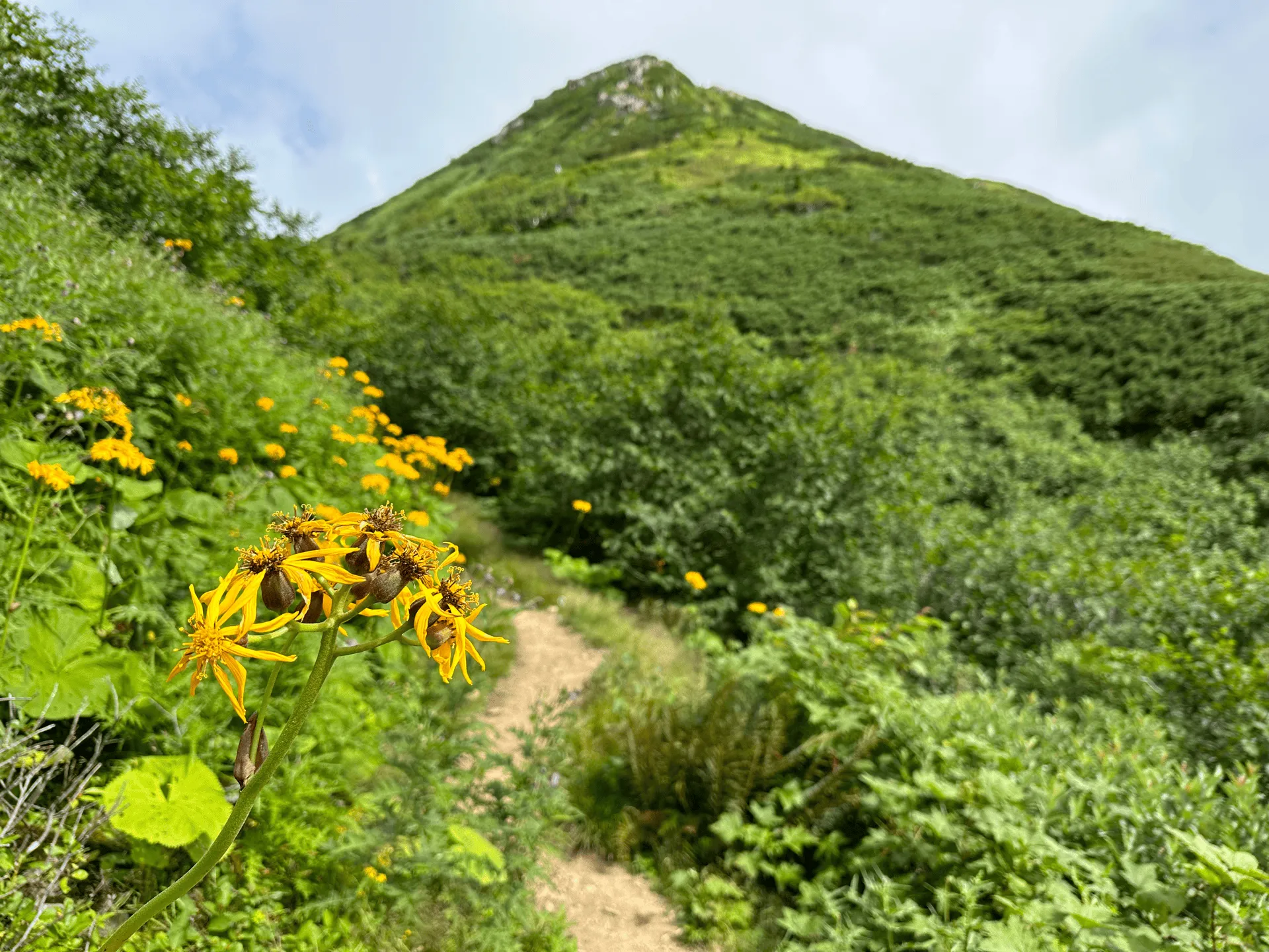
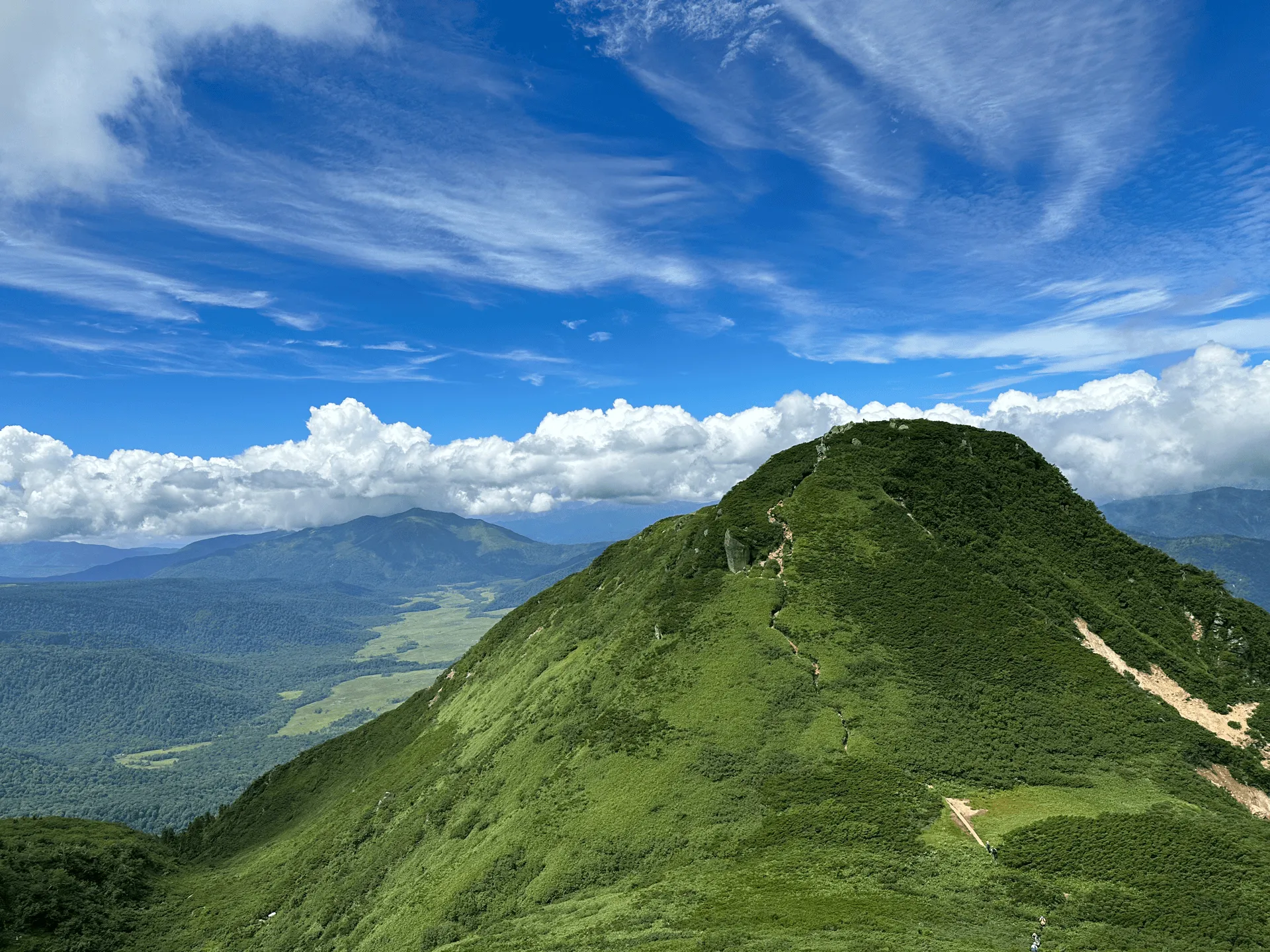
Before reaching Mt Hiuchigatake, you’ll also pass Manaitagura (俎嵓), which at an elevation of 2346m is only 10m lower than the highest point. The kanji 嵓 or “gura” means something along the lines of a “rock below the summit” so it’s aptly named in this case. The kanji itself looks pretty cute too - it’s a 山 (mountain) stacked on top of 品 (which means things or items). Not quite the direct meaning, but you can sort of visualise it, right?
If you turn in the other direction, you can look back towards the lake and you’ll also spot the minor peak of Minobuchi-dake (ミノブチ岳), which we will be passing on the way back down.
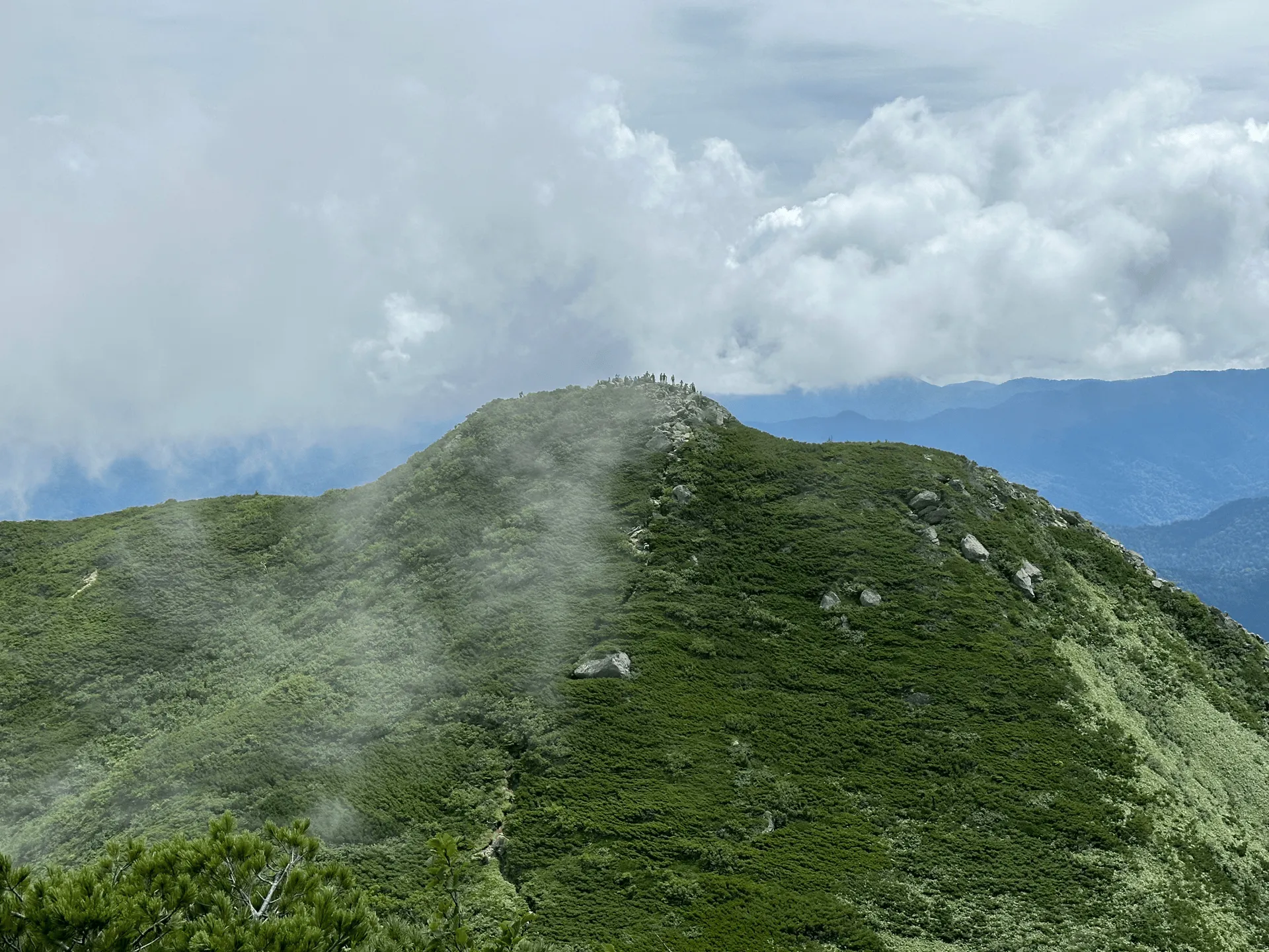
We reached Manaitagura around 9:20am. The peak was quite crowded with people, but its highlight is the great view it gives of the peak of Mt Hiuchigatake.
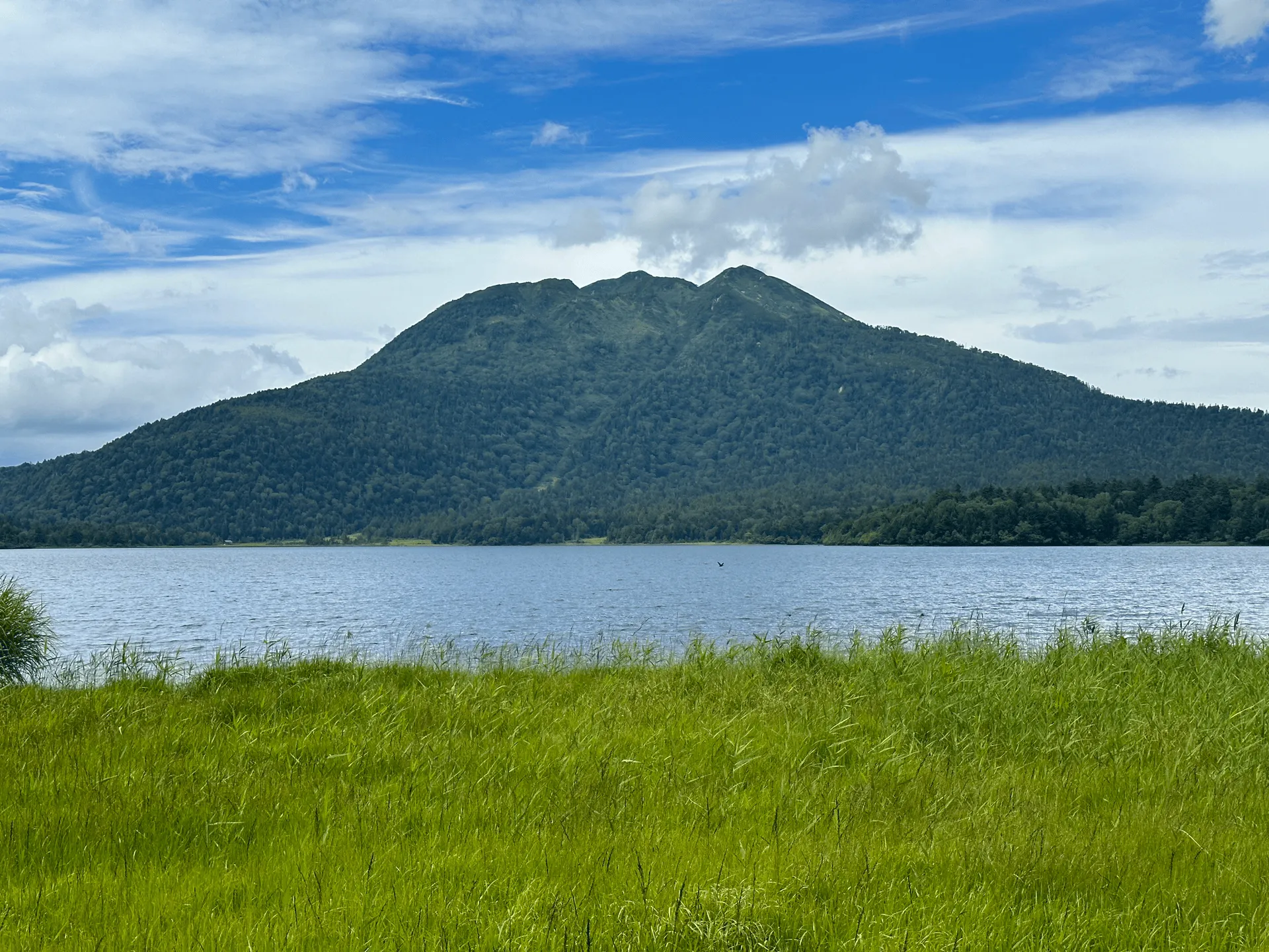
This is also your only chance to get to see both Mt Hiuchigatake and Mt Shibutsu in the same shot.
From Manaitagura, you’ll have to descend a bit and then climb again to reach the highest point of Mt Hiuchigatake.
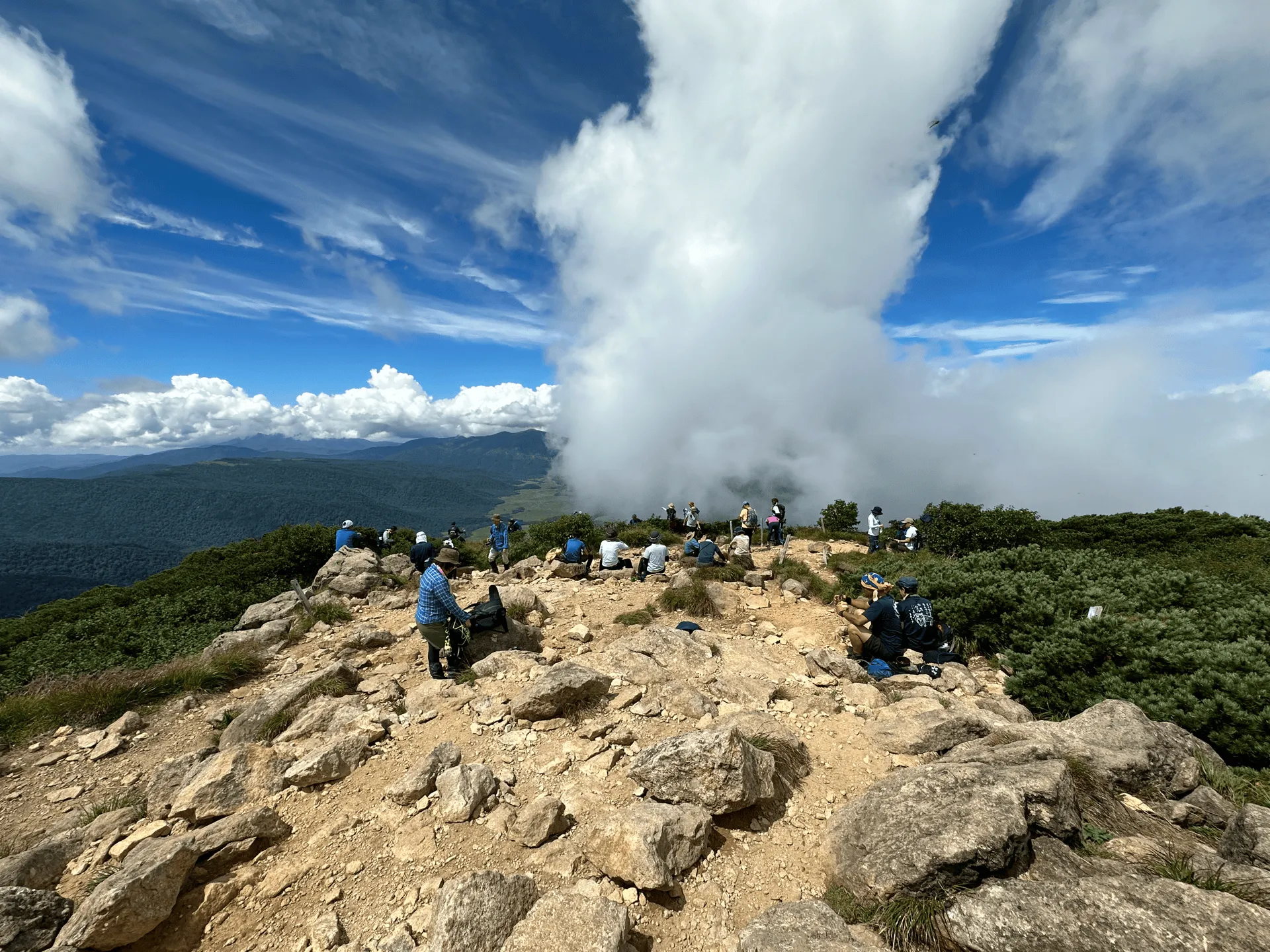
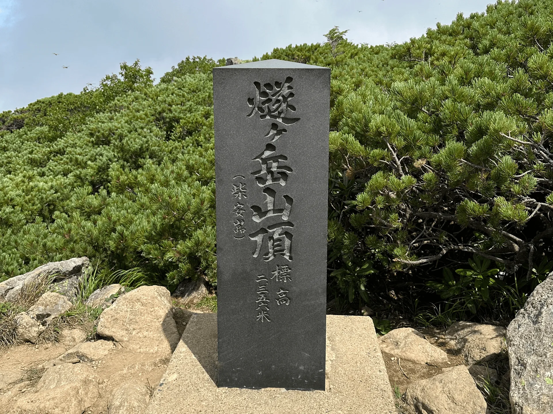
Mt Hiuchigatake’s highest point is also known as Shibayasugura (柴安嵓), which you can see is written in brackets on the peak marker. The entire mountain itself is known as Mt Hiuchigatake, so I suppose Shibayasugura helps to distinguish this specific peak.
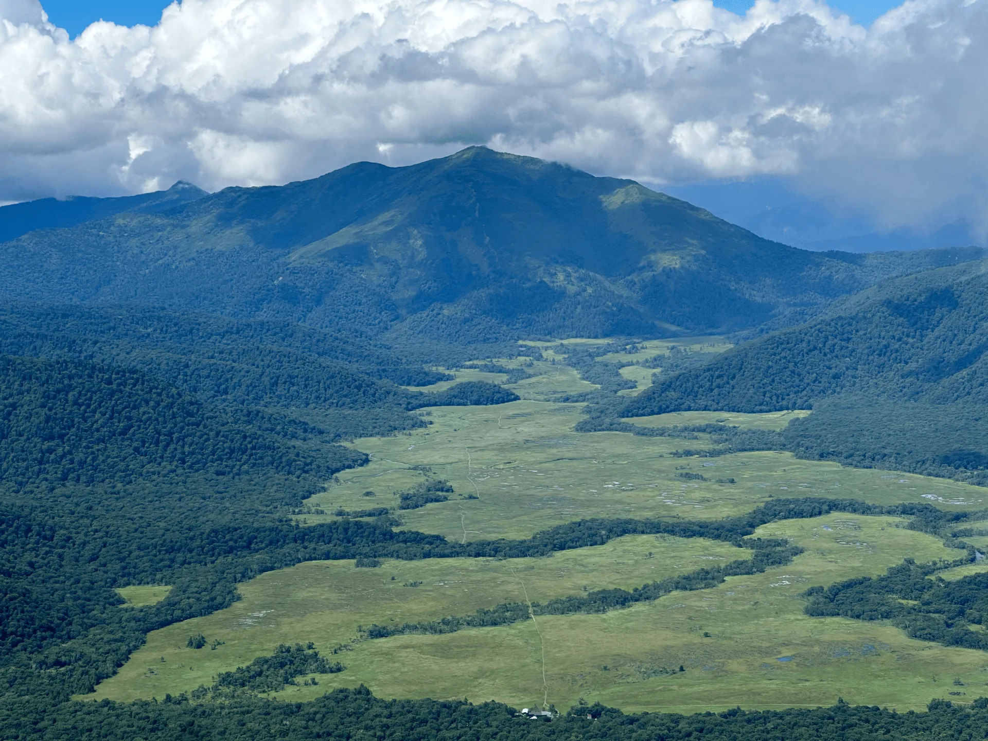
From Mt Hiuchigatake, you can see the entire Oze marshland stretch out before you, leading up to the peak of Mt Shibutsu on the other side. In my Mt Shibutsu post, you can see the opposite photo of Mt Hiuchigatake from Mt Shibutsu’s side. I visited Mt Shibutsu in November, so it’s pretty interesting to see how much difference 3 months can make to the colour of the marsh as well.
To begin our descent, we first had to climb back up to Manaitagura, before descending down towards Minobuchidake.
Along the way, we passed a field of summer ragwort or マルバダケブキ (“marubadakebuki”). I had visited Mt Kirigamine the month prior to see its famous yellow nikko kisuge blooming, but actually I thought this was prettier. I suppose there is also something very satisfying about being able to see flowers that require an exerting hike to reach.
Eventually we descended back to the Oze boardwalk, and walked along the opposite side of Lake Ozenuma on our way back. We didn’t quite do a full loop of the lake during today’s hike, but I think we walked around at least half of it.
We also got one final view of Mt Hiuchigatake from across the lake. The peak in the middle is the highest point (Shibayasugura), while the bit sticking out on the right is Manaitagura.
We finished our hike just before 2pm at the Ichinose (一ノ瀬) bus stop, where we got a shuttle bus back down the road to Oshimizu. At 21km in just under 10 hours, this was quite a long day, but what a great hike it turned out to be!
| Date climbed | Length | Course time |
|---|---|---|
| 2023-08-11 | 21km | 11h45min (the expected time for an average hiker without breaks) |
I took the 21km course up to Mt Hiuchigatake via the Oshimizu (大清水) bus stop. This is a partial out-and-back, partial loop course, where you take the trail to the edge of Lake Ozenuma, before you then do a loop course to Mt Hiuchigatake and the back down to the lake. Finally, you take the same route back to the bus stop.
There are shuttle buses running in between Oshimizu and the Ichinose (一ノ瀬) bus stops, so we shortened our hike by 3km by finishing at Ichinose and getting the bus back to Oshimizu on the way back.
In terms of toilet locations, they are available:
The timings are quite tight on this hike, even coming by overnight bus, and it is quite long. For those looking for a shorter option, there is also a 6 hour out-and back hike starting and ending at Miike trailhead (御池登山口).
Of course, this also can be extended into an overnight hike. There are plenty of people who camp or stay at one of the huts on the marsh. This also gives you the opportunity to combine the hike with Mt Shibutsu.
I climbed Mt Hiuchigatake as a “day hike” via an overnight bus. The upside of an overnight bus is that you get plenty of time to finish the hike, since you arrive so early in the morning. The downside is that you may not get very much sleep. Personally speaking, I find myself to be OK with just one night of sleep deprivation - I just need to doubly make sure that I have been getting a full 8 hours rest at least 1 or 2 nights before the bus ride.
You can usually book overnight buses via sites like Hassha Orai or bushikaku.net. Usually I will just Google “新宿 ~ 大清水 夜行バス” (“Shinjuku ~ Oshimizu overnight bus”) and a website with booking options will show up.
The Kan-estu website has the schedule for the overnight bus, and there are a couple of options for where you can get on the bus - at Shinjuku, Nerima or Kawagoe station. I opted to get on at Kawagoe, just because I wanted to reduce the time I had to spend in the bus itself.
When I used the bus in 2023, it departed Kawagoe at 23:35, but it looks like the new departure time is now 0:15, which gets you to the final stop of Oshinomizu (大清水) at 4:30. Although the schedule shows the bus trip taking over 4 hours, this includes several longer stops at service areas on the highway, so people have a chance to use the toilet and stretch their legs.
Once you arrive at Oshimizu, there are shuttle buses running between Oshimizu and Ichinose (see 2024 timetable) but they only start running at 5:30. It’s 3.3km walk uphill between the bus stops, and YAMAP puts the official course time to take 75 miniutes to walk between the two. Personally, I am a fast walker so I was able to do it in 45 minutes. So it will be a matter of timing, or whether you want to conserve your stamina, for whether you take the shuttle bus or not.
I would however recommend taking it on the way back down, since I’m sure you will be super tired at that point. Make sure to bring cash, as the bus fare is 1000 yen one way, cash-only.
Once you are back at the Oshimizu trailhead, you have two options to get home back to Tokyo:
This means you will need to make the 15:30 shuttle bus from Ichinose to get on the final 15:55 bus. If you start your hike at 4:30 in the morning, you will need to finish in 11 hours, which is slightly shorter than YAMAP’s official course time of 11h 45min for the course. Although I’m not so fast on uphill climbs, I’m quite fast over flat surfaces and road, and so there was the opportunity for me to shave off some time there. I did the whole hike in just under 10 hours. I recommend being sure of your own stamina and speed before attempting this.
Alternatively, if you would like to do the 6 hour out-and back course, you can also get an overnight bus to the Miike trailhead. The Maitabi company (which caters mostly to hikers) does an overnight bus route which first stops at the trailhead for Mt Aizu-Komagatake before dropping you off at the Miike trailhead at around 5am.
If you are coming by car, you can park at the Oshimizu carpark (大清水 駐車場) which costs 1000 yen for the day. Expect it to be a 3.5 - 4 hours drive from Tokyo.
Similarly, the Miike trailhead (御池登山口) also has a 1000 yen per day carpark.
The road up to Oshimizu and Miike are both closed in winter, so this will limit when you can do your hike. For the 2024-25 season, the road up to Oshimizu is closed from the 5th of November through to the 18th of April 2025.
Although the neighbouring Mt Shibutsu has closures on its hiking trail during May and June to protect its vegetation, Mt Hiuchigatake has no closures, so you can start climbing as soon as the roads re-open in April.
However, there will still be snow left on the trail in April and May (e.g. see this hiking log at the end of May) so realistically the snow-free hiking season will be in June through to the end of October.
Comments
Leave a comment