Mt Ishiwari (石割山)


Mt Ishiwari (石割山 Ishiwari-yama) is a mountain right next to Lake Yamana-ko, and its close proximity to Mt Fuji makes for some excellent scenery if the weather is in your favour. Mt Ishiwari is also known for being a 100 Famous Mountain of Yamanashi.
Today's course involved climbing both Mt Ishiwari and the nearby Mt Ohira (大平山, Ohira-yama). The trail is beginner-friendly and makes for a good daytrip from Tokyo, with direct access via highway buses at both the start and end of the trails.

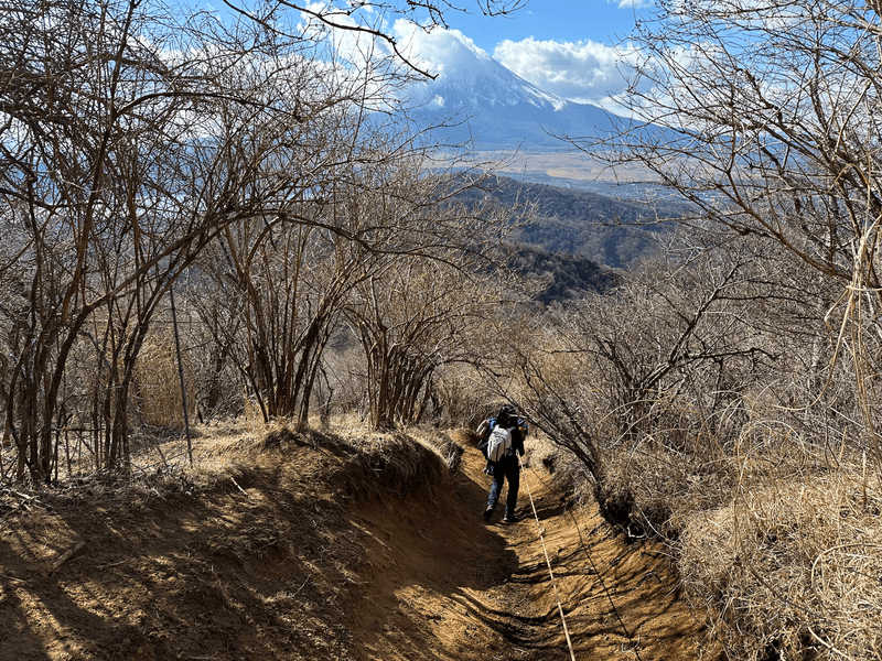
Your first hurdle after beginning the course is a very long, soul-crushing staircase. This is probably the toughest part of the course, so once you're past this it's a relatively easy hike.

We saw some people doing the hike in the reverse direction, possibly so that they get to go down these stairs instead of up. The overall elevation gain is still going to be the same and so I don't think one way is better than the other - it depends how much you hate stairs!
Both ends of the trail have an onsen too, so maybe you could make your choice on which onsen you'd prefer, or if there's a specific restaurant you want to visit at the end of the trail.

The next point you'll pass in the course is Ishiwari Shrine, which features a large cracked rock you can pass through.

For those who aren't too tired out from the stairs, it's said that if you do three loops around the shrine and pass through this rock, you will be granted good luck. I prayed for a good 2024 hiking year without any injuries.

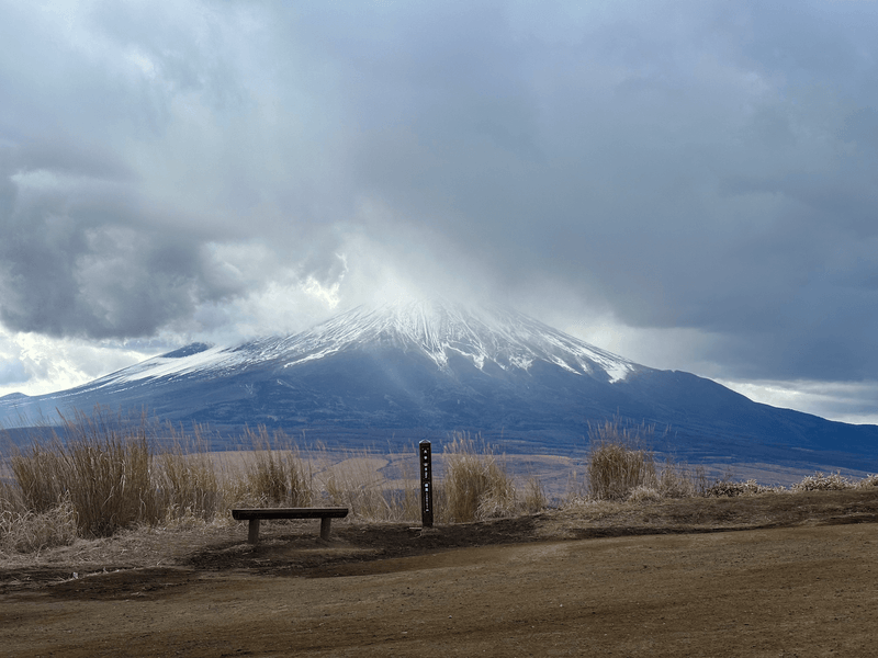
Fairly soon after the shrine you'll reach the first peak, Mt Ishiwari (石割山). Mt Fuji was a little bit shy behind the clouds today, but it wasn't a bad view!

It was pretty windy and cold at the summit so we decided to continue on without much of a break. From here, there's quite a steep (and a little muddy) trail downwards. There's a rope you can hold onto for most of it though, which makes things a little easier.
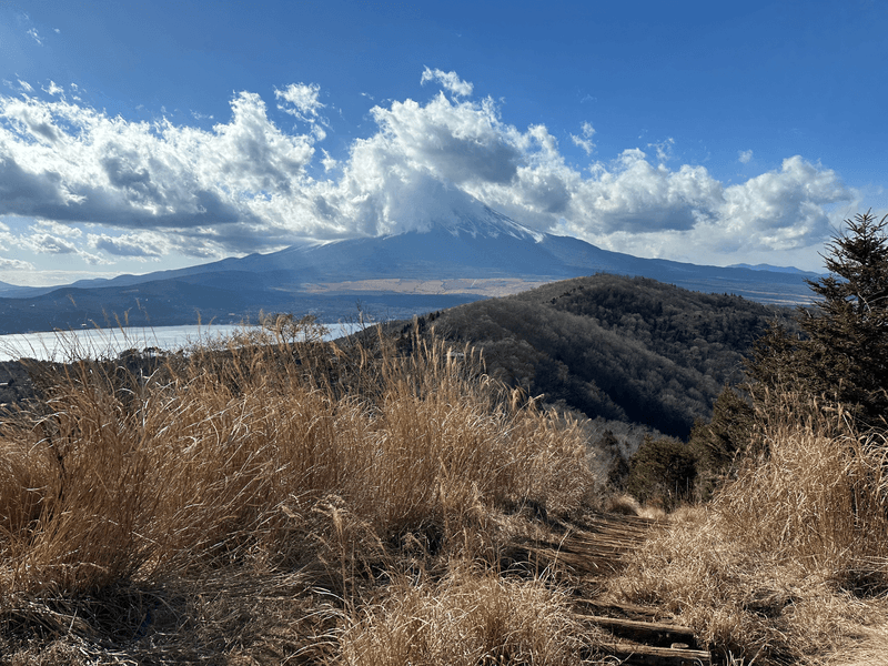
After the descent and a little bit more of a climb, you'll reach the second peak, Mt Hirao (平尾山), again with excellent views of Mt Fuji. We decided to take our lunch break here, although the winds kept us pretty chilled. I've recently started bringing my burner along to hikes but the strong winds today foiled my efforts to try and properly boil some water.
The weather forecast for the evening was snow (in Tokyo as well!) so as we started our descent the skies started to become a bit cloudier.
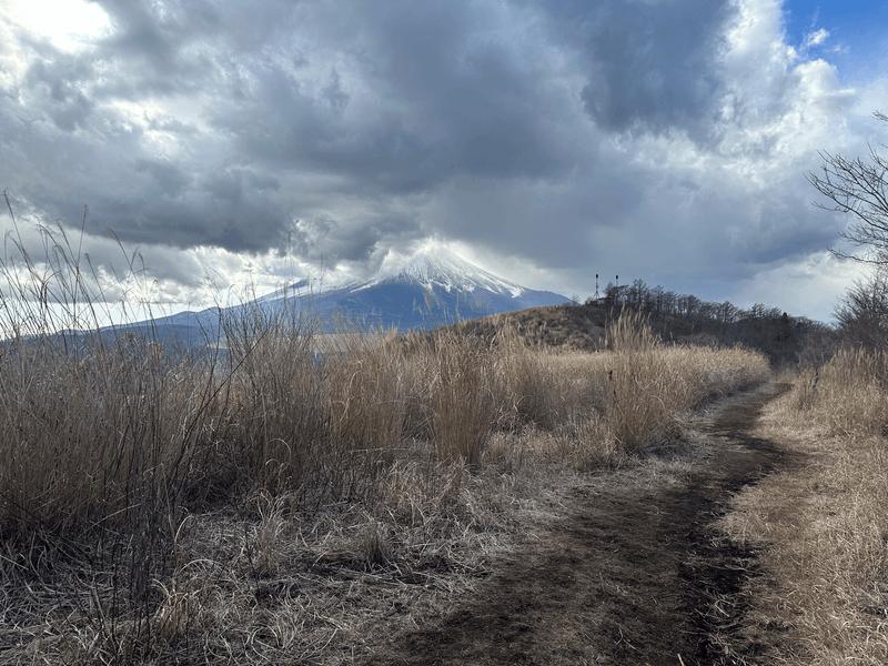
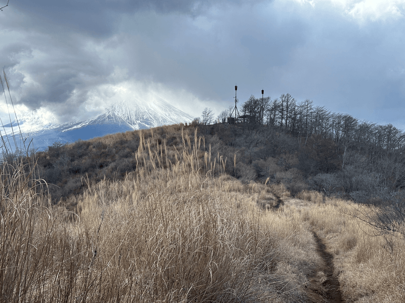
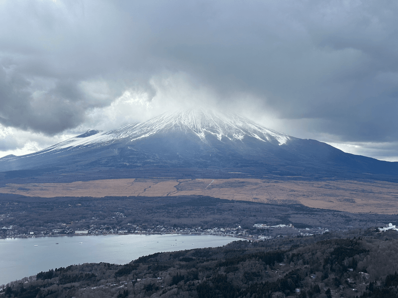
Finally we reach our third and final summit for the day, Mt Ohira (大平山). Even with the clouds, Mt Fuji still makes for a beautiful sight.
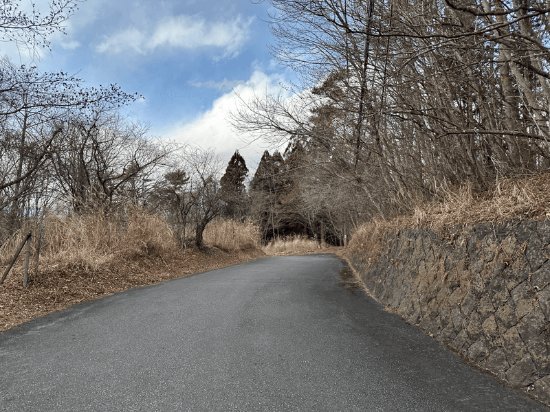
There's a final bit of a descent through the forest before you're out onto the road back towards Lake Yamanaka-ko.
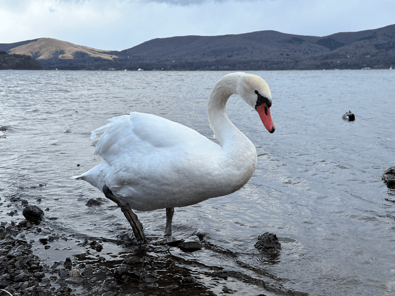
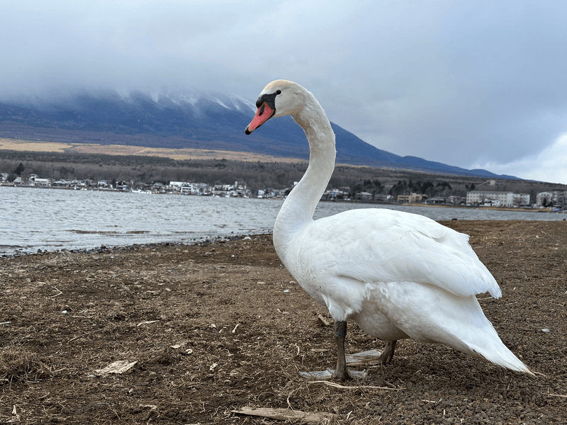
As we reached the lake, we noticed there were two photographers who were feeding the swans (with bird pellets). I'm not too sure if you are supposed to be doing this, but the pair seemed quite knowledgeable about the birds and the swans seemed very used to humans.
Although we didn't get a 100% clear view of Mt Fuji today, being able to take some photos up close with these birds was one of the highlights of today's hike!
I ended my hike today at the nearby Benifuji no Yu onsen which is about 15 minutes from the bus stop.
Hiking course details
| Date climbed | Length | Course time |
|---|---|---|
| 2024-01-13 | 10.1km | 4h40m (the expected time for an average hiker without breaks) |
This is a point-to-point course that that starts at 山中湖平野 (Yamanaka-ko Hirano) and ends at the 富士山山中湖 (Fuji-san Yamanaka-ko) bus stops.
There is a toilet available near the starting bus stop, as well as at the start of trail.
Public transport access with example schedule
You can book your bus through highwaybus.com. I recommend doing this a week in advance if you can, as the first bus tends to become fully booked.
| Time | Location | Transport | Cost | |
|---|---|---|---|---|
| 07:19 | 東京 (とうきょう) | Train | 210 | |
| 07:33 | 新宿 (しんじゅく) | |||
| 07:45 | バスタ新宿 | Highway bus | 2350 | |
| 10:09 | 山中湖平野 (やまなかこひらの) |
Busta Shinjuku is accessible via the south side of Shinjuku station. Make sure to plan in enough time between getting off the train and transferring to the bus terminal.
Unfortunately due to the tourism around Kagaguchi-ko, the buses can become a little bit delayed in getting home. An alternative option would be to go via Kawaguchi-ko station and get a train home instead.
| Time | Location | Transport | Cost | |
|---|---|---|---|---|
| 16:55 | 富士山山中湖 ふじさんやまなかこ) | Highway Bus | 2300 | |
| 19:10 | バスタ新宿 | |||
| 19:30 | 新宿 | Train | 210 | |
| 19:43 | 東京 | |||
| Trip total: | 5070 |


