hikes
Mt Ena (恵那山)
14 Jun
2.5 hours from Tokyo to the trailhead, via a bus from Kawaguchiko station.
Carpark available at the trailhead.
Mt Mitsutoge (三つ峠, mitsu-toge) is a mountain right next to Lake Kawaguchiko. Its two claims to fame are being one of the 100 Famous Mountains of Yamanashi and also one of the 200 Famous Mountains of Japan.
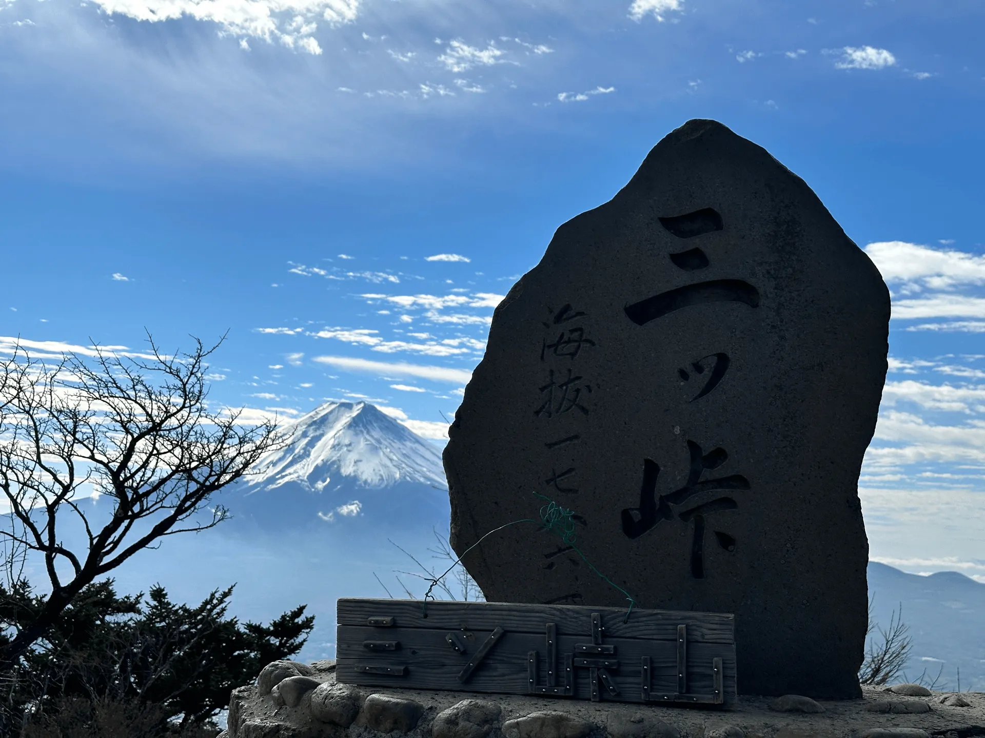
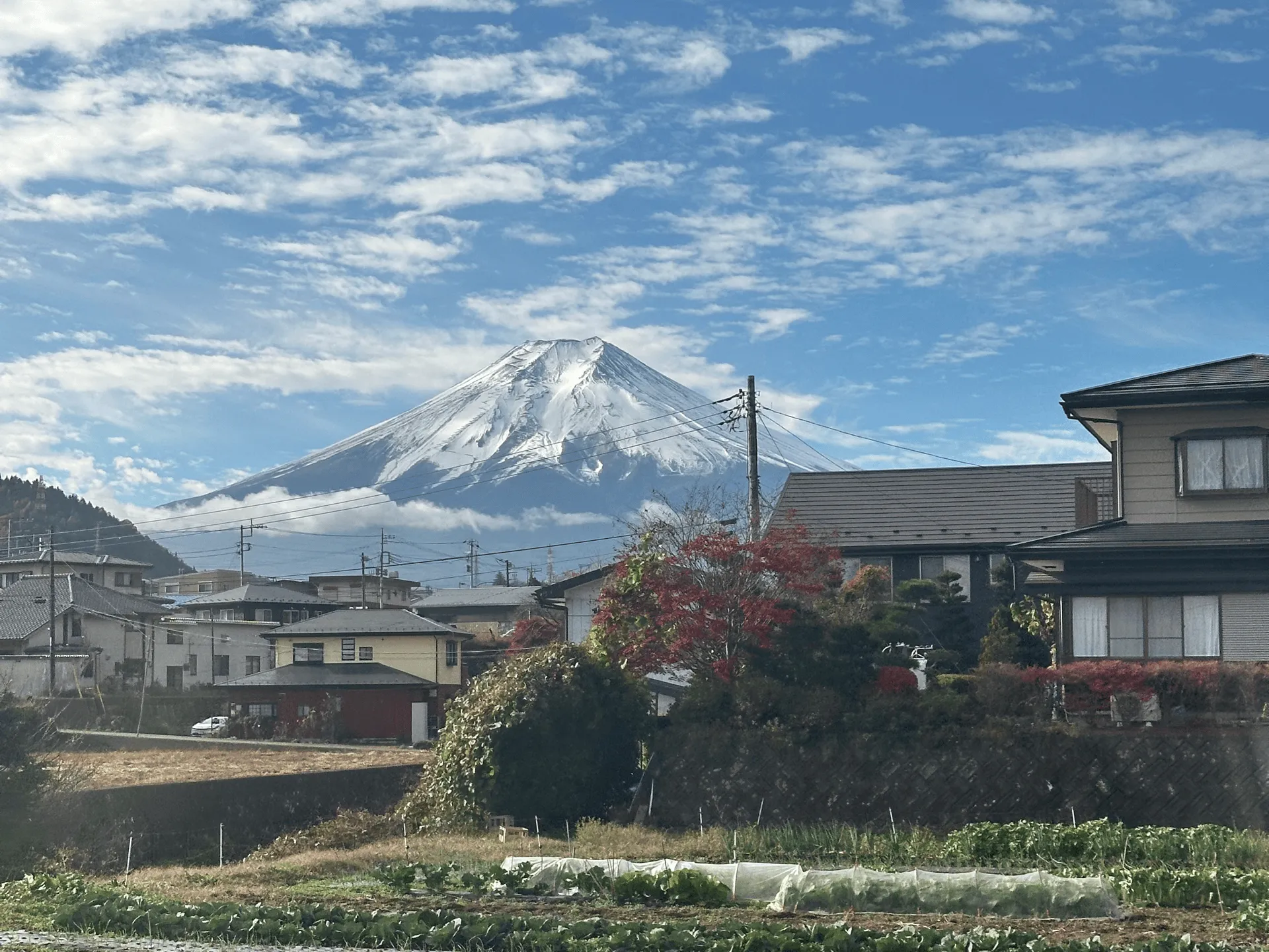
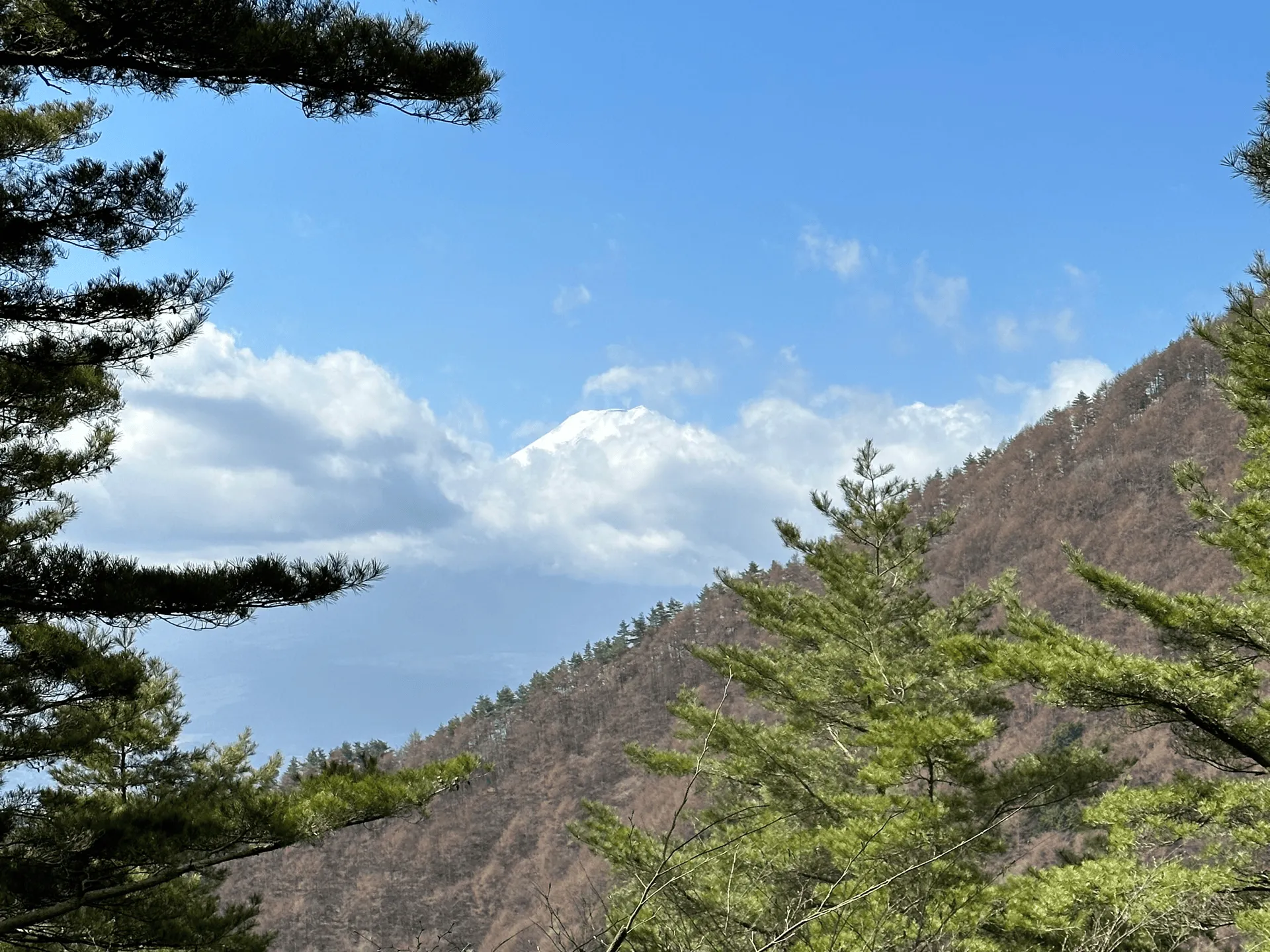
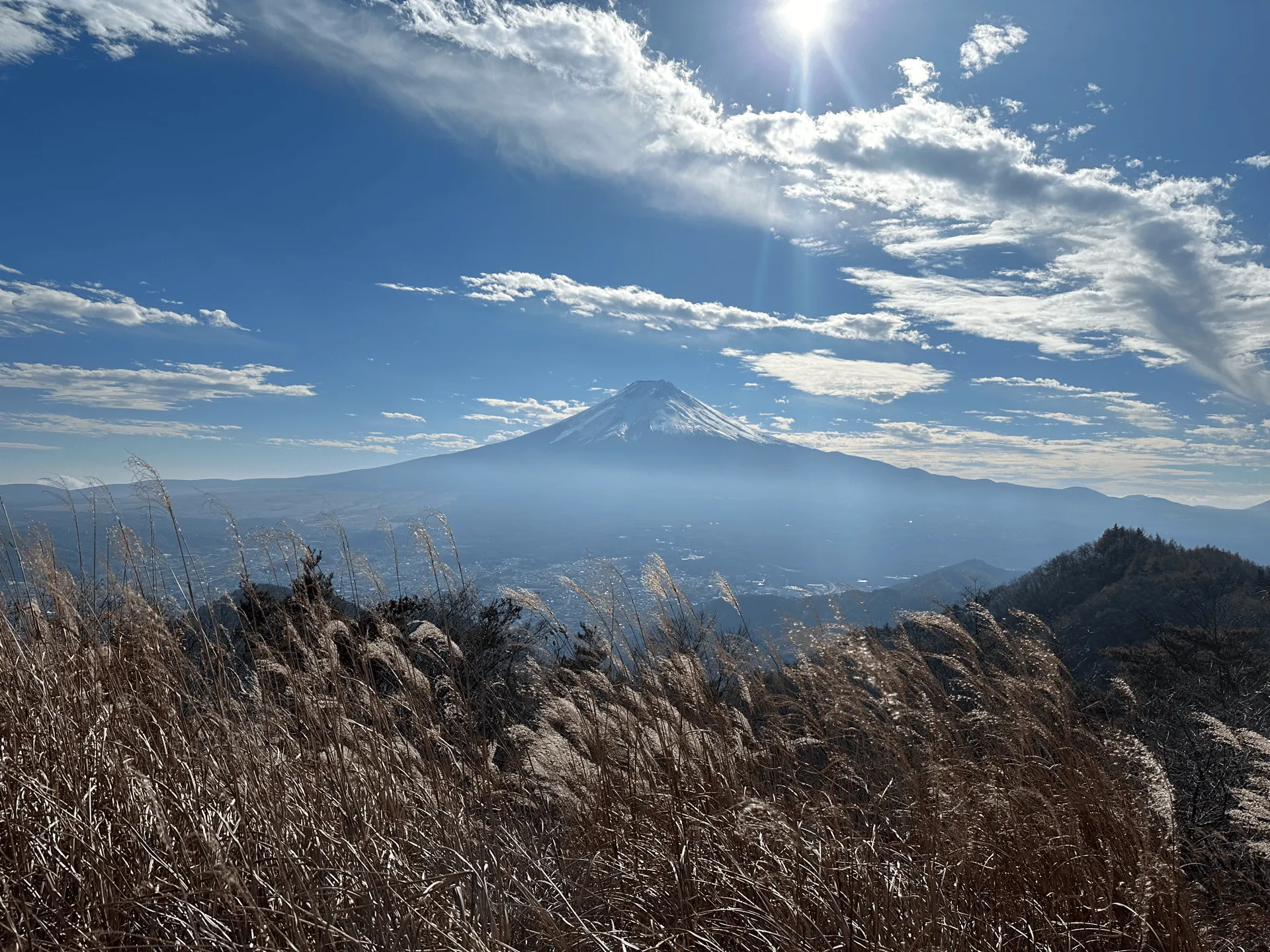
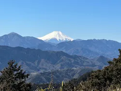
From Mt Mitsutoge’s peak, you can get an an awesome view of Mt Fuji together with its cool peak marker. On my first hike in Spring of 2023, I unfortunately didn’t get to to see Mt Fuji at all, so I ended up coming back in Autumn that same year. The second time around, my luck was much better!
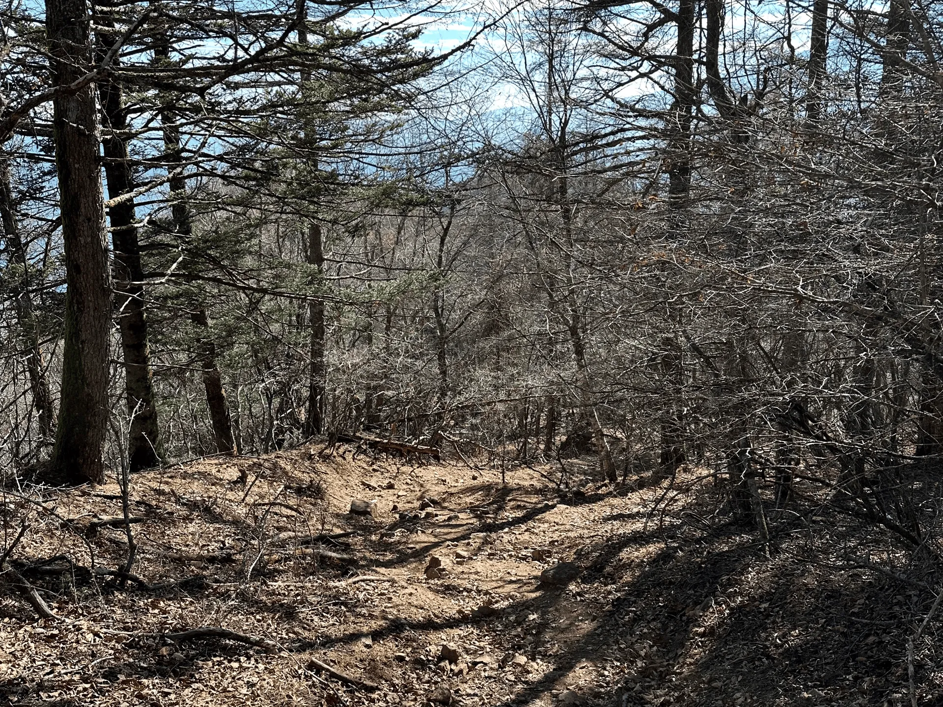
My first hike was a rather long one, going from Mitsutoge station, up to Mt Mitsutoge, and then down to finish at Kawaguchiko station. With 1400m of elevation gain over 15km, and an estimated course time of 8.5 hours, I would put this course into the “medium difficulty” bucket.
The upside of this course is that since it starts and ends at a train station, the timings are are a lot more flexible. The downside is that the first 3km from the train station to the trailhead are all along a road, so it can be a little boring.
Not to mention 1400m of elevation is pretty hefty so I wouldn’t recommend it if you are a beginner hiker. But if you time your hike for the cherry blossom season, you can enjoy the roads lined with cherry blossom trees, without all of the crowds that you would get in Tokyo.
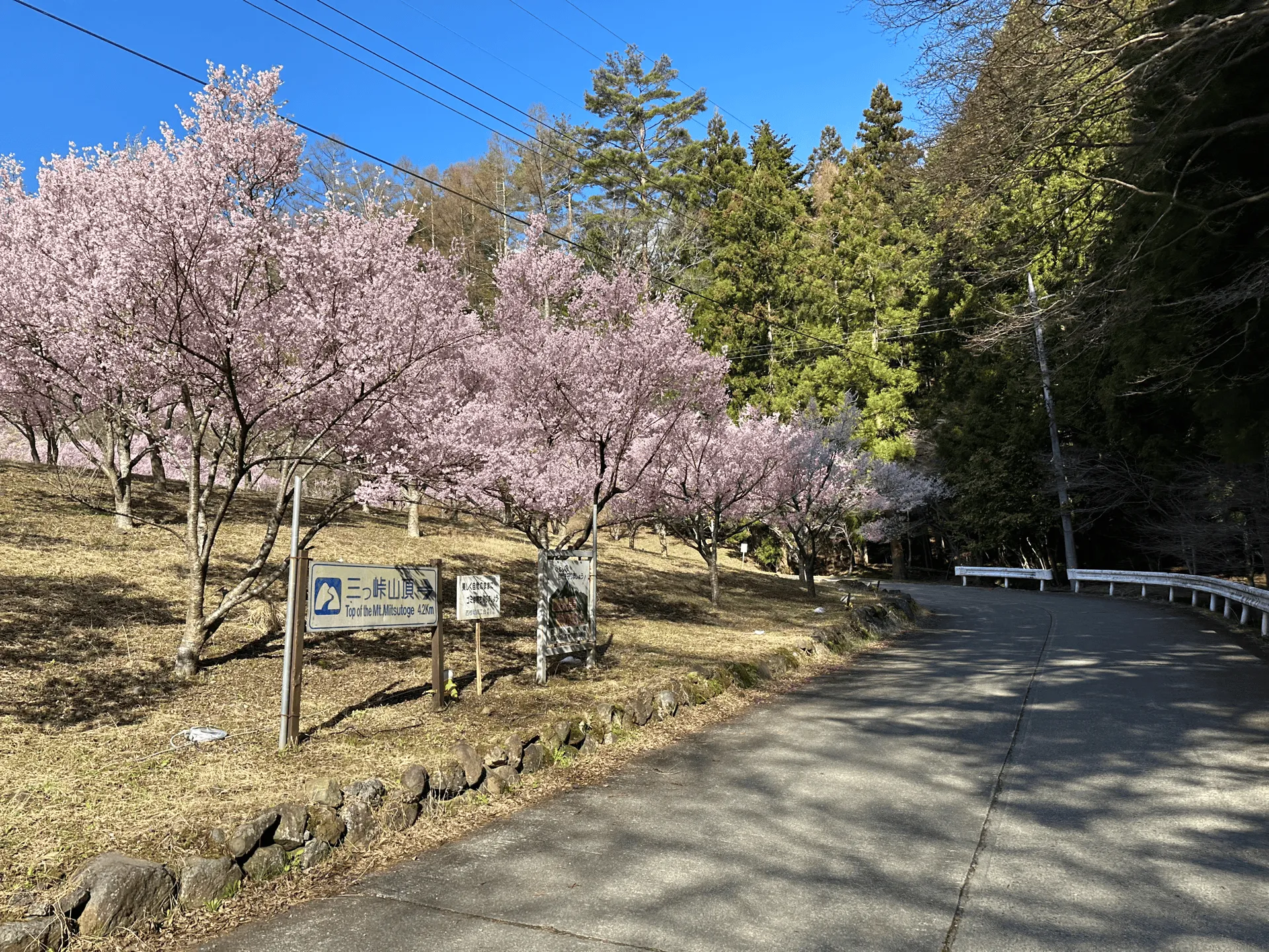
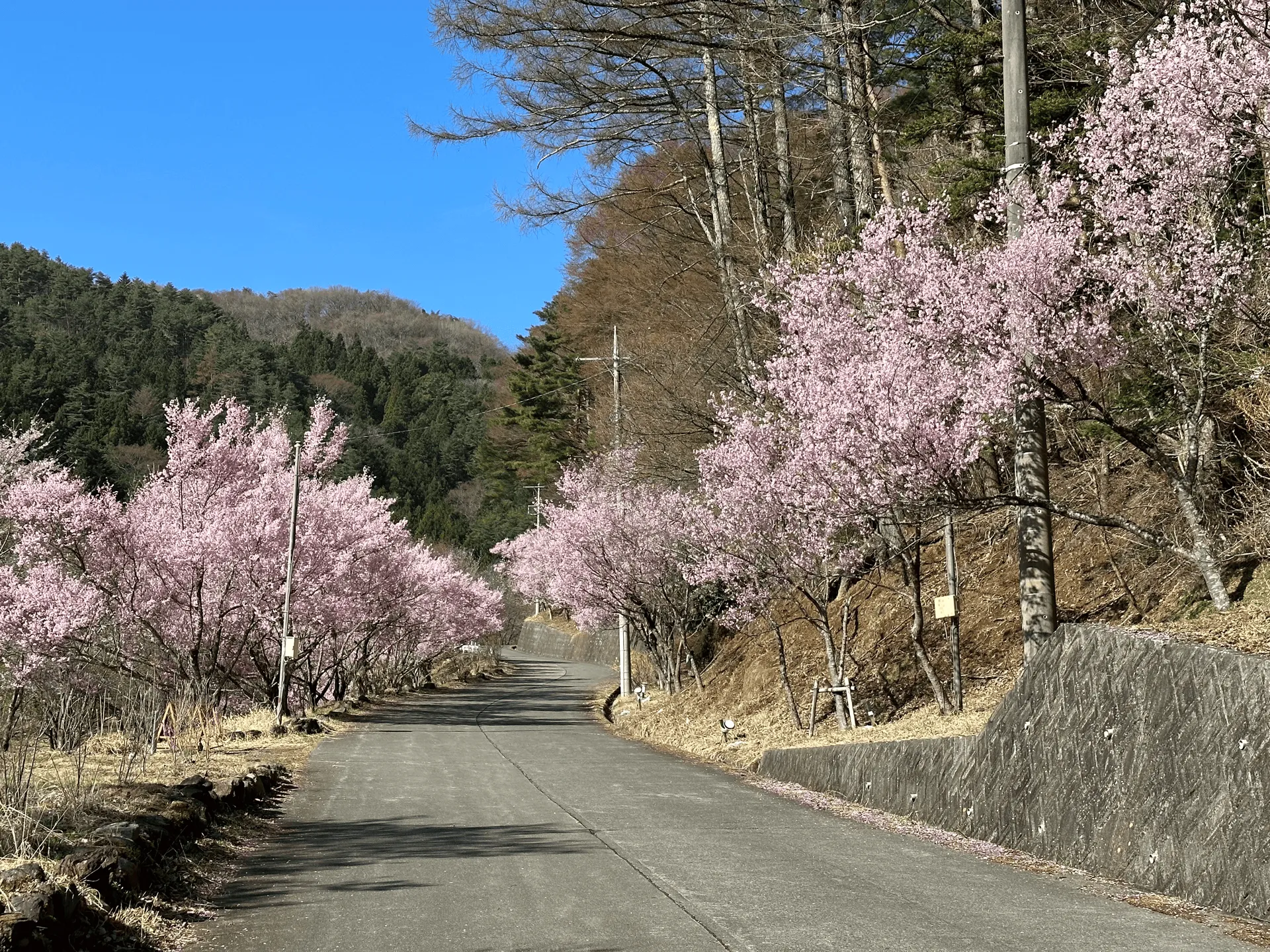
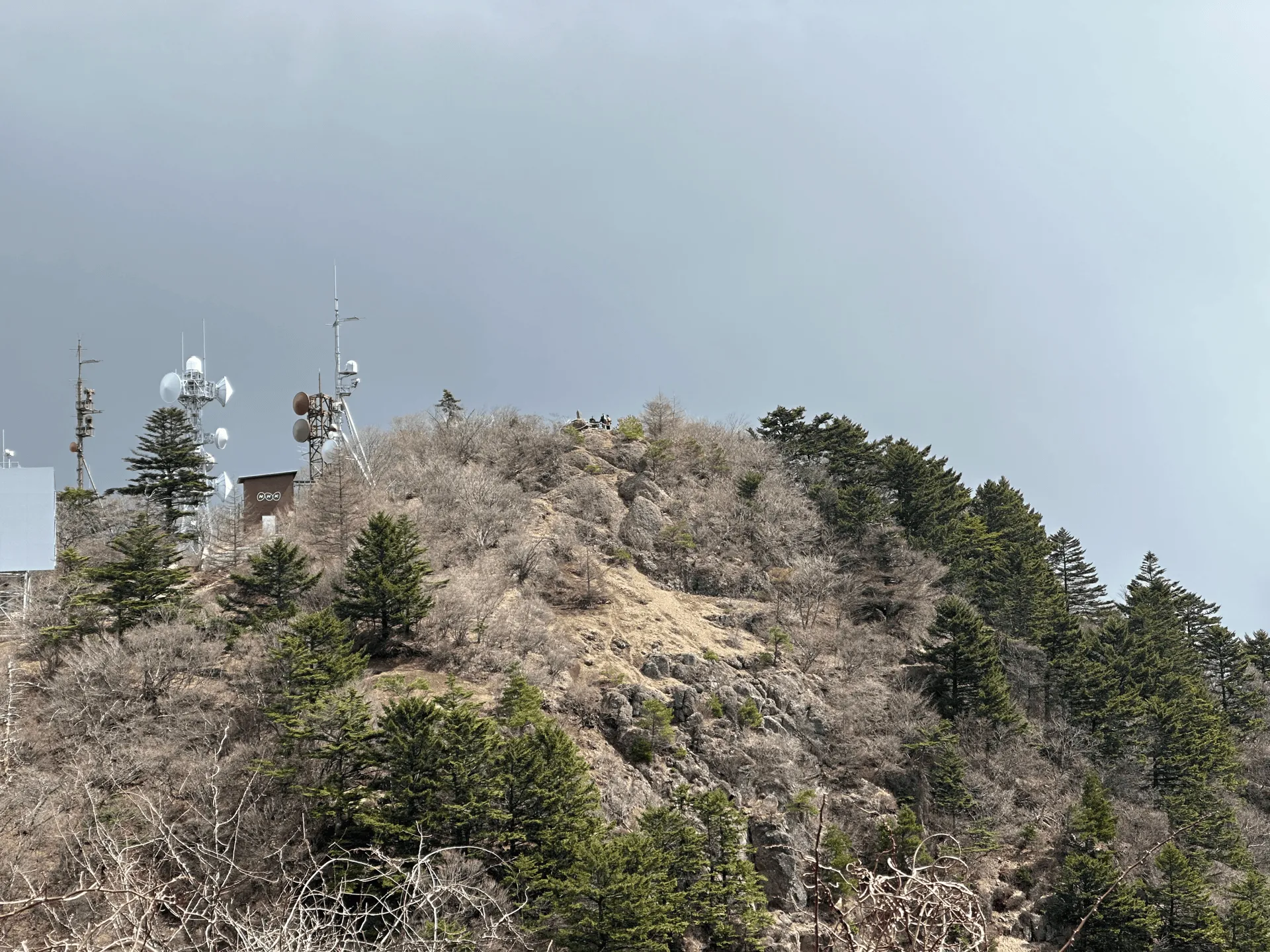
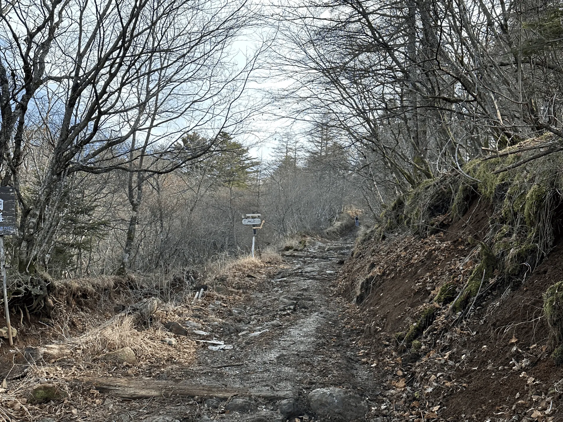
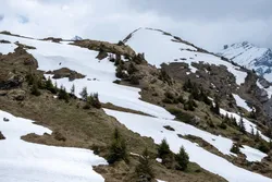
What’s even more fun, is you can see the peak of Mt Mitsutoge from the trailhead!
Well, I’m pretty sure it’s Mt Mitsutoge - you can see a small white structure on the side of it, and you pass a similar one up near the summit.
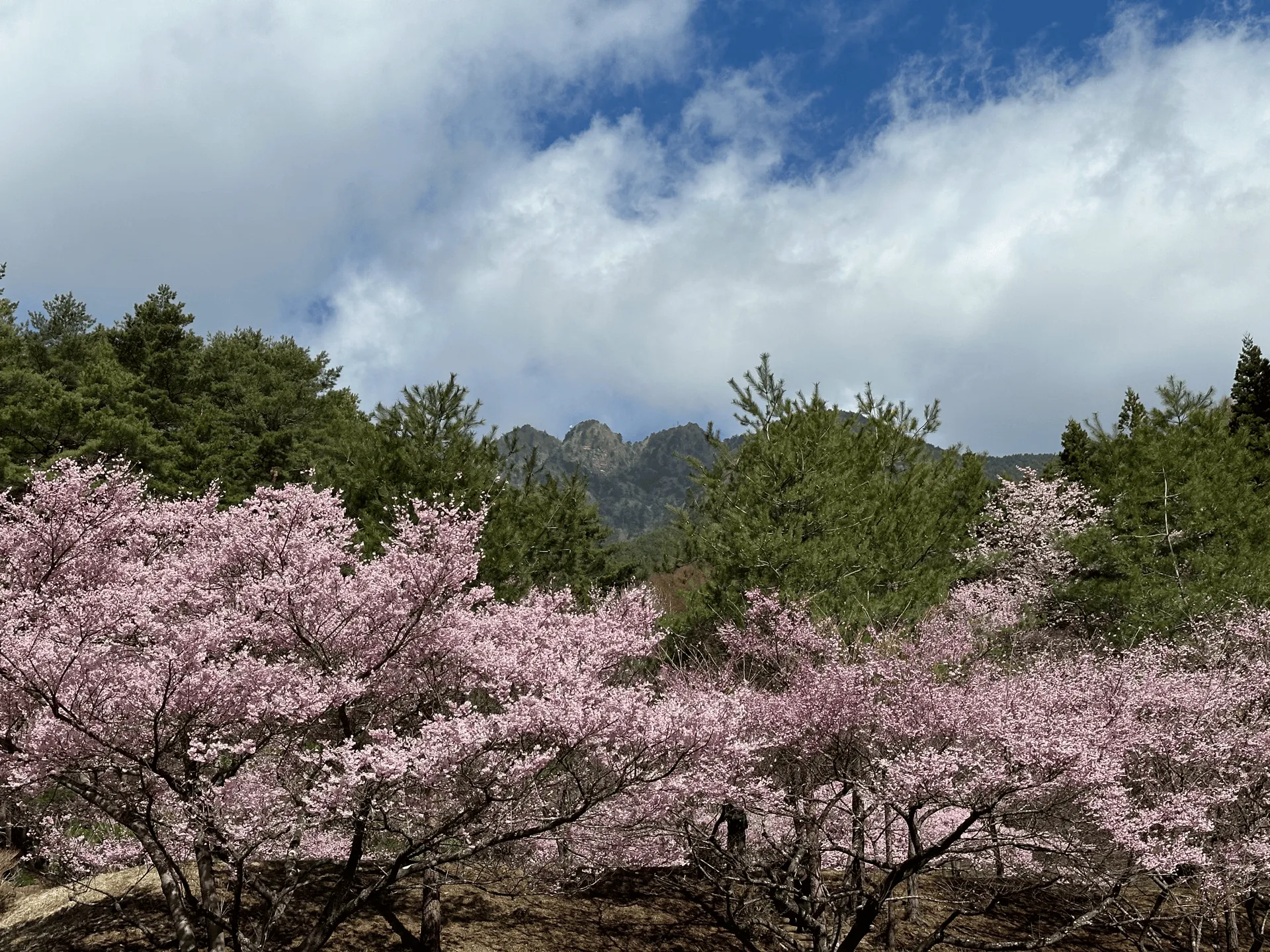
As you climb, there’s another opportunity to spot Mt Fuji, but on this hike I unfortunately watched it disappear behind the clouds, which made me glad I at least got a photo from the train.
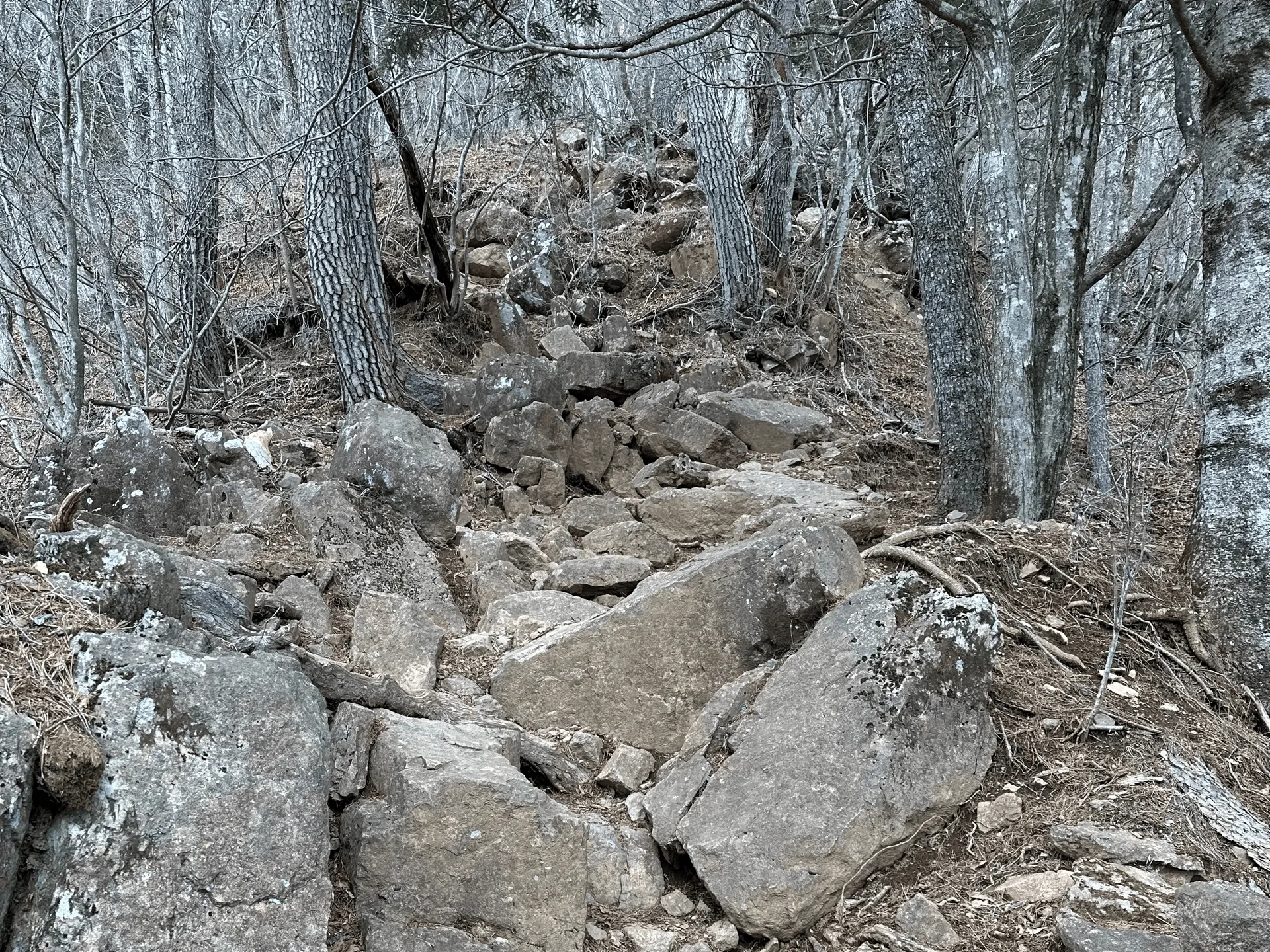
It is a long climb, so make sure you are mentally prepared for the struggle if you choose to take this course. There’s a hut at the summit that lets you book in for an overnight stay, so that’s an option as well if you wanted to split this hike up into 2 days.
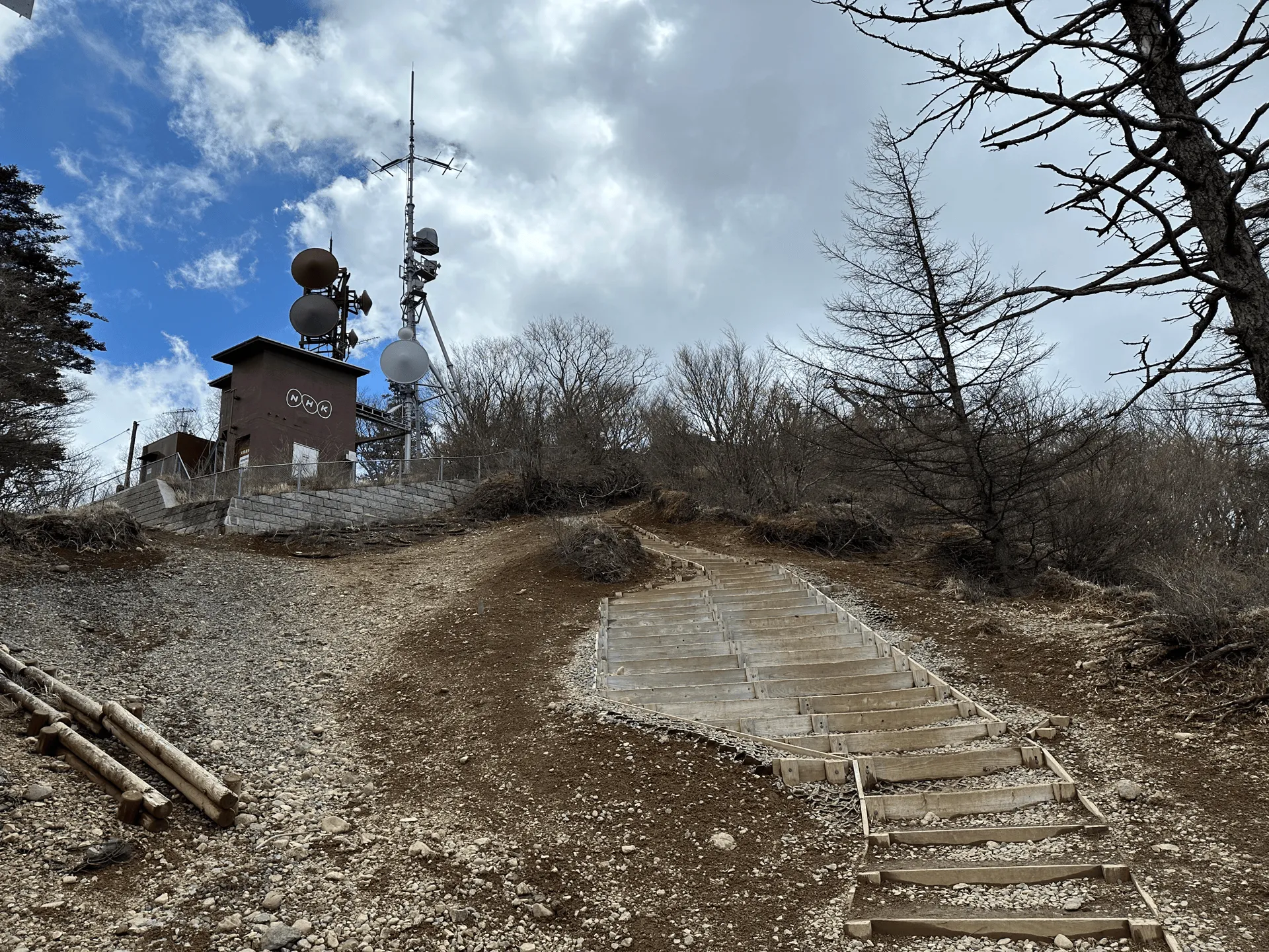
As you approach the peak, you can spot a building with a NHK logo on the side of it - this is Japan’s public broadcaster. I assume the mountain is a good spot to put a satellite dish.
Luck was not on my side for my first hike, and so Mt Fuji was nowhere to be seen at the peak.
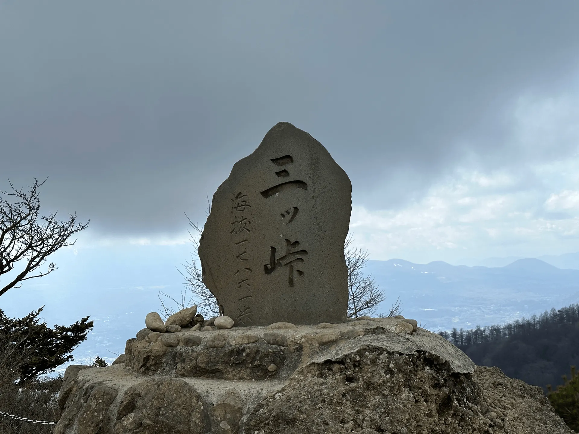
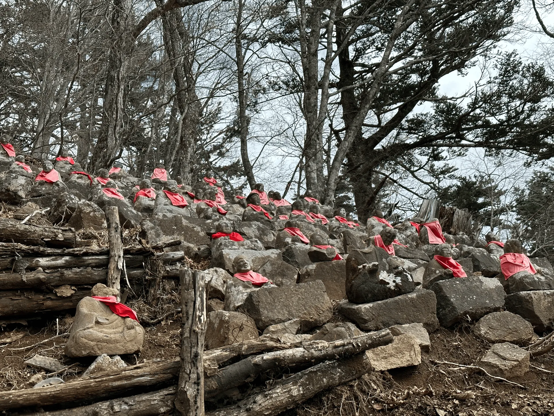
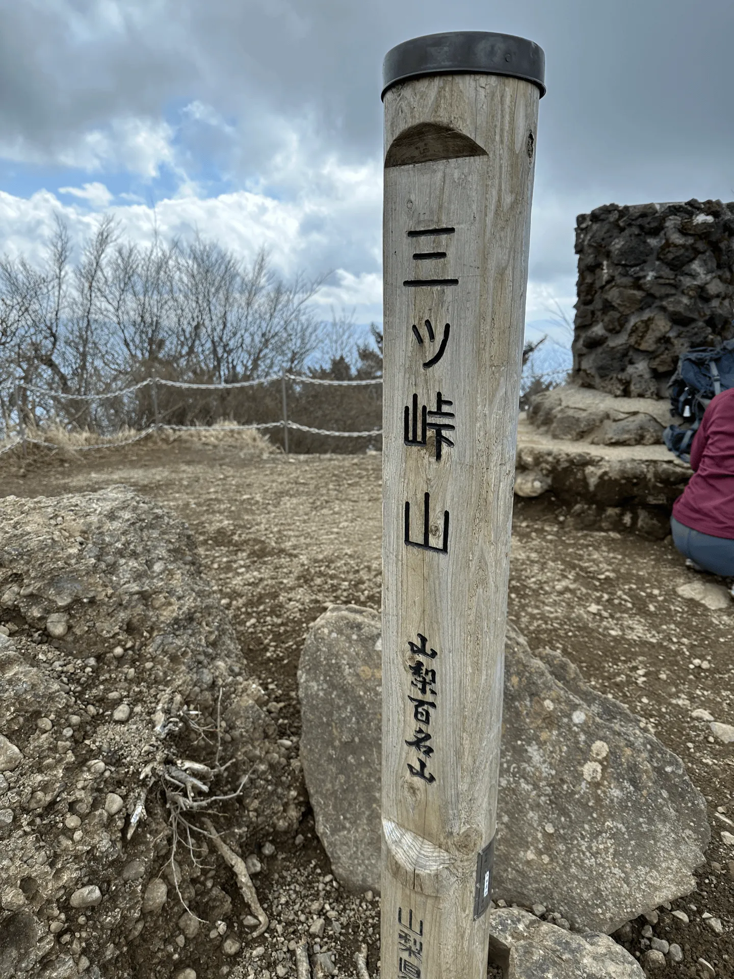
As well as the main stone marker, there is also a secondary wooden one. This one is used to designate Mt Mitsutoge as one of the 100 Famous Mountains of Yamanashi.
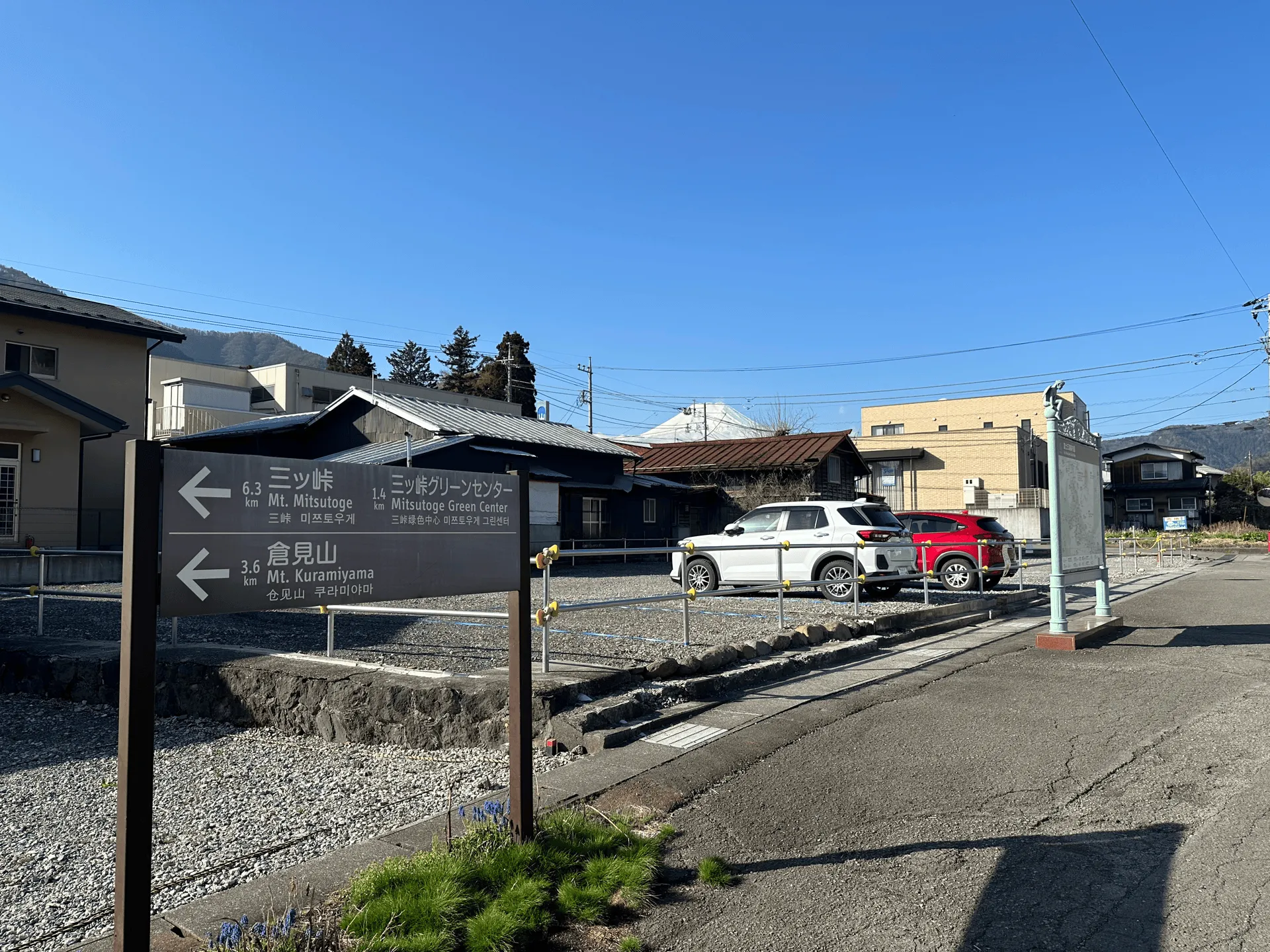
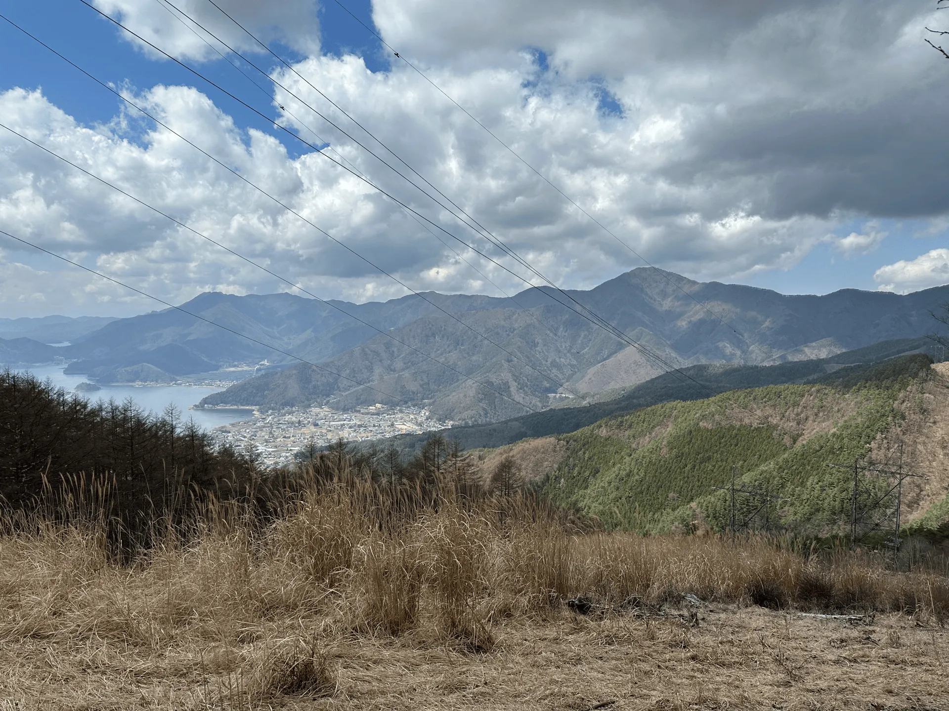
So the whole drawcard of Mt Mitsutoge is its amazing Fuji view, so with fingers crossed I made a second visit half a year later in Autumn. This time I took a different course, and came via Kawaguchiko station. From the station you can get on a bus which takes you to the trailhead (a different one) in about 25 minutes. You’ll need to get off at the Mitsutoge trailhead (三ツ峠登山口) bus stop.
From here, I hiked up to Mt Mitsutoge, then back down to Kawaguchiko station. This is a more reasonable 12km course with 750m of elevation gain that should take you 5.5 hours.
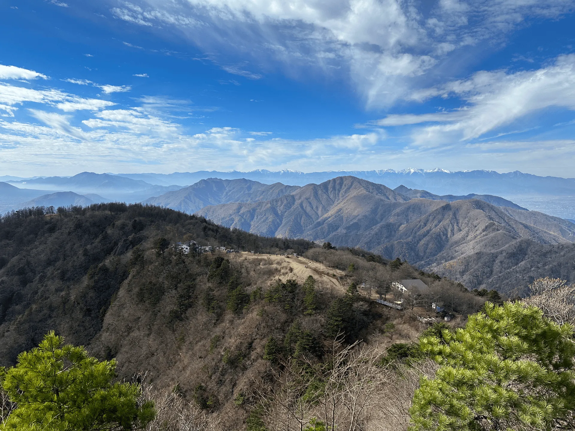
I will say the hike up via the bus stop is a lot more boring, and it’s mostly a walk along a very rough road. There’s a mountain hut near the peak and its caretakers seem to live there full-time, so I suppose this is used as an access road when they need to head into town.
After 60 - 90 minutes of hiking you’ll pop up above the treeline and reach the mountain hut. If the weather conditions are right you will be rewarded with a view of Mt Fuji!
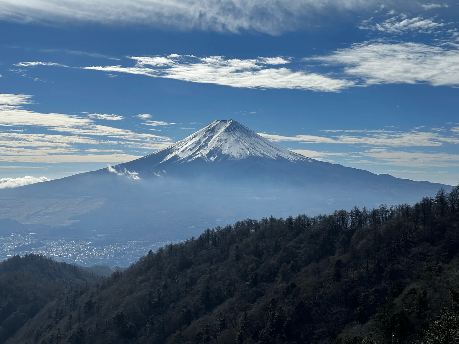
The peak is not too far from the hut, so coming by the bus makes for a very quick climb overall. On a clear day, you can get a photo of Mt Mitsutoge’s peak marker together with Mt Fuji.
Near the summit is the Mitsutoge Sanso mountain hut, where you might get the opportunity to be barked at by a rather fierce-looking Kai Ken. Kai Kens are one of the six native dog breeds of Japan - not quite as well-known as the more popular Shibas and Akitas, but you will see them around occassionally. They’re also native to the Yamanashi region where Mt Mitsutoge is located, so it’s rather fitting to meet them here.
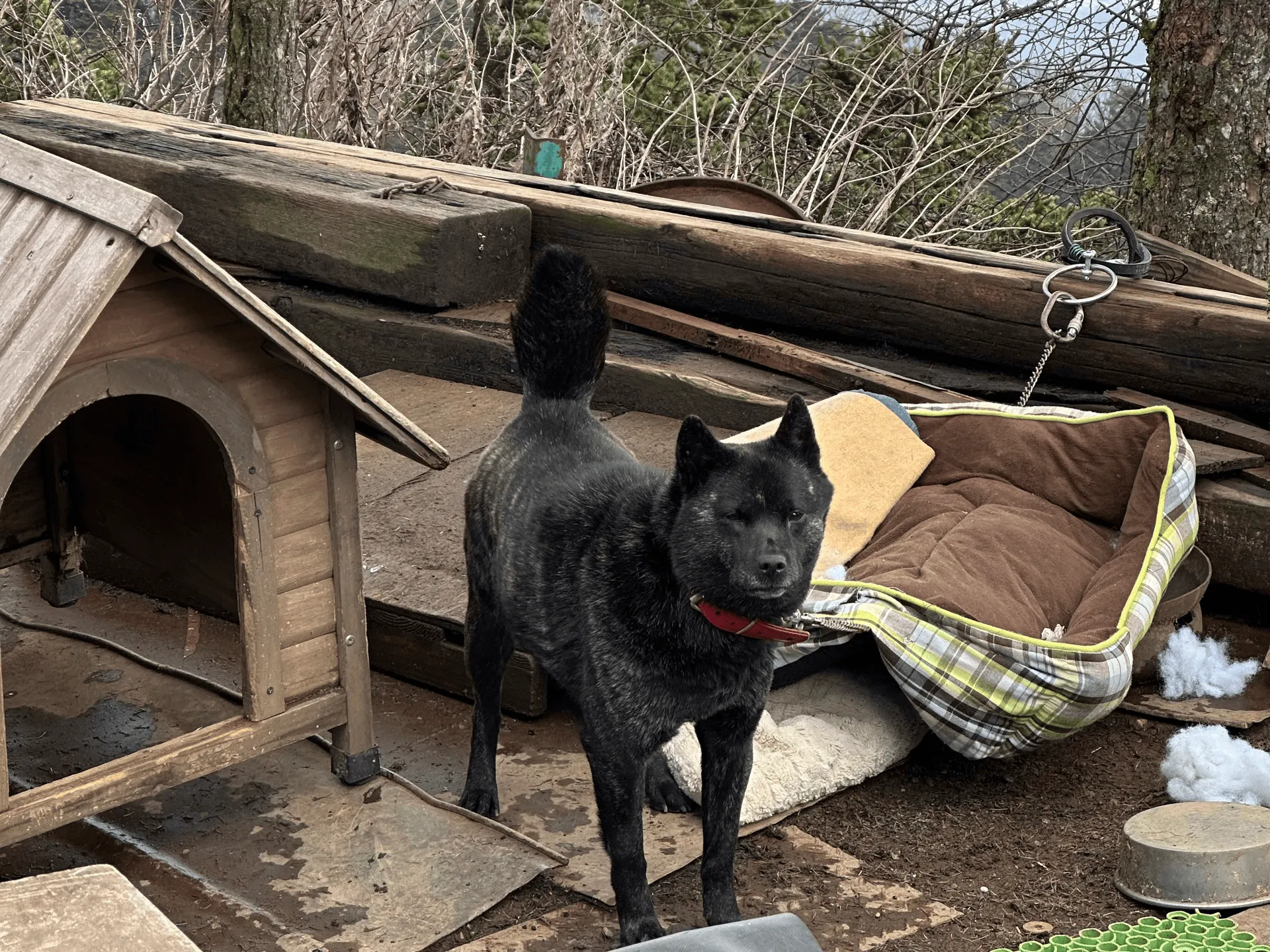
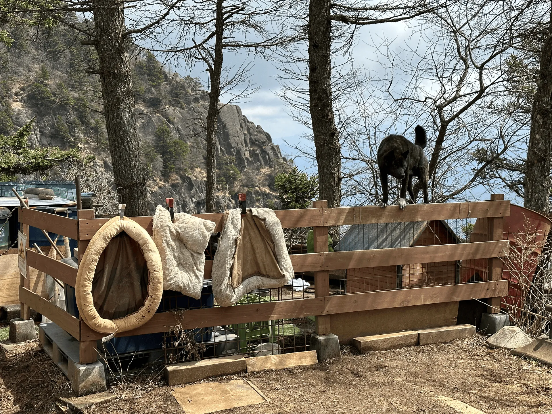
The fully black Kai is a girl called Kako, and her son Gon is the boy with a white sock. (I learned this from a rather useful YAMAP log). It looks like Kako had puppies a couple of years ago, and so I think Gon is one of the puppies from that litter!
Although I don’t really like to see dogs chained up, they do seem to be well-loved - and I suppose Gon-kun would be quite the escape artist without the chain, so I maybe it is a necessary evil.
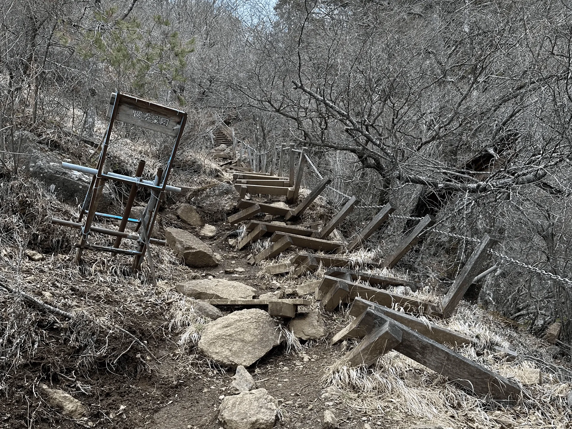
For both of my hikes, I took the same descent trail back to Kawaguchiko station. It is over 8km so it can feel quite long, but it’s all downhill so it’s not too bad.
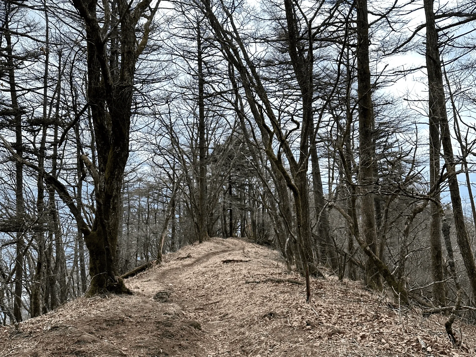
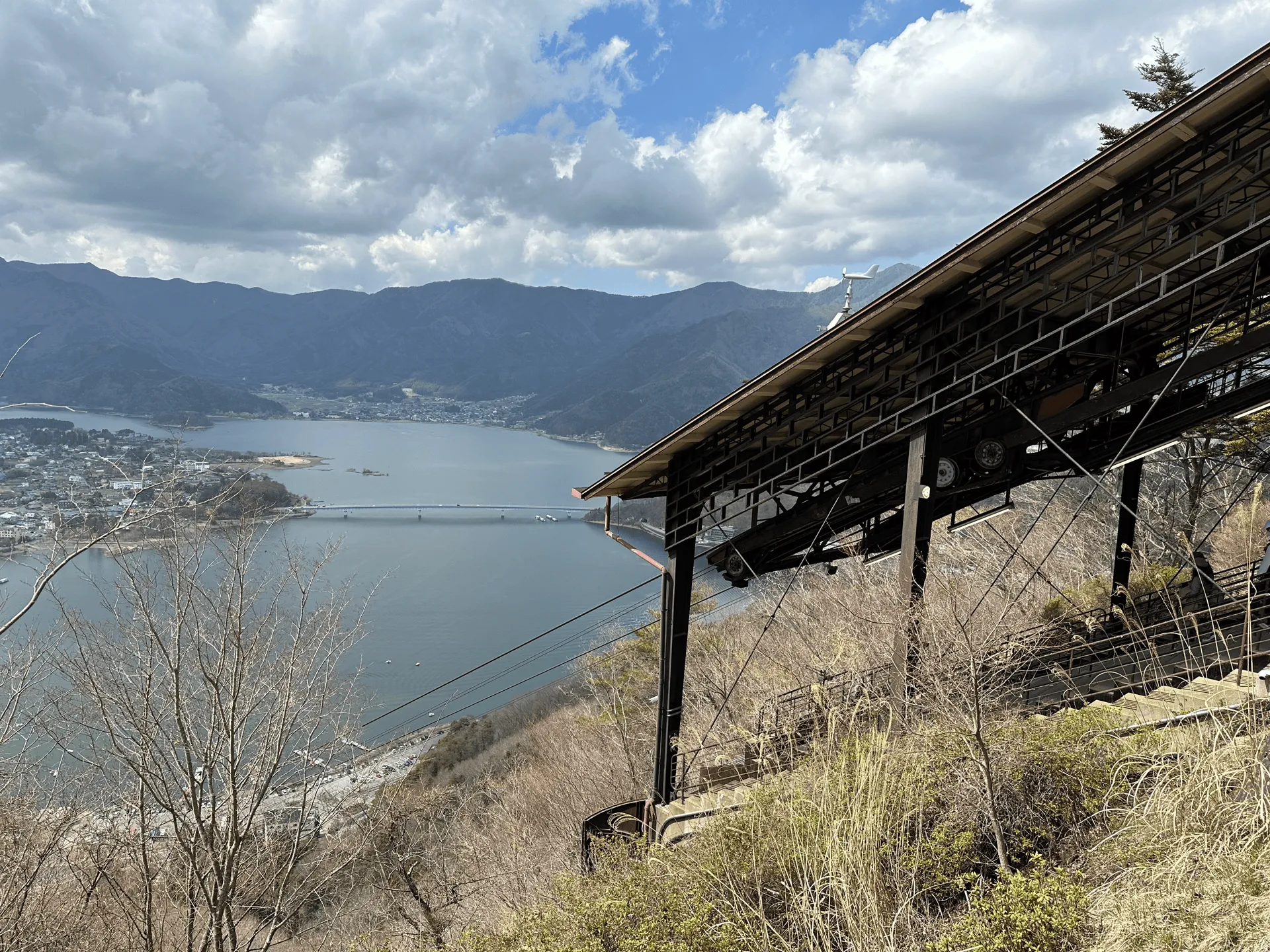
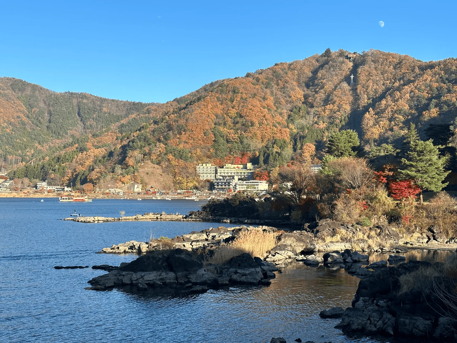
After about 3 hours of descent, you will reach the Tenojoyama Park, which is a very popular scenic spot complete with a ropeway. In comparison to the quietness of the mountain trail, you’ll feel very much back in civilisation here as you wade through the crowd of tourists.
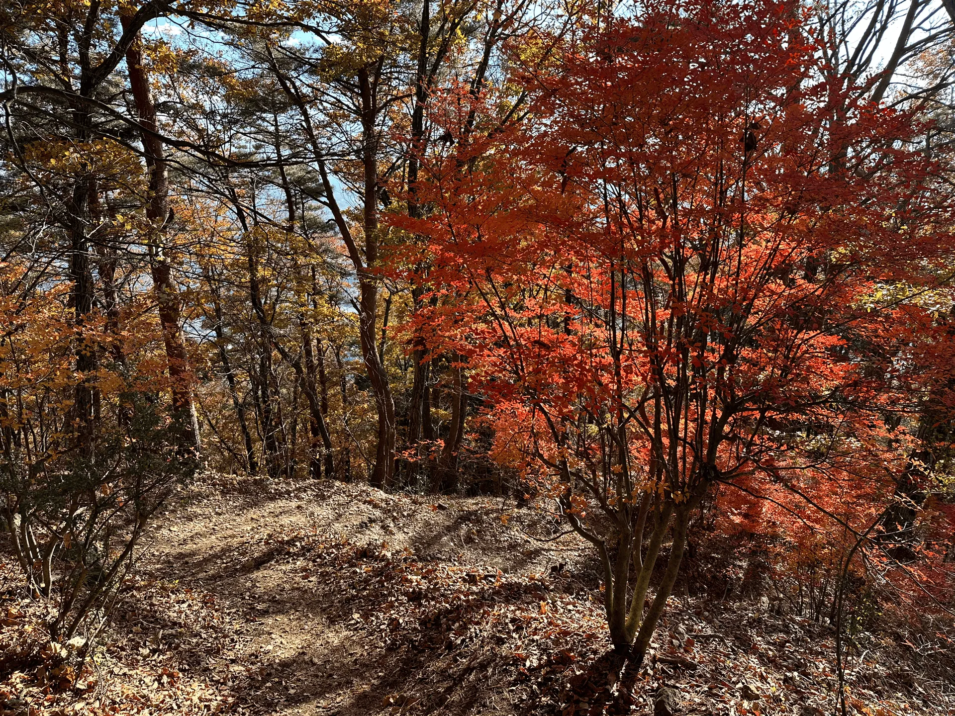
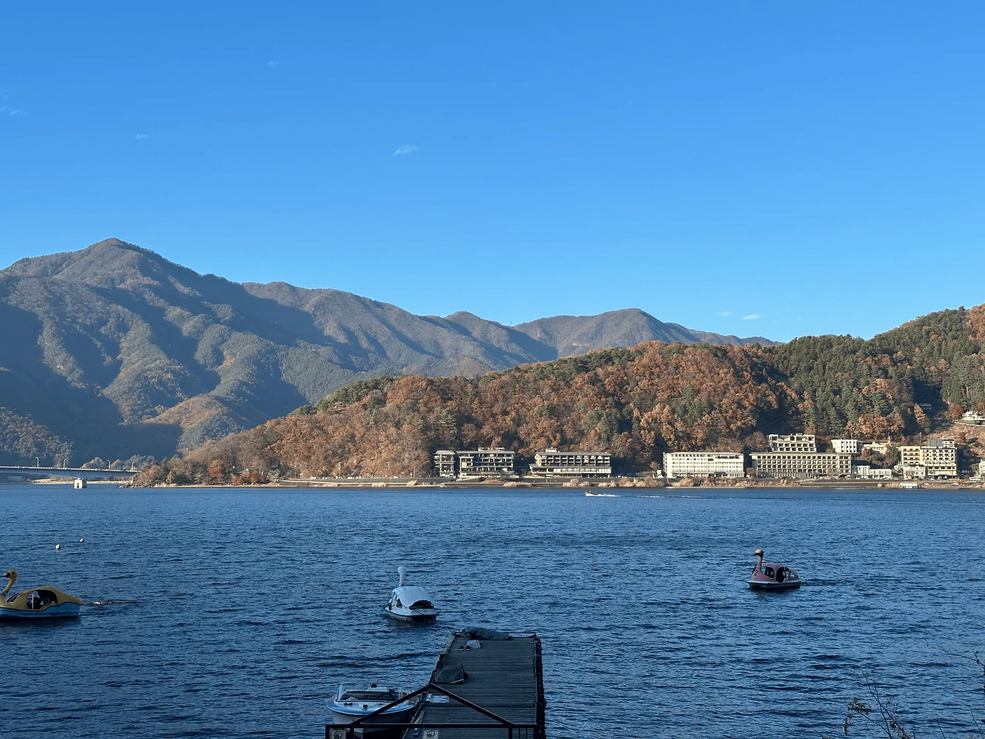
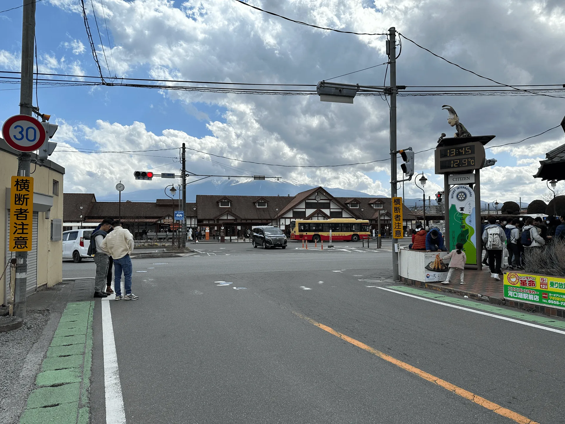
Eventually, you’ll make back down to the town of Kawaguchiko. Although the course back to the station doesn’t take you along the lake, we made a little detour to a nearby onsen (Royal Hotel Kawaguchiko) which gave us the chance to take in the lake together with the pretty autumn leaves.
You’ll finish your hike back at Kawaguchiko station. Booking a train ticket in advance is a good idea here, as the seats on the express trains back to Tokyo are always booked out. You can always get a standing ticket, but that can be a bit rough after a long day’s hike.
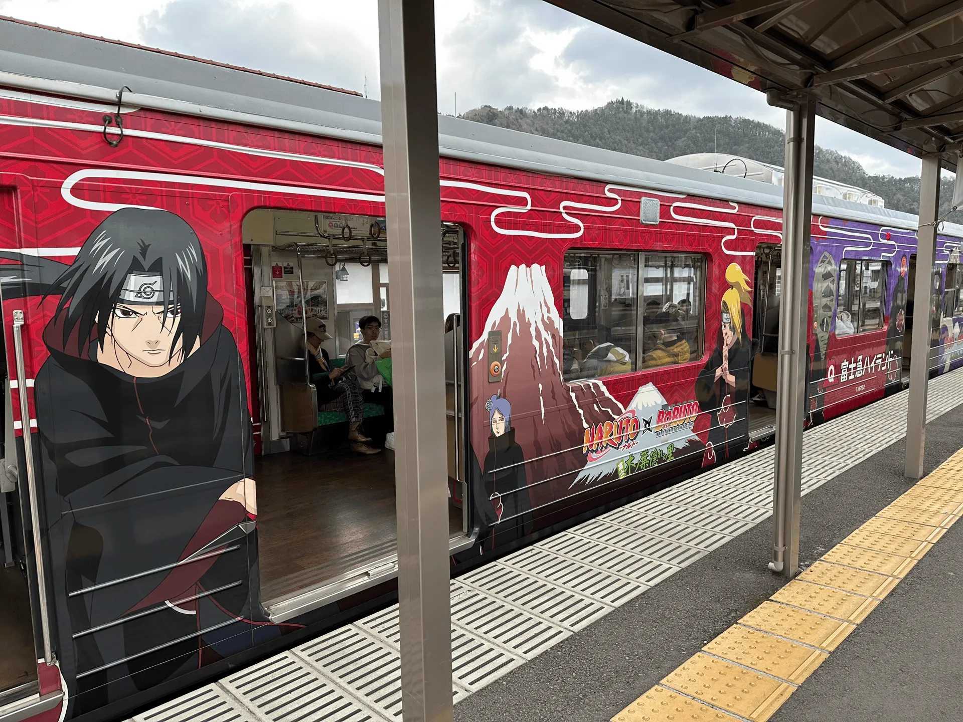
Alternately, you can try and get a seat on the local (but slower) Fujikyu train back. You might be lucky enough to spot one of the specially-decorated trains.
| Date climbed | Length | Course time |
|---|---|---|
| 2024-11-23 | 12km | 5.5h (the expected time for an average hiker without breaks) |
There are a number of course options here, the two I have mentioned on this page are:
I would say the 12km course is the most reasonable if you’re looking to get a day of walking in, and would be the one I would recommend.
The 15km course is the most interesting since it’s quite varied, but with the large elevation gain I would only recommend it if you have previous experience in hiking those distances. You can see my YAMAP activity log for it here.
There are some shorter courses (5km and 8km options), which start and finish at the bus stop. But it seems like there is only one bus at 10:20 running in the opposite direction. So this would only be feasible if you came by car.
There is also a digital map courtesy of Japanwilds available for this mountain.
If you are coming to Mitsutoge station (三つ峠駅), expect a 2.5 hour train ride from Tokyo. You’ll need use the JR line to Otsuki station, and then transfer onto the local Fujikyu line. You can just use your Suica/IC card and tap on, there’s no need for a special ticket or anything like that.
If you are coming to Kawaguchiko station, I’ve outlined on my Kawaguchiko hikes page how you can get there in more detail - your options are highway bus, express train, or the local Fujikyu line.
Once at the station, you’ll get on a local bus headed towards Tenkachaya (天下茶屋) which departs from the #5 bus stop. Searching for 河口湖駅 三つ峠登山口 バス (“Kawaguchiko station Mt Mitsutoge trailhead bus”) should hopefully give you the latest timetable.
Mt Mitsutoge is a mountain with a little amount of popularity so I’m a bit suprised to see that it seems like there is only one bus running a day which leaves at 9:50. So be sure not to miss this one! I would recommend getting the train to Kawaguchiko station in the morning, as the highway bus times can be a little unpredictable with traffic.
You will get off the bus at 三ッ峠登山口 (Mitstsutoge trailhead). Make sure not to get this confused with the bus stop before this one, which is called Mitsutoge entrance (三ツ峠入口).
If you’re coming by car, you can try and attempt to park at the carparks at either trailhead. Unortunately, both of the carparks are named 三ッ峠山登山口駐車場 or “Mitsutoge trailhead carpark” which can make things a little confusing. If you use YAMAP, it has links out to the Google Maps locations on the Kawaguchiko side and the Mitsutoge station side.
If parking at the Mitstsutoge station side, you’ll be able to do a 6 hour, 7km out-and-back course with 1000m of elevation gain. While from the Kawaguchiko side you’ll be able to do the 2h45min out-and-back course (the shortest possible) or a 4 hour loop course as well.
Mt Mitsutoge can be climbed without snow from April to mid-December. Looking at YAMAP, February and August tie for being the least-climbed months, as I suppose both the coldest and the hottest month of the year aren’t very pleasant to climb in.
If you’re looking to want to spot Mt Fuji, I would recommend trying to come in the colder weather, as your chances in summer can drop quite dramatically.
The Mitsutoge Sanso conveniently has a page in English with their contact details, so if you are interested in spending a night at the summit, it would be a pretty easy thing to organise via email. Doing the 15km long course would be quite nice with the option to split it up into two days. They seem to be open year round.
Comments
Leave a comment