hikes
Mont Salève: hiking Geneva's local mountain
27 May
Take the cogwheel train from Montreux station. Trains run hourly and take 50 minutes to the summit. Get off at Haut-de-Caux or Caux for hiking options. Swiss Travel Pass covers fare to Haut-de-Caux and offers 50% discount to summit.
You'll have to park near Montreux station for this one.
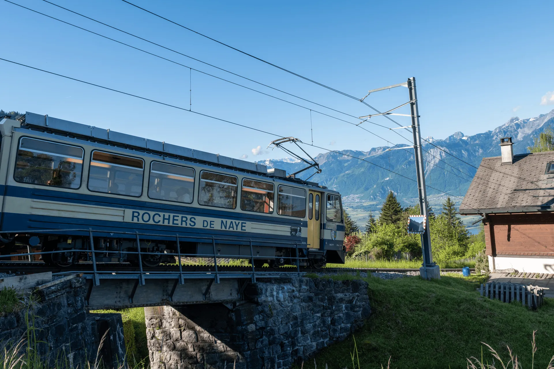
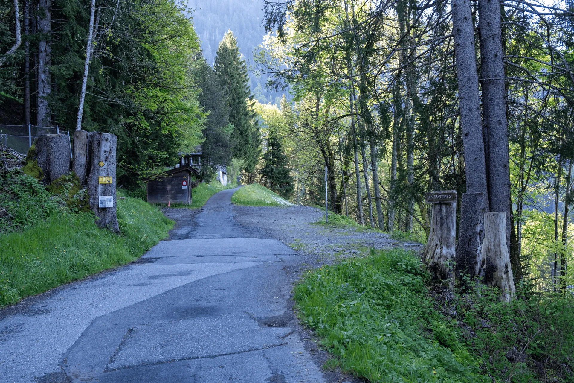
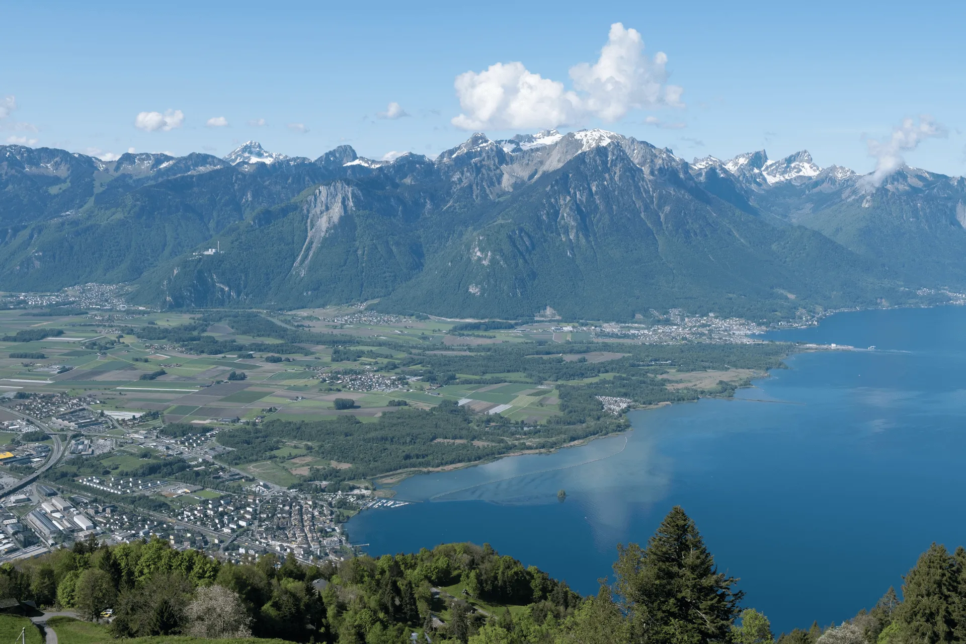
Rochers de Naye is Montreux’s local mountain, and it’s a pretty gorgeous one too. Like Rigi, there’s even a cogwheel train that can take you all the way to the summit. Of course, I wanted to do some hiking as well so I got off the train partway at Haut-de-Caux and hiked up the remaining 8km. I came a bit before the summer hiking season so there was plenty of snow still at the summit, but luckily none on the trail itself.
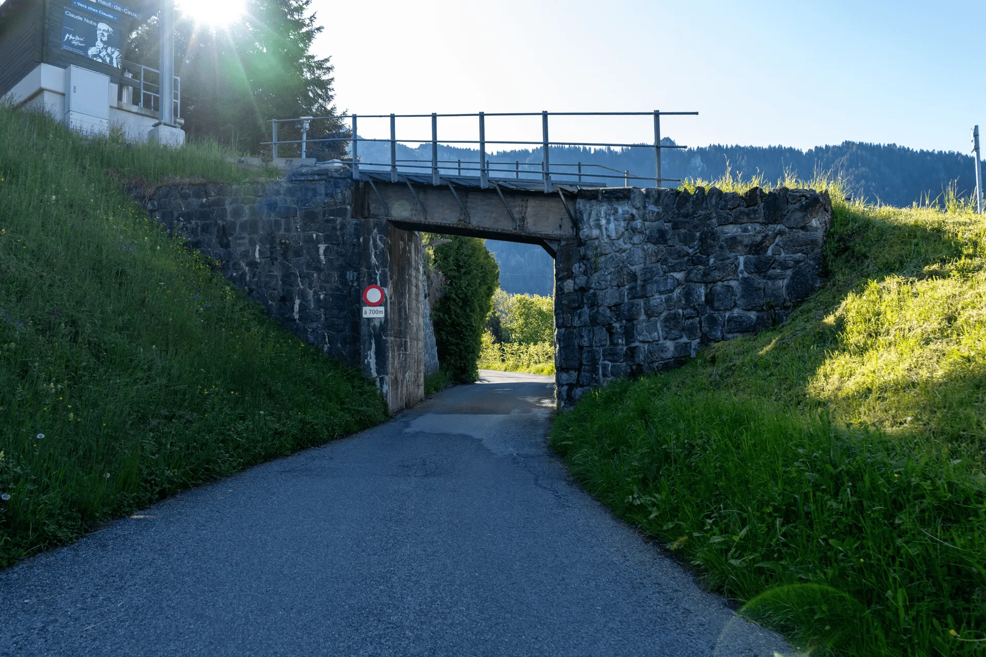
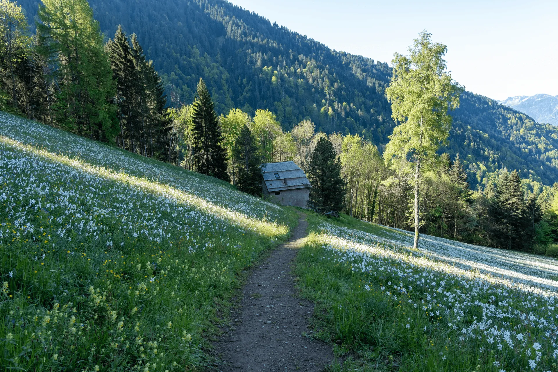
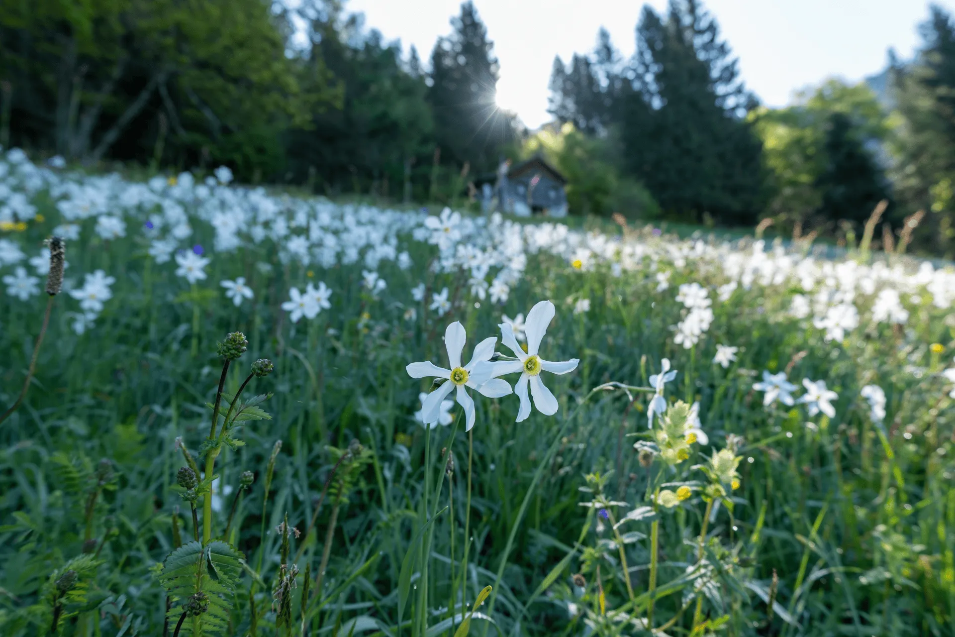
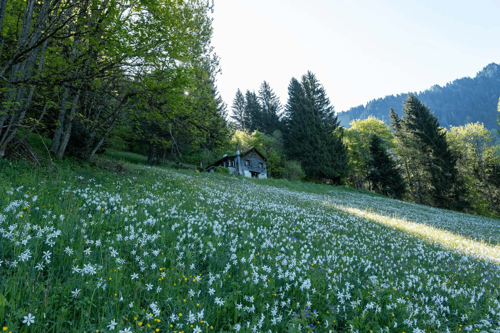
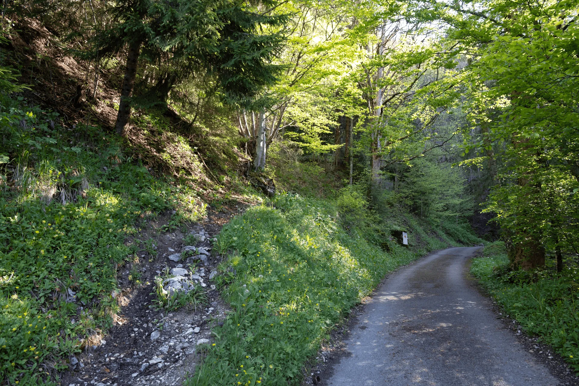
The first stretch of the hike is all road, but I took a quick detour to check out a narcissus field.
Each year in May, Montreux has its “May snow” - fields of blooming white narcissus flowers. There’s a lot of these flowering spots on the side of Rochers de Naye, and they all bloom at slightly different times. Luckily the one I passed on my hike seemed to be in full bloom. So pretty!
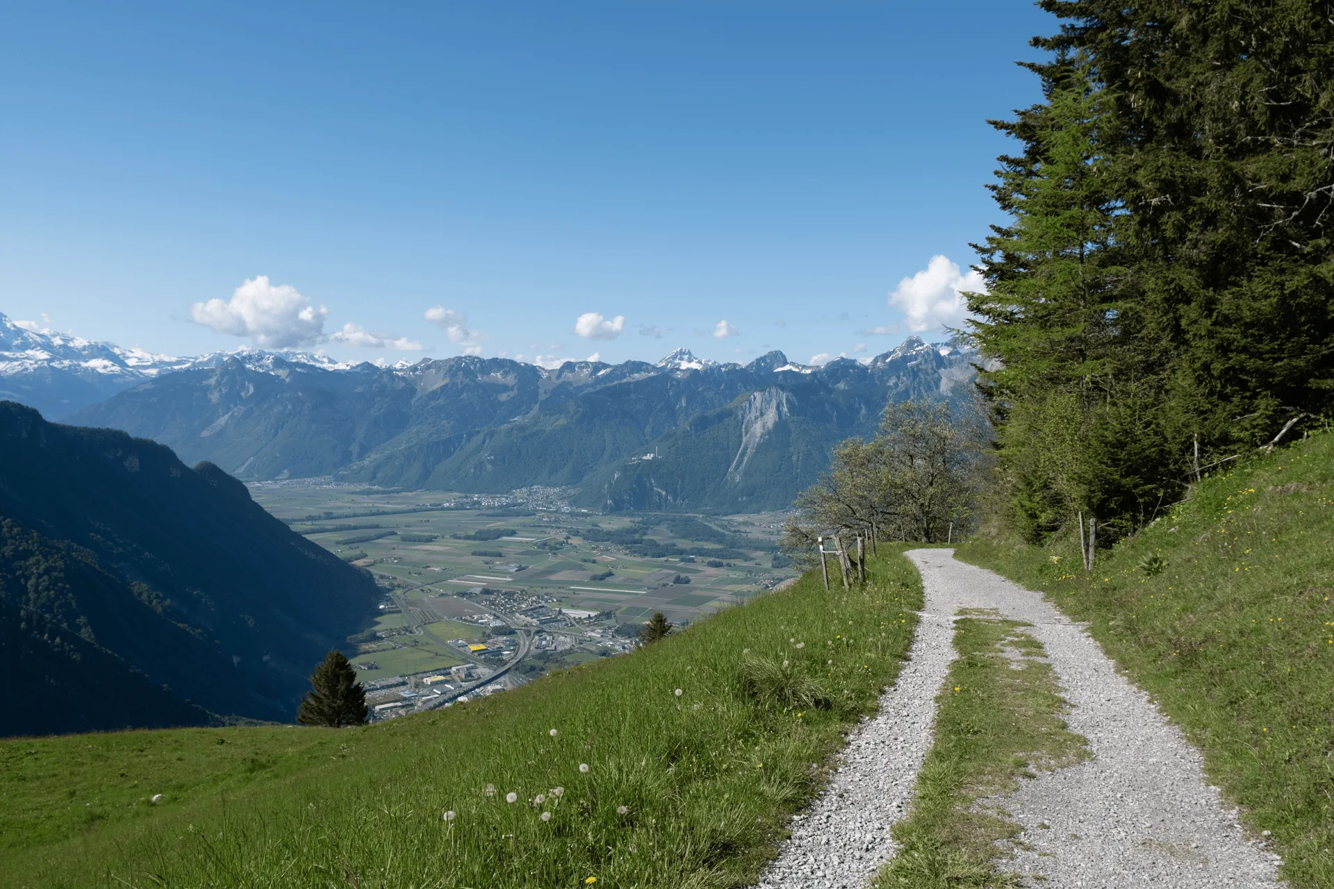
From here I returned to the road and kept climbing up. Although there is over 900m of elevation gain on this hike, the path is never that steep so it’s pretty walkable. And like my hike to Mont Saleve the day before, I had another encounter with a cat on the trail.
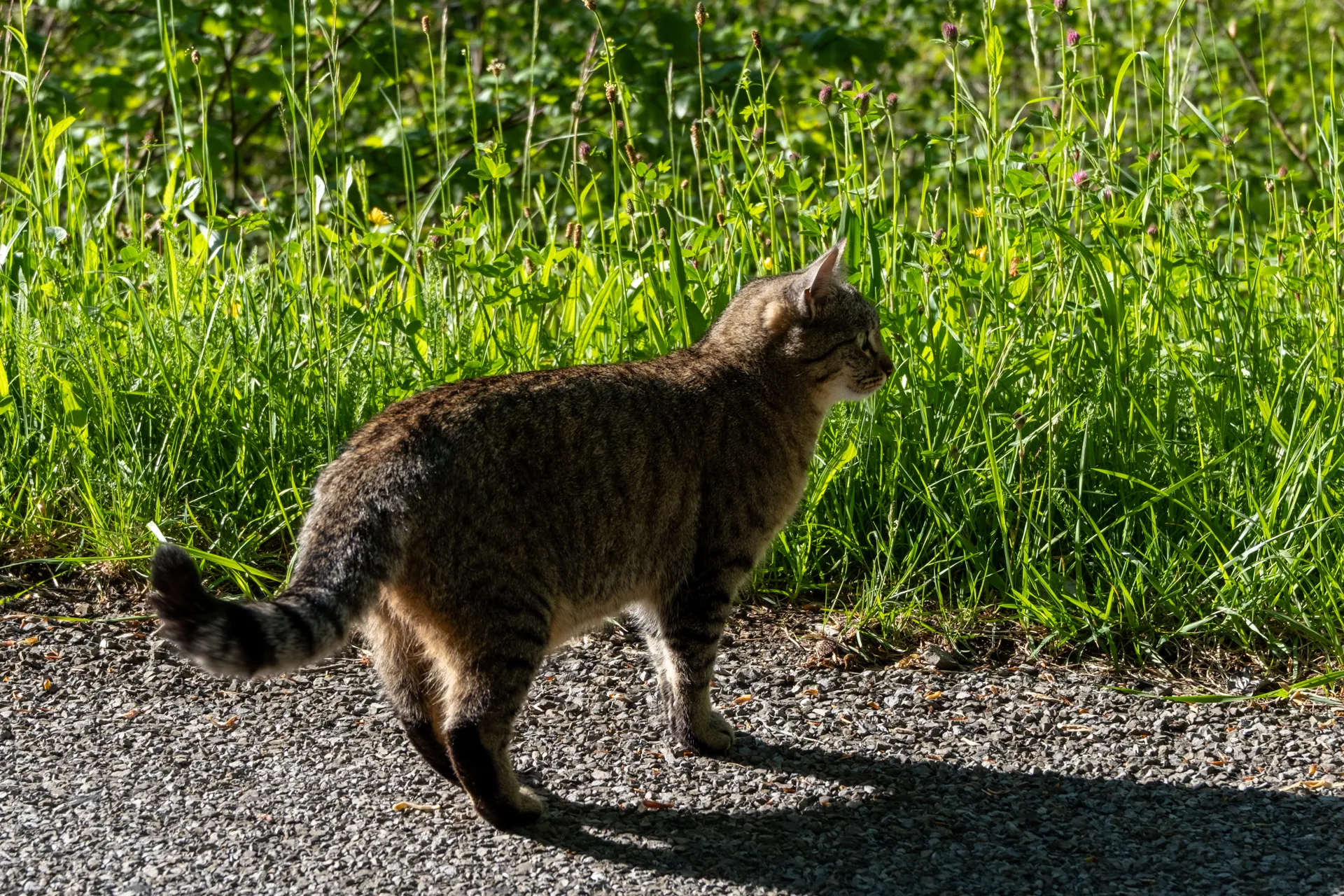
This guy was also very friendly and rubbed himself all against me when I knelt down. Are all Swiss mountain cats just really friendly?
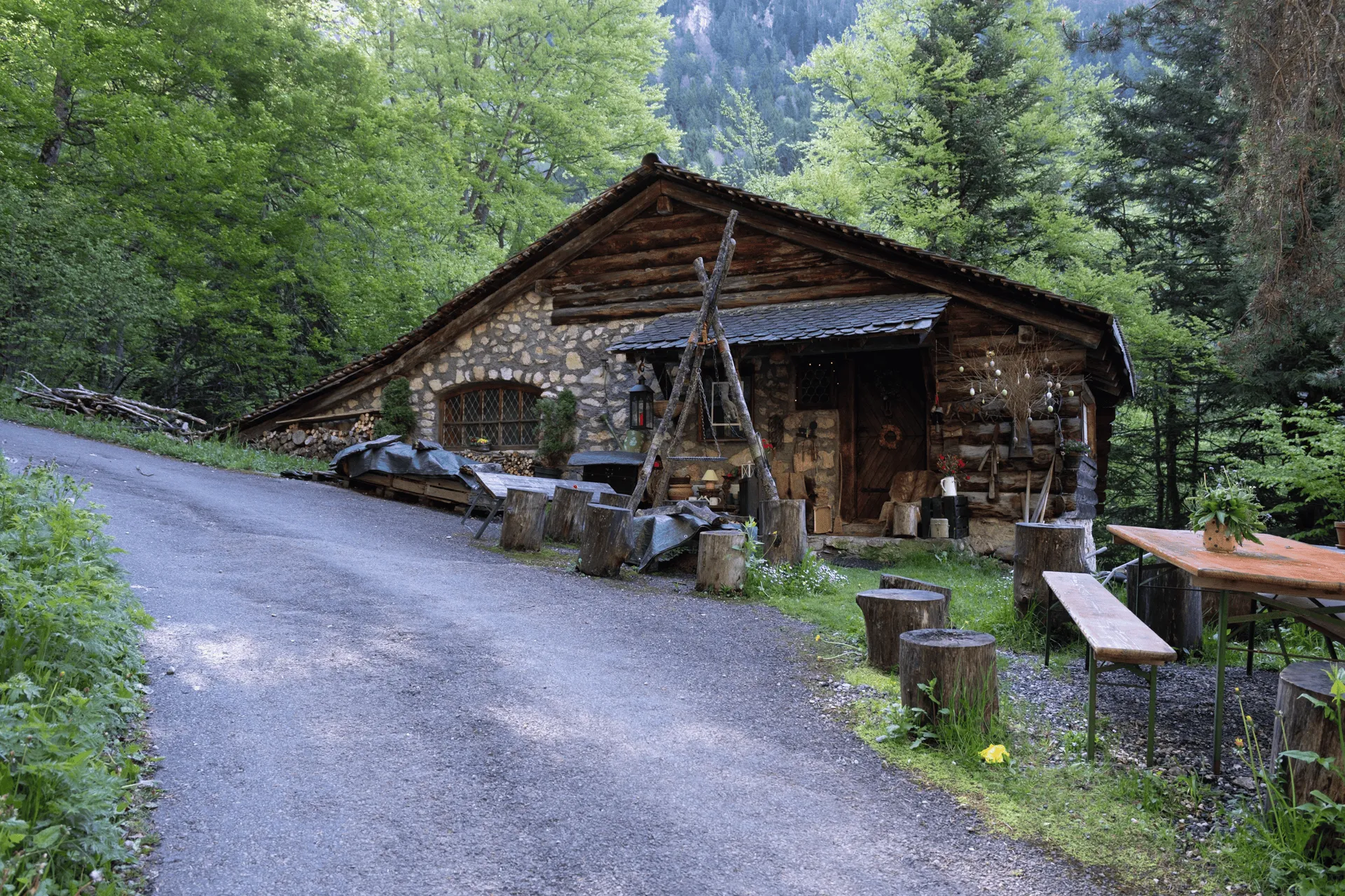
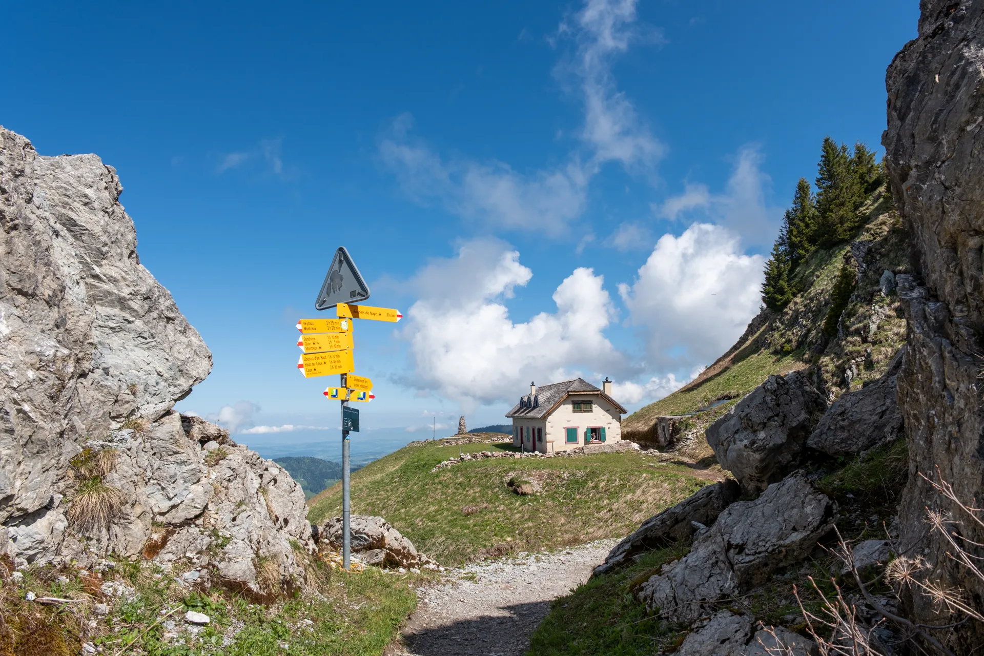
After passing a wooden house, you’ll come to a fork in the trail - both options take the same time to get to the summit, but the left side is a more direct but steep trail with a lot of switchbacks, while the right path is more of a gradual incline all the way up.
In researching this hike on AllTrails, it seemed like the recommended course was a loop course, going up via the left trail, which is quite steep and then descending via the right (i.e. clockwise). It was definitely not recommended to do the course counter-clockwise, because descending via the left path was steep to the point where it was possibly dangerous (there were even mentions of a helicopter rescue just recently in March). I wasn’t really sure how much snow was left on the trail, and since a steep slope + snow was definitely not a good idea, I decided to play it safe and go up via the less-steep right-hand path and descend via the train.
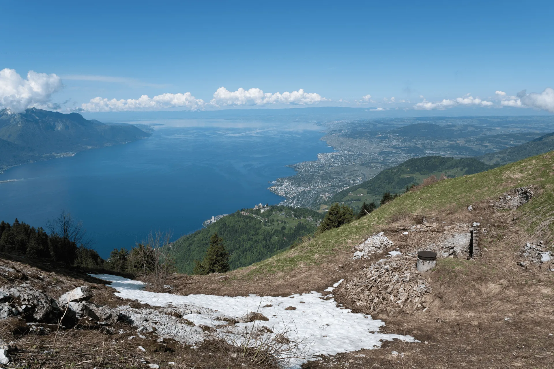
The downside of taking the “easier” path is that I assume it is a little bit more boring. But there’s a couple of really scenic viewpoints.
I could see I was getting closer to the summit when I got my first glimpse of a telecommunications tower.
It was also around this time that a cuckoo began to stalk me. For a good 10+ minutes, I could always hear its call somewhere nearby in the trees nearby. I could have easily mistaken it for whole flock of cuckoos in this stretch of forest, but I could actually see it flying ahead of me from tree to tree as I walked. I’m not really sure why it was following me - to let its buddies know there’s danger, or just to be a pest?

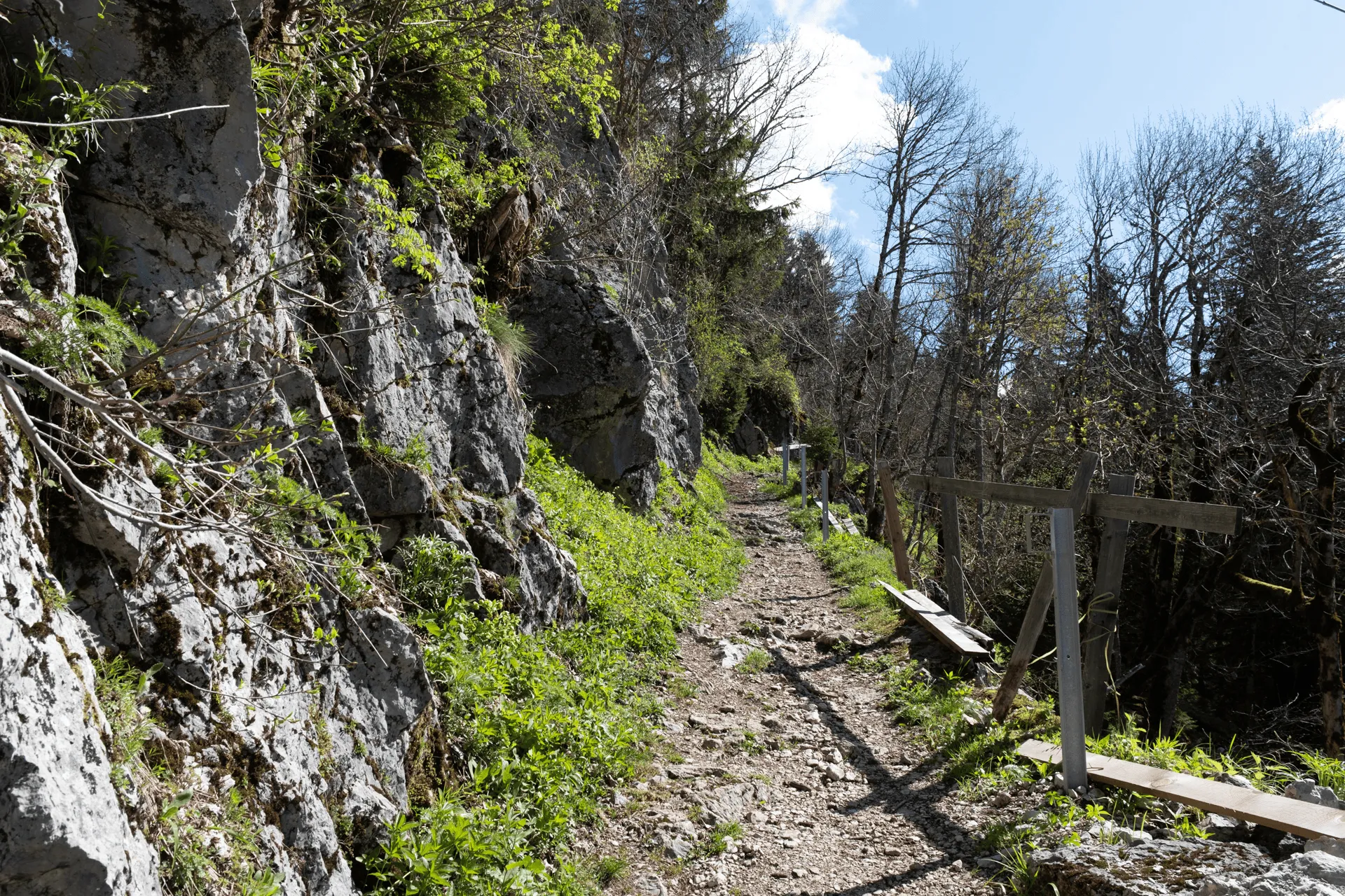
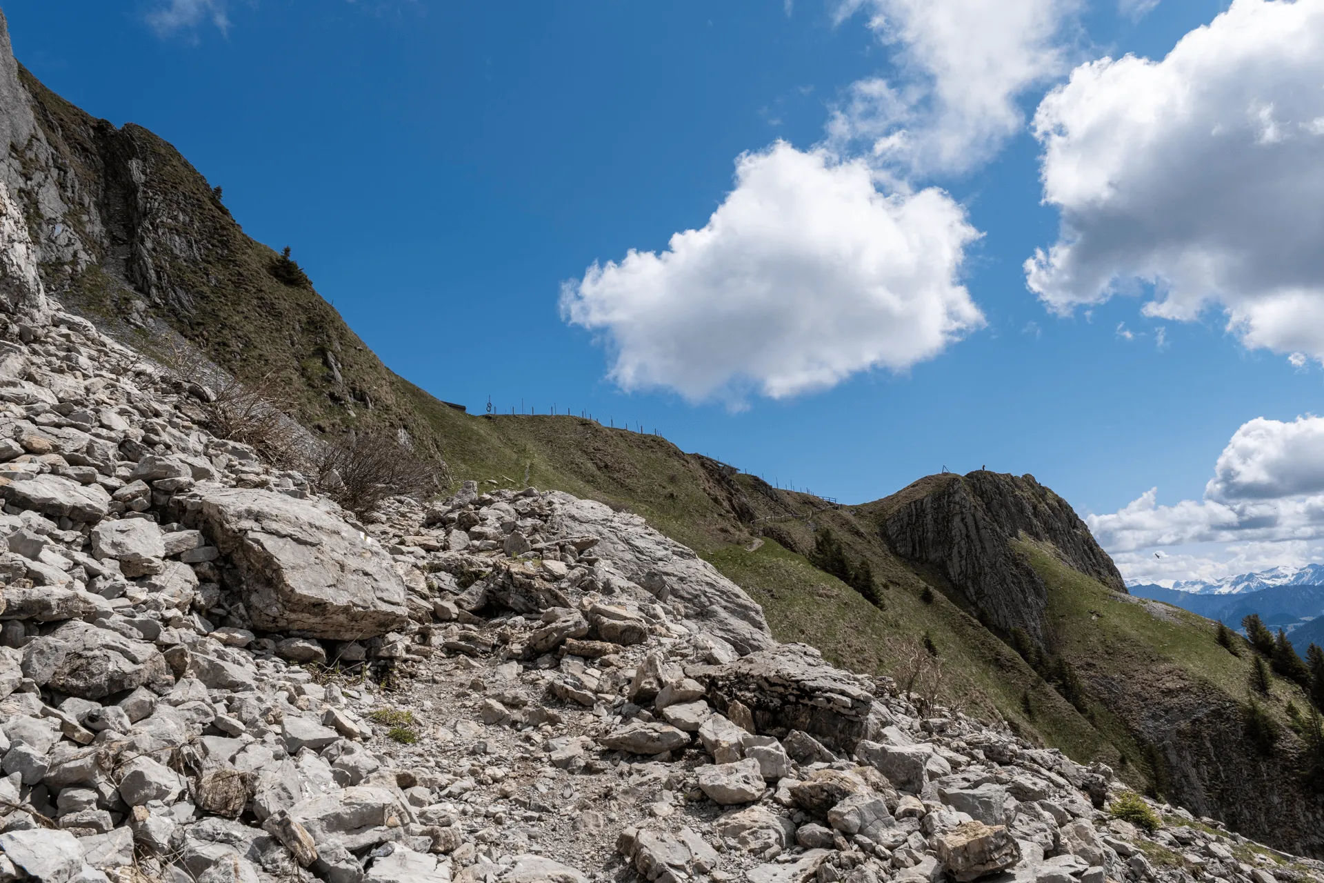
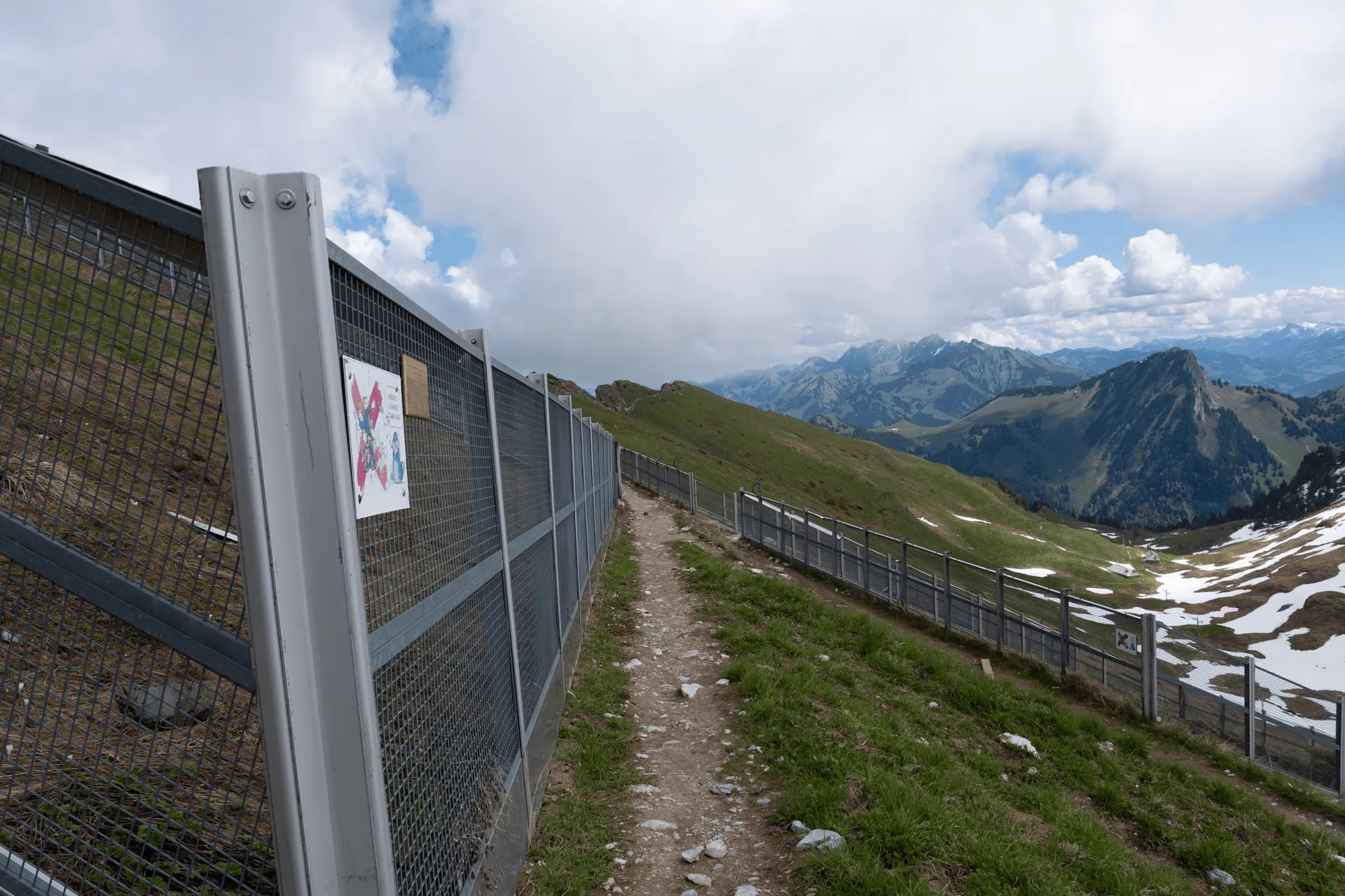
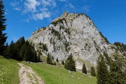
The trail takes you along a path with some rather steep drops if you stray too close to the edge.
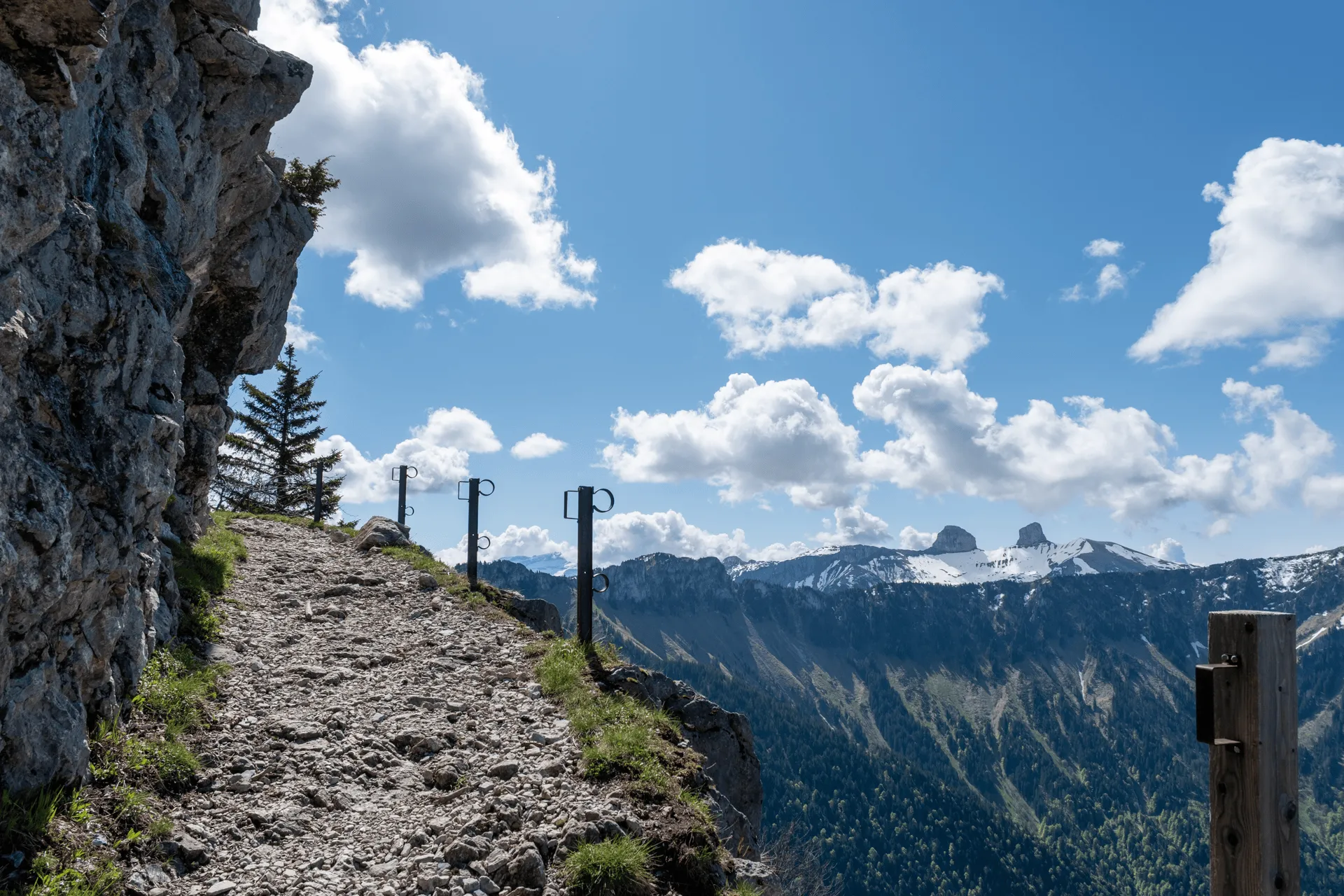
There were vertical poles with slots, presumably for some horizontal planks to go in to create fences. Actually I passed a group of workers around here doing some maintenance to the fence (maybe adding the planks) so maybe it’s something they aim to have ready for the main hiking season from June.
You’ll then come to a fork in the trail, with a cute little house. If you remember the clockwise course I mentioned earlier, somewhere around here is where that trail joins back up with the path I took. I’m not sure exactly where though - possibly behind the house?
I did see start to see some snow lingering on this side of the mountain though, so I think there was a bit of snow left on the trail if you came up via this side. I’m glad I didn’t!
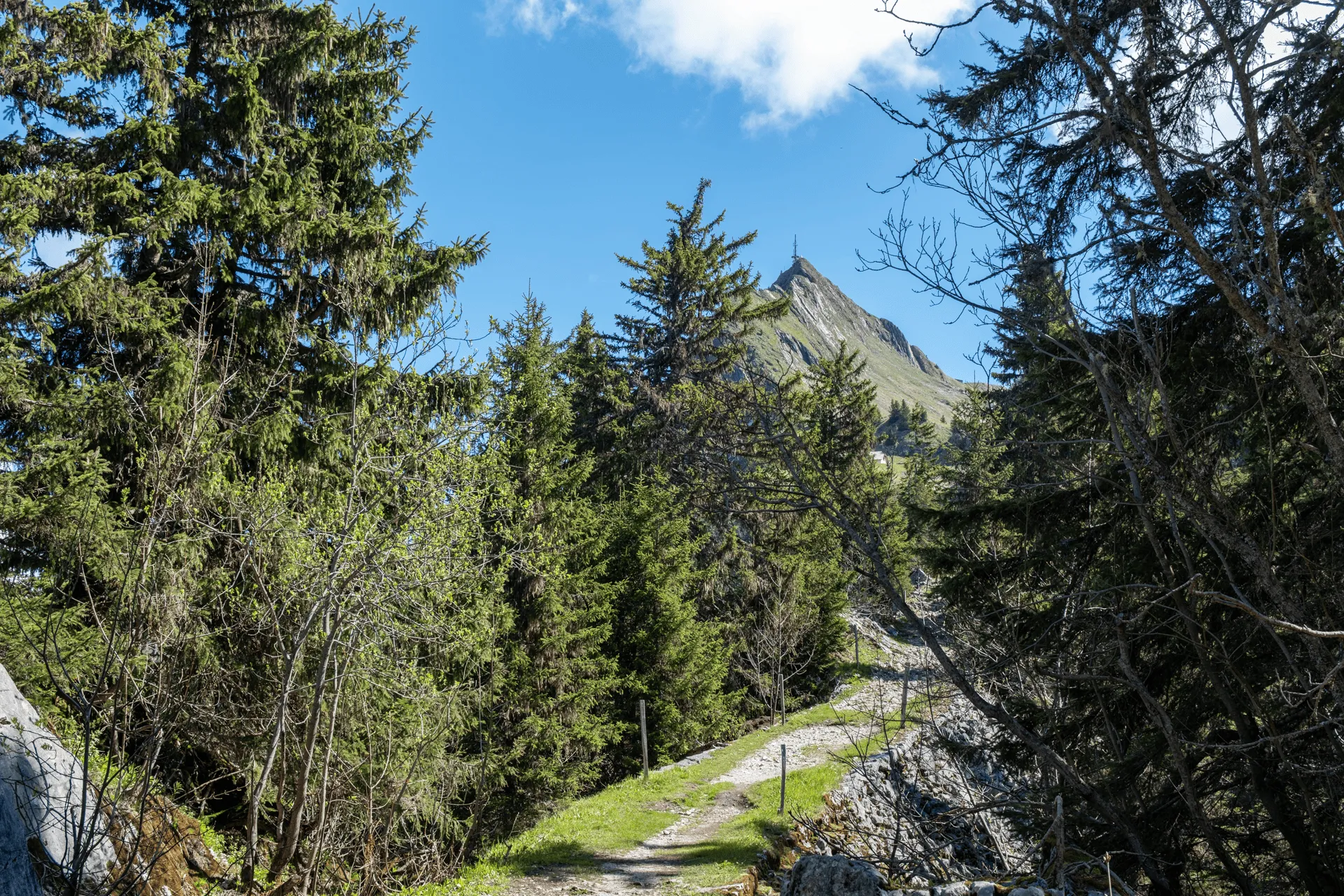
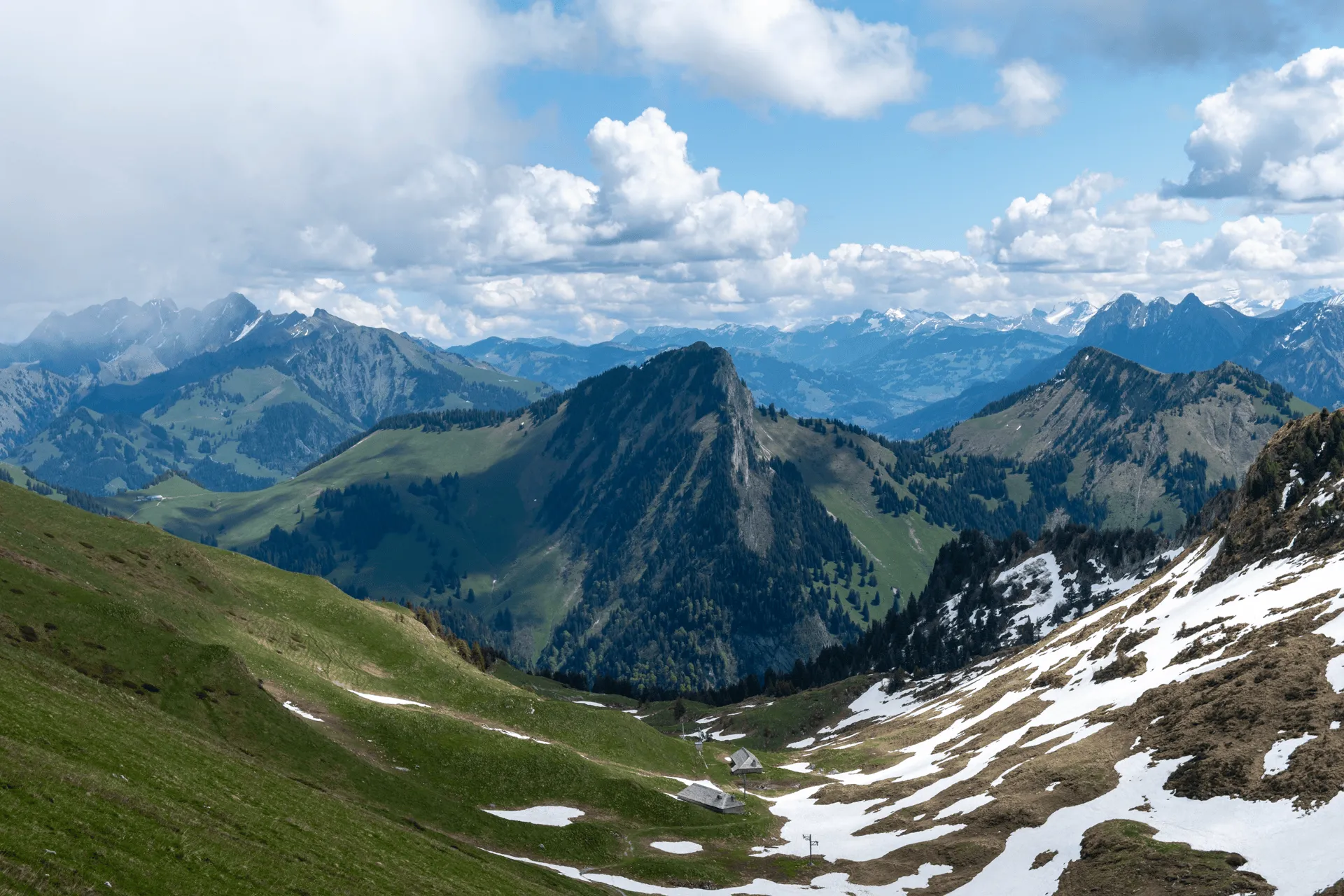
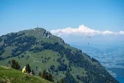
Now I was on the final stretch of the hike, which was the coolest and most “mountainy” bit of the course. I could see a couple of people wandering up along the ridge near the peak, and at one point there were even a couple of eagles soaring overhead which I’m sad I didn’t manage to get a picture of.
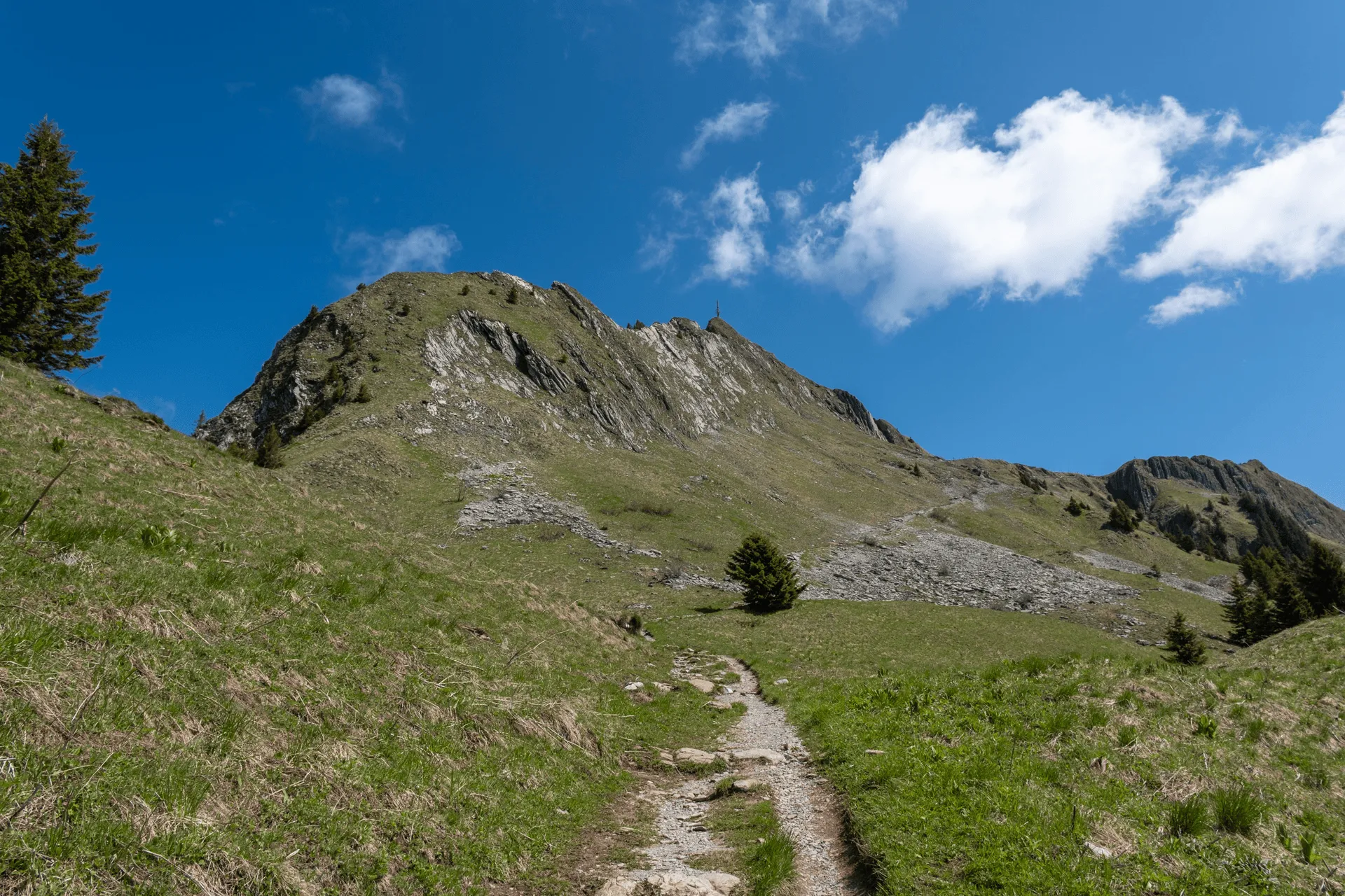
The last bit was a bit steeper, and I was starting to get a bit more tired at this point so I took my time.
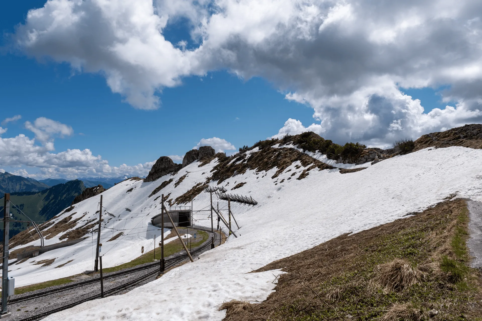
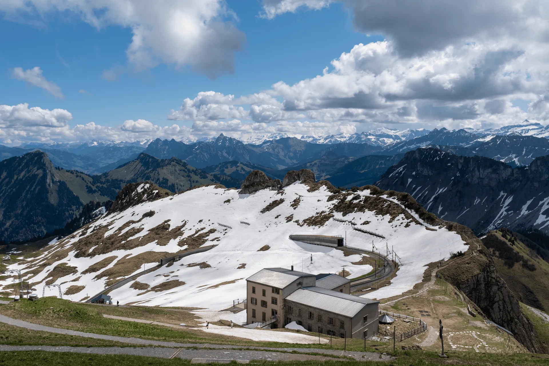
And then I made it to the summit! I had seen nearly no snow on the trail up, so I was surprised to see how much of the peak was just blanketed in it. You can also see the train has a tunnel it comes out of.
If you head out along this narrow ridge to the right, it leads to the Alpine Garden which is open from sometime in June. I was a month too early for that, so I didn’t head too far along it.
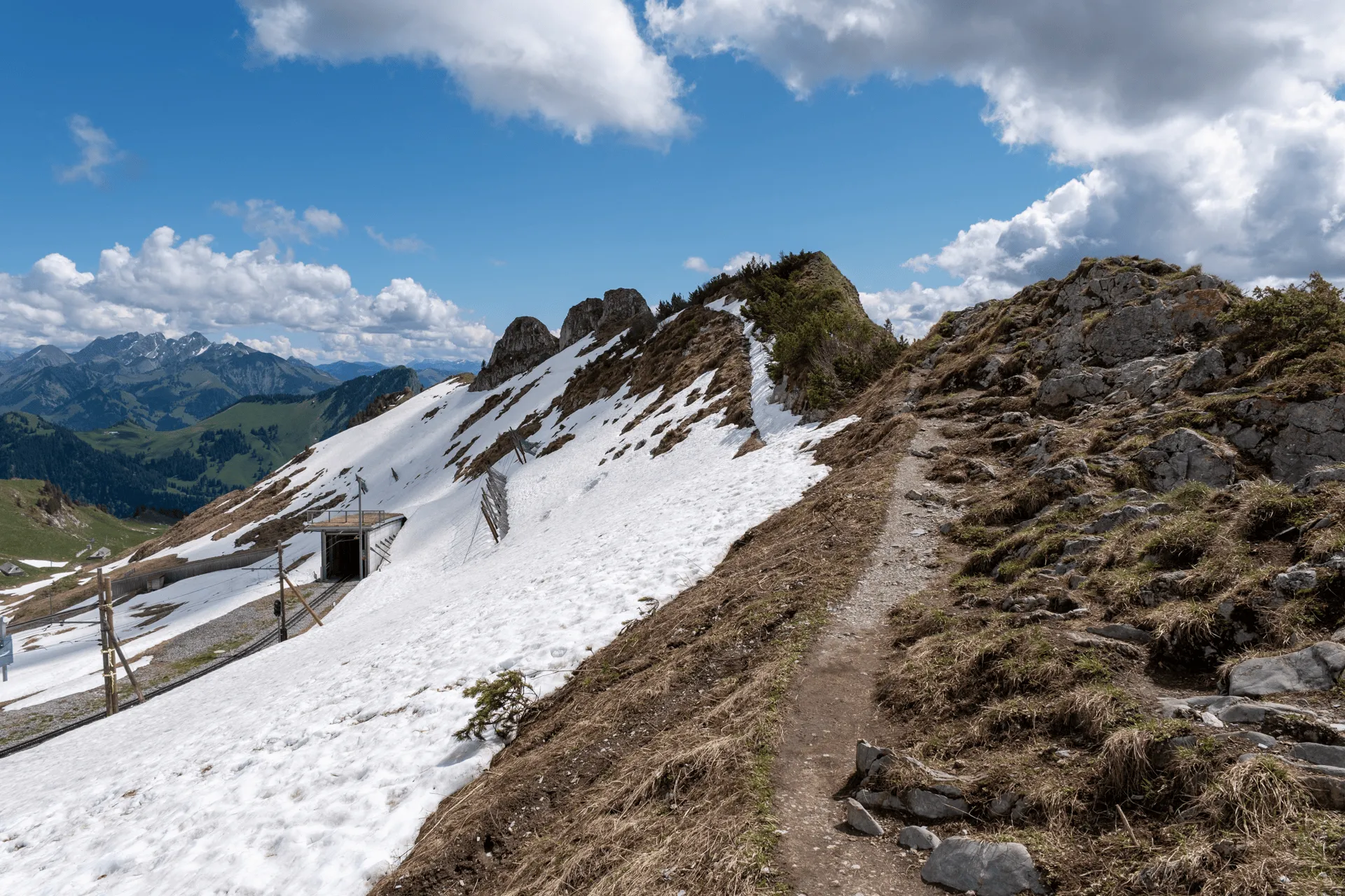
And if you look in the other direction, you can see the peak and the terminus of the train line.
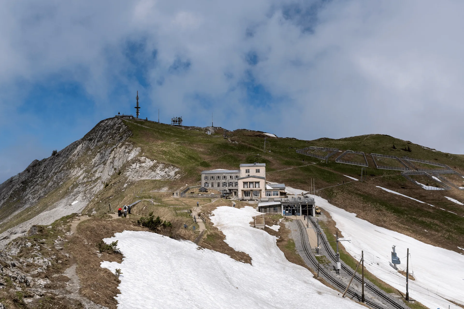
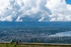
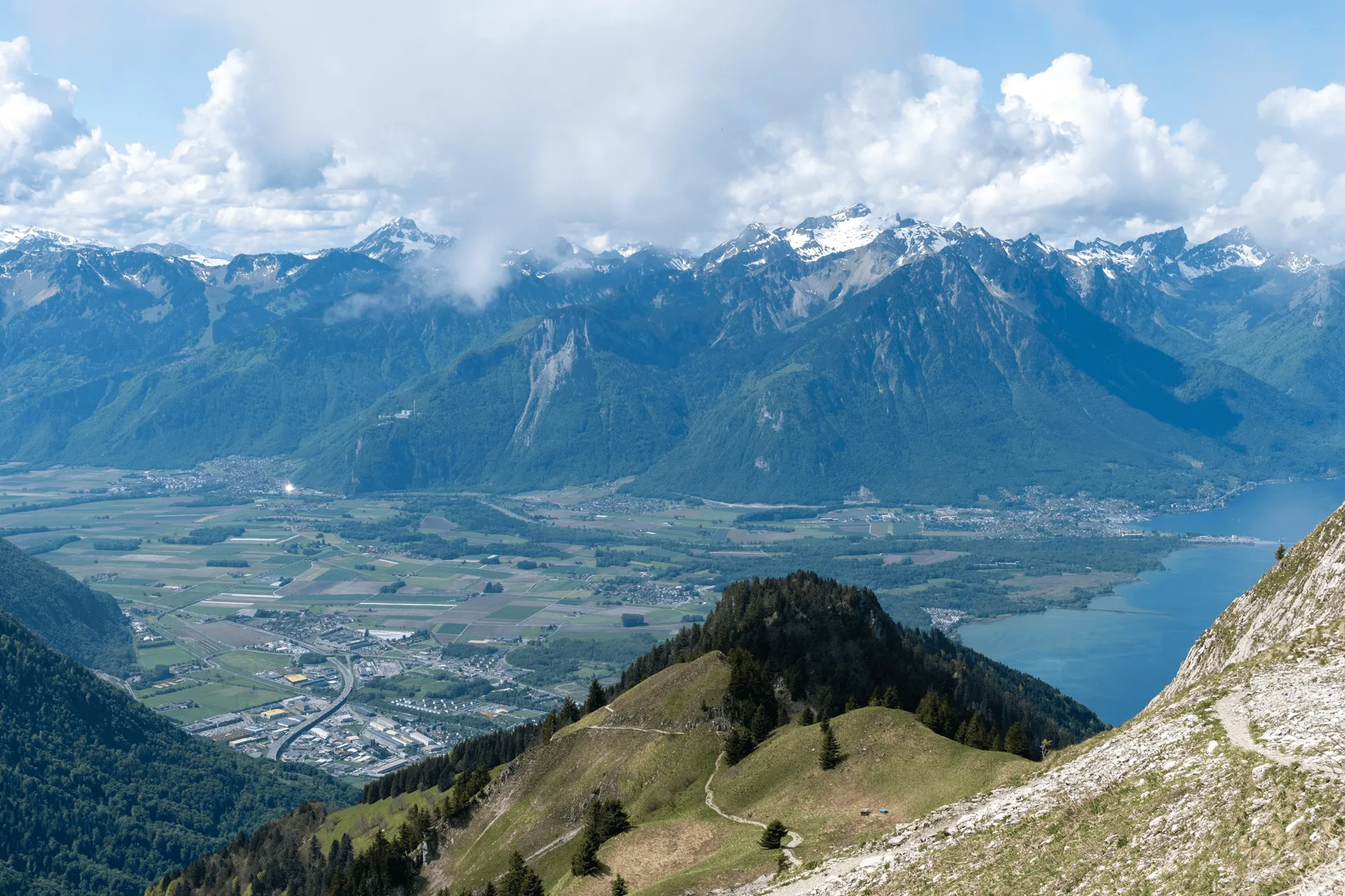
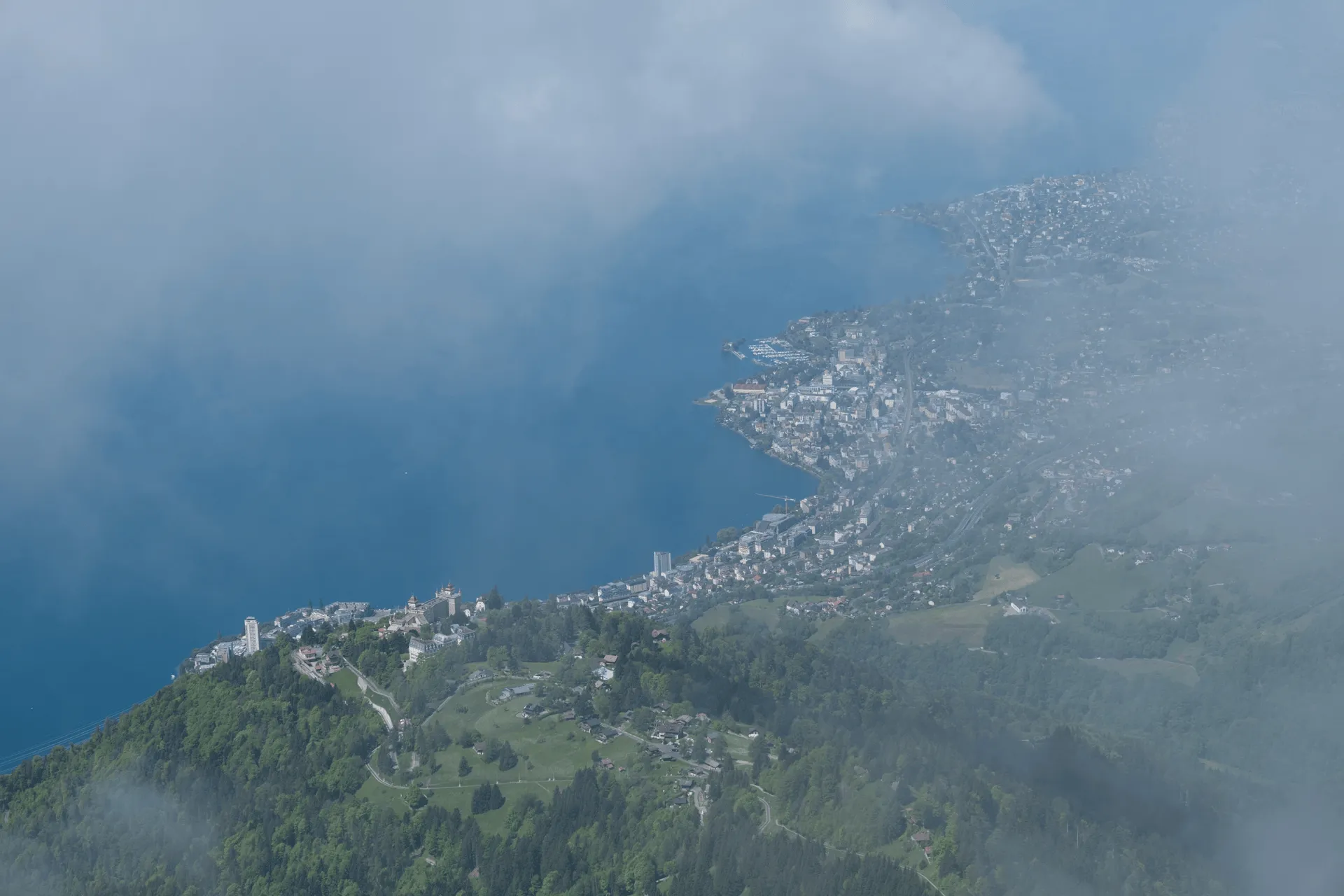
I headed to the summit to take in the views. Unfortunately there was a good amount of clouds that had just decided to roll in at that moment. I’ve been pretty lucky with the weather on this trip, so I guess I had to run into some bad luck eventually. I think Rigi has the better view from the summit, although it’s not much of a fair comparison today.
I took a walk past the “marmot paradise” which is on the slope of the summit. They’re these huge fenced enclosures. I’m not sure at what time of year you can see them (or if there are still any marmots at all), but there were none around.
The TripAdvisor reviews on this one are pretty funny:
“There is only one marmot left next to the restaurant which seems to be bored and waiting for deliverance from death”
“More like a “High Security Prison” than a Paradise”
Yep, I’ll admit the tall fences of the enclosures don’t really conjure up images of a paradise.
Anyway, imprisoned marmots aside, the half-melted snow made for some pretty scenery.
I didn’t have too much time to idle around at the summit, since the train back down only comes once an hour and I wasn’t planning on waiting another hour for the next one. Although if you do miss the train, there is a restaurant so you can spend some time relaxing there as well.
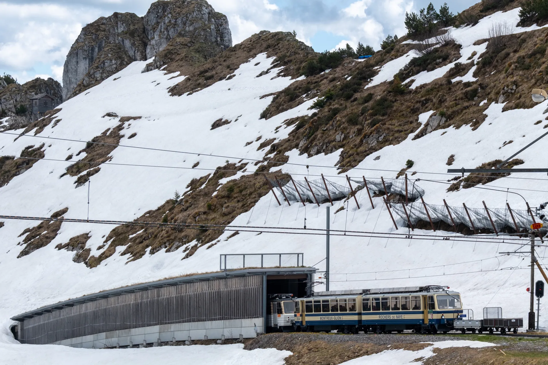
As the train comes out of the tunnel, you can see it’s pushing a little metal cart out in front - that’s where people can store their luggage if they have any.
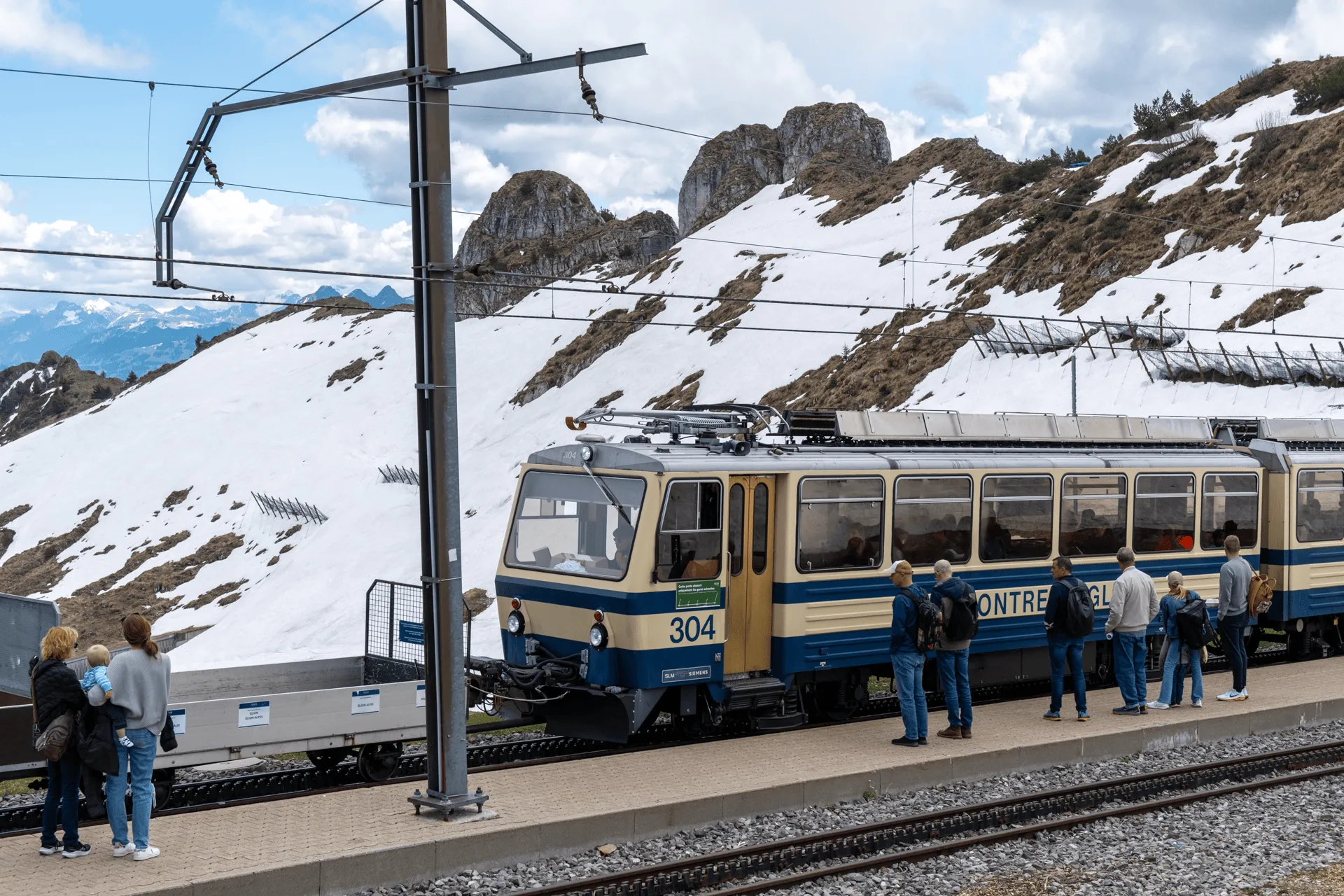
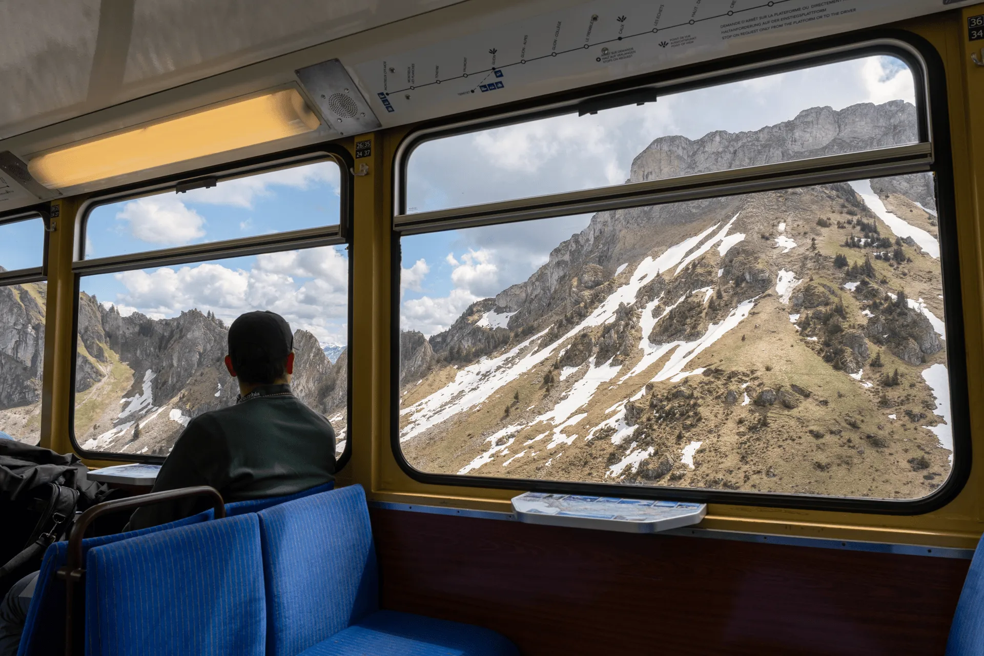
I jumped on the train, and enjoyed the views from the window on the way back down.
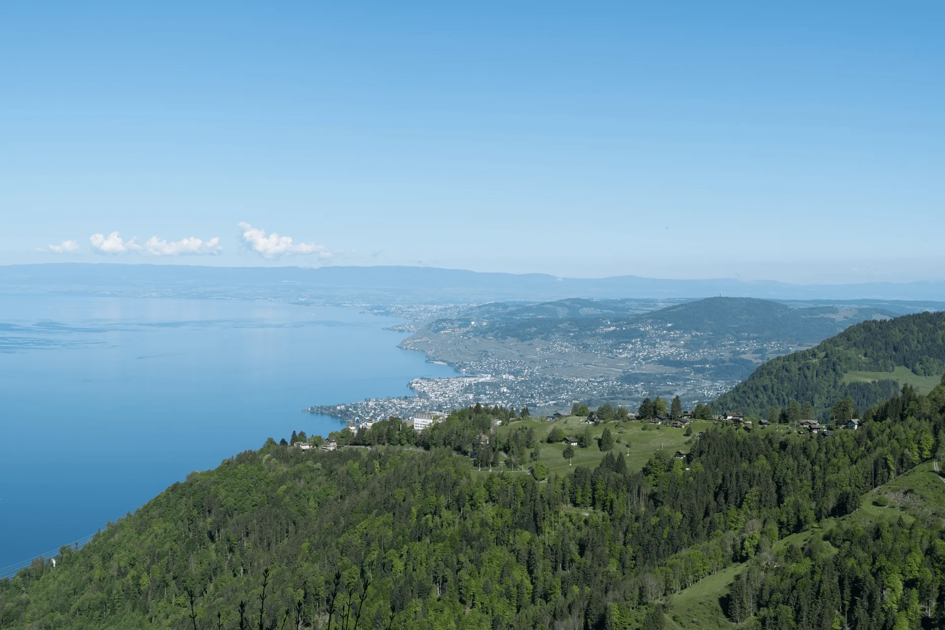
As the train approaches Montreux station, you can spot the Chillon Castle out of the window on your left as well.
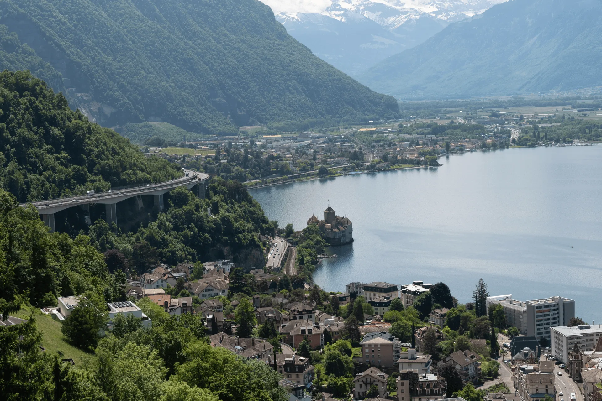
I ended up visiting it a couple of days later right before I headed back home. It’s a very old castle with a lot of history, and you can walk through the entire thing like a museum. Although it looks small, it’s deceivingly large on the inside and there is a lot to see. I highly recommend checking it out if you’re in the area.
And that was my hike in Montreux done! With four hikes done in my Swiss trip, I had my final hike the next day at Les Diablerets.
The summer hiking season for Rochers de Naye is June to October.
Depending on the year, you may be able to squeeze in a hike in May like I did. I got lucky, and although there was still snow at the summit (off the trail), my hike up was snow-free. It also helped that I took the less-steep path up. Looking at Alltrails, a recent review from early May mentioned that there was still 100m of snow remaining on the trail near the summit on the steeper course.
I spent a fair bit of time trying to figure out what course I should take to climb Rochers de Naye, and whether I could even climb it at all due to the snow. There were 3 options I could see:
If you search this mountain on AllTrails, the Rochers de Naye via Haut-de-Caux loop course is one of the top recommended trails. You should only do this clockwise, as the last portion of the climb is very steep and should not be done as a descent. Some of the reviews mention 70 degree inclines, so steep that you pull yourself up by grabbing onto grass, a helicopter rescue (they attempted to do it anticlockwise and got stuck on the descent), and even sadly, 3 deaths on the course as well.
Now the helicopter rescues and deaths were in March 2025 and February 2024 respectively, so I’m sure the snow combined with the steepness was the issue, and it’s probably not that dangerous in summer. But just something to keep in mind, especially if you are hiking solo or hiking outside of the main summer season.
The official tourism website for Montreux mentions the Caux - Rochers de Naye course as one of their recommended options. Caux is another one of the train stations near Haut-de-Caux, so it just makes for a slightly longer hike. If you visualise the clockwise Haut-de-Caux loop course, this is just the descent portion of that course. Of course, you can do it as a climb (like I did) or do it in both directions as well.
I saw a review mentioning that the trail between Caux and Haut-de-Caux is quite boring, so I decided to just start from Haut-de-Caux instead.
Interestingly, the official tourism website makes no mention of the loop course at all. It does seem to be properly signposted on the trail itself, though.
For those up for a longer distance (or wanting to save on the train fare), you can hike 13km all the way from the summit back down to the city of Montreux. There is a 390km hiking course across Switzerland called the Via Alpina which is split up into 20 separate stages, and this is actually stage 20/20 of that long hike.
The course via Caux I mentioned in option 2 above follows this same route as well. So after passing Haut-de-Caux and Caux, you would keep heading all the way down. If you get tired, you will pass a couple more train stations along the way so there are a couple of escape routes. If you make it to the Glion stop and are in time for the narcissus flowers, there are some fields blooming there as well so it can make for a good detour point.
Also as a side note, Dent de Jaman neighbours Rochers de Naye, and it is about an hour-long hike between the two. It was not definitely not possible to hike it during May, but maybe in the summer months you could look into other hiking course options that involve hiking between the two peaks as well.
Rochers de Naye is accessible via a cogwheel station to the summit that departs from one of the platforms at Montreux station. The train departs once an hour, and takes about 50 minutes to get the summit. You can also get off at either the Caux or Haut-de-Caux stations so you can climb the last part of the way up (in which case it’s about 30-minutes one way).
If you have the Swiss Travel Pass, travelling to Haut-de-Caux station is free, and then to the summit you have to pay 50% of the fare. At the summit there is a ticket machine (that takes card and cash), so once I reached the top, I bought a descent ticket there. You can select to buy from the peak to Haut-de-Caux, and then once you’ve selected the ticket, the next menu screen should show the option to pay a half-fare (i.e. half price). I spent way too long trying to figure out that option on the machine, ha.
There are a number of narcissus fields on the way up to Rochers de Naye, and you can handily see which ones are in full bloom at narcisses.com. The Montreux Riveria site has a list of all the possible hiking trails where you can see the narcissus. The one I passed near Haut-de-Caux was the most accessible for my hike, but you can get off the cogwheel train at other stops like Glion to access the other fields as well.
Leave a comment